You are now at post Nr. 08 out of 10 for this tour.
If you want to read the post of that trip in order, voilà:
00a Freiburg – Barcelona preparation
00b Freiburg – Barcelona READY to go
01 Freiburg – Lake Neuchâtel (206km, 1200m)
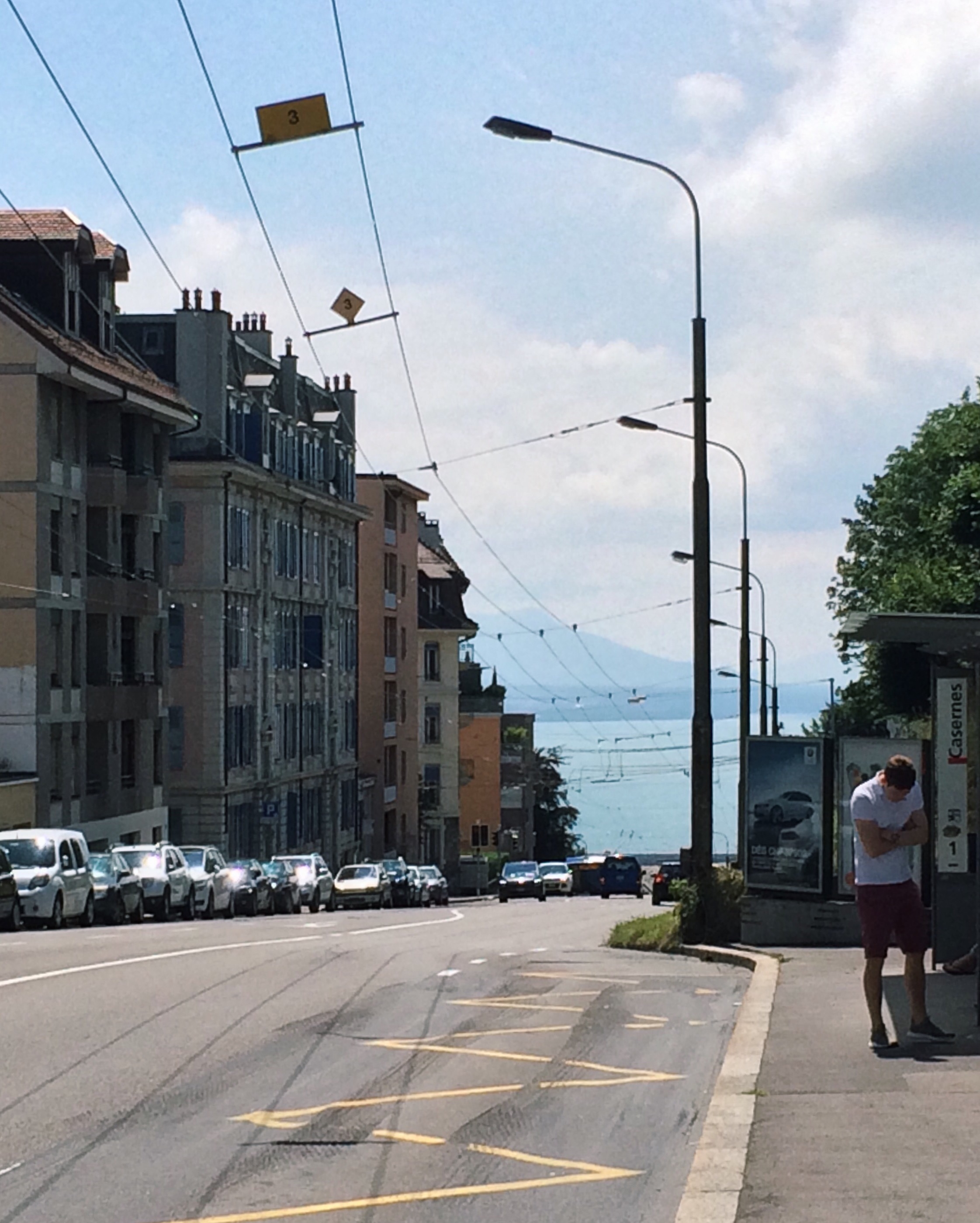
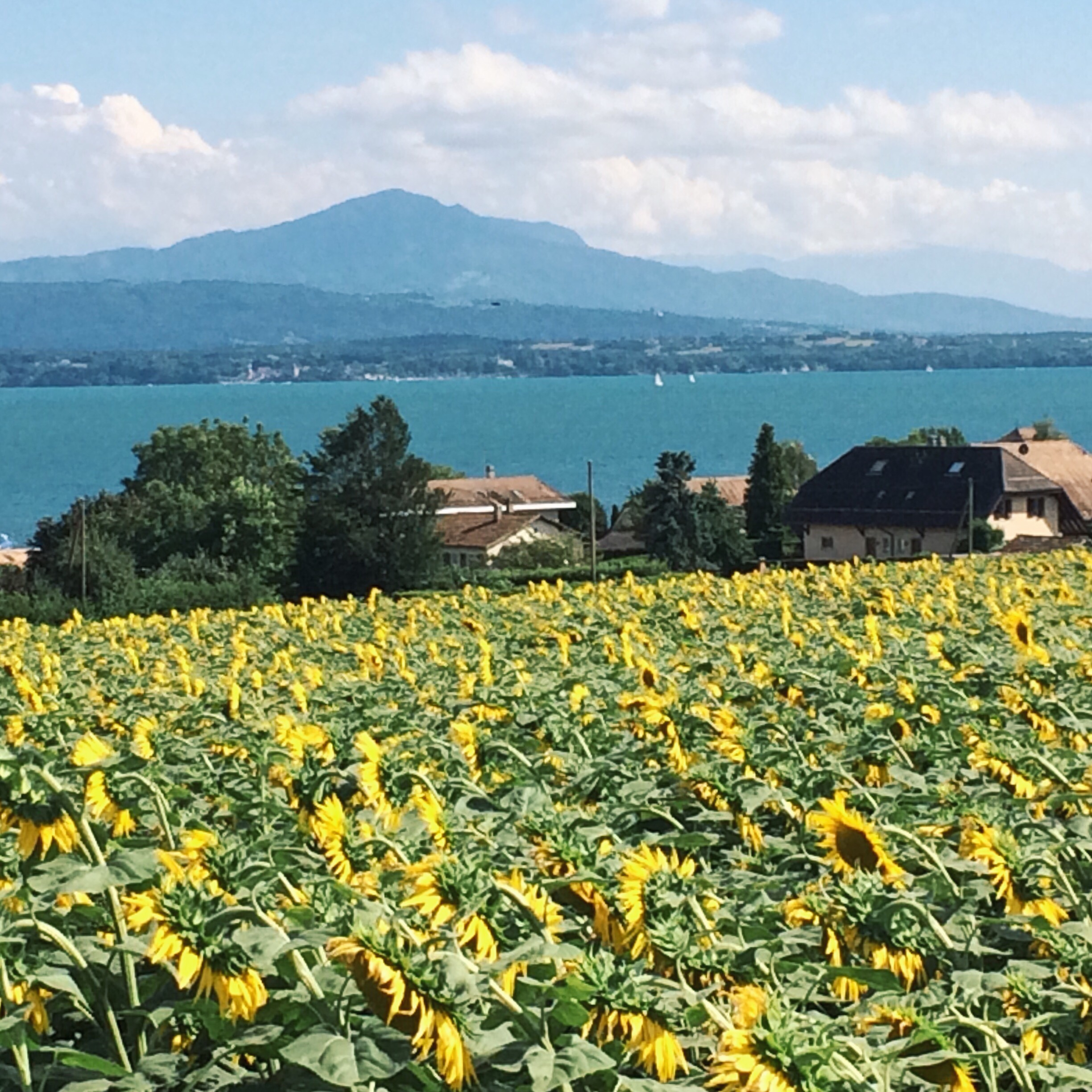
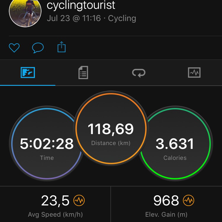
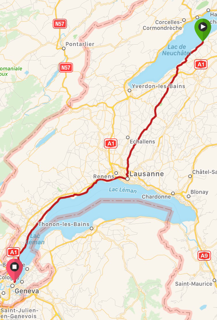
02 Lake Neuchâtel – Geneva (119km, 968m)
03 Geneva – Lyon (167km, 1585m)
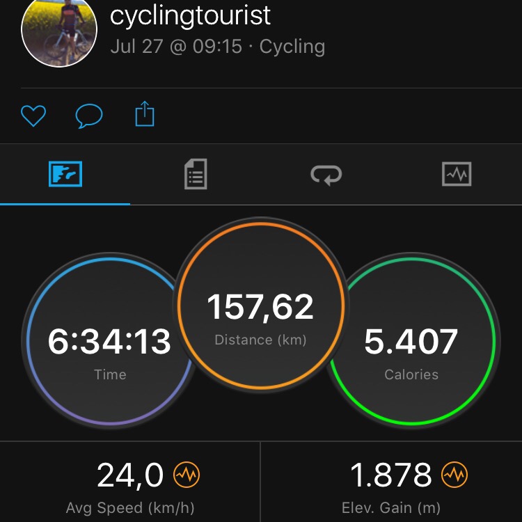
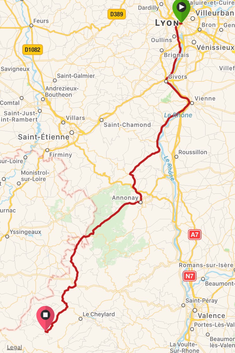
04 Lyon into the Cevennes – on climbing and descending… (157km, 1885m)
05 Lac St. Martial – Tarn (187km, 2900m) Prototype of THE cycle touring day
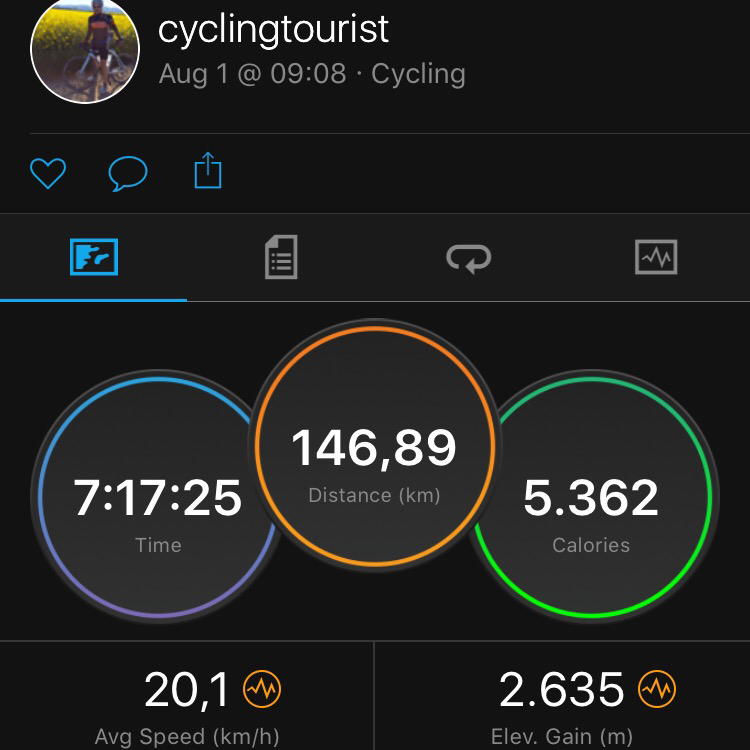
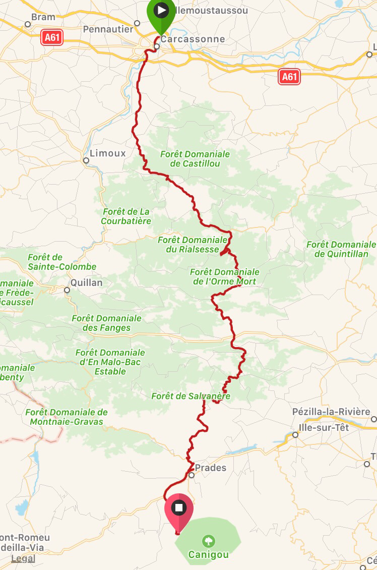
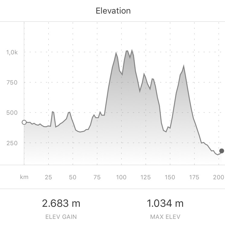
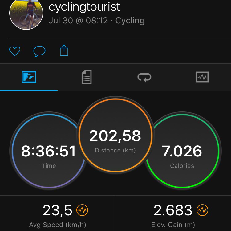
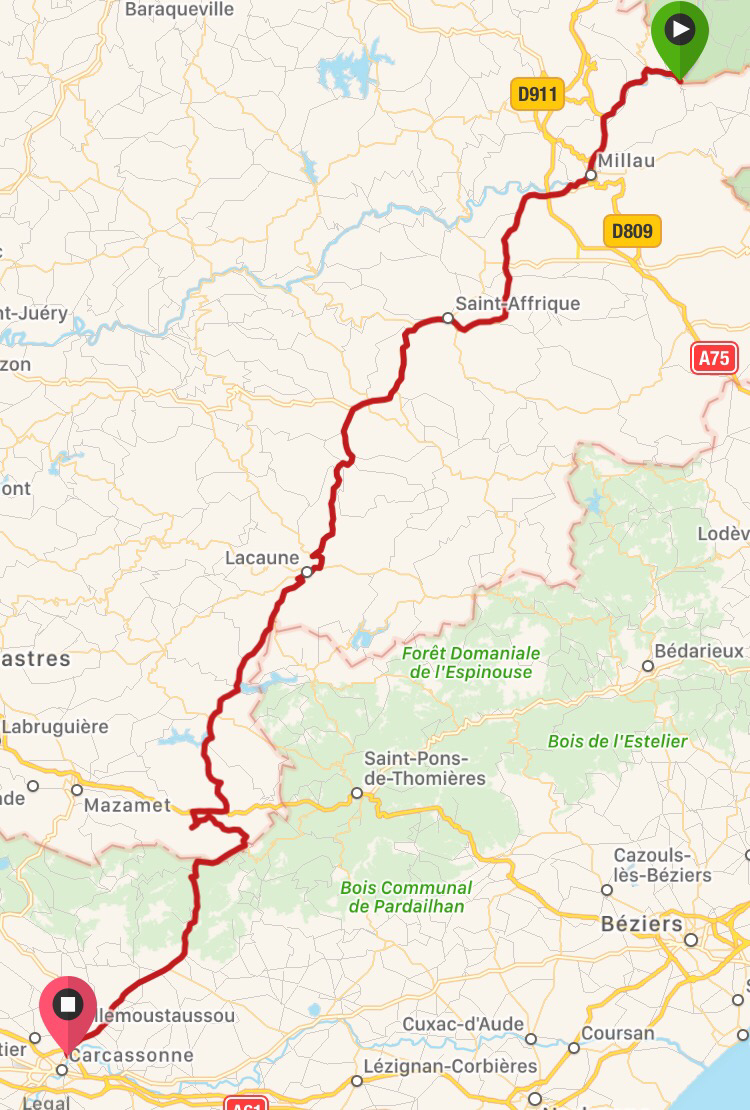
06 Tarn – Carcassonne (203km, 2683m) – A long day in 3 dimensions
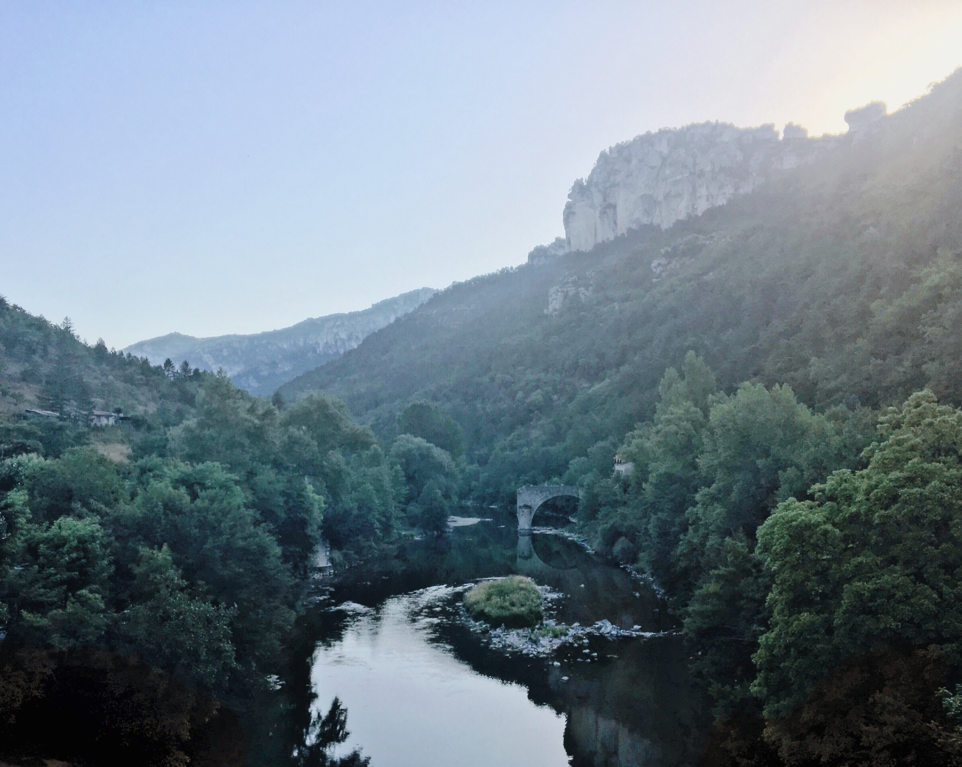
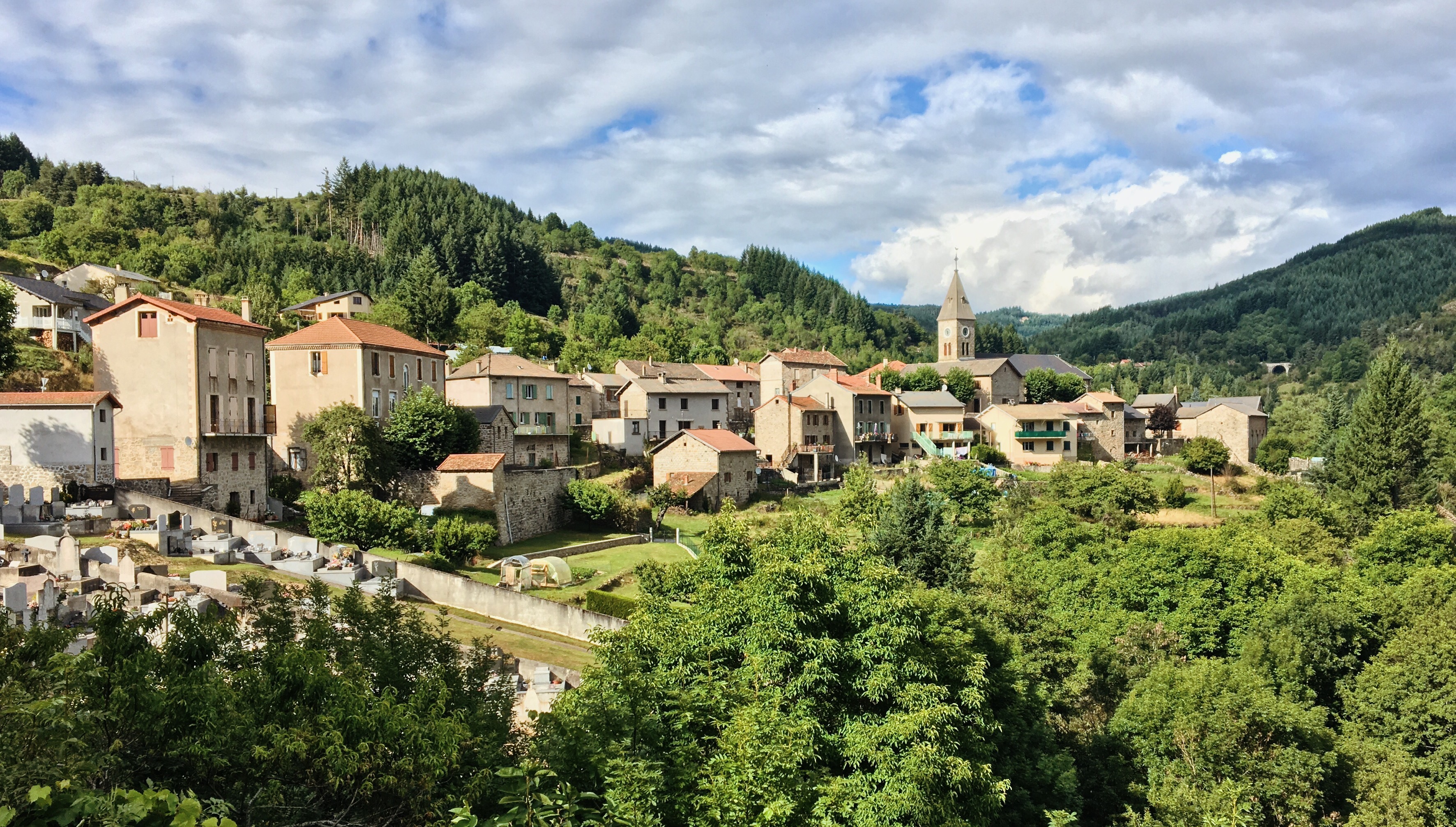
07 Carcassonne – Casteil (148km, 2635m) Arrival at the ‘base camp’
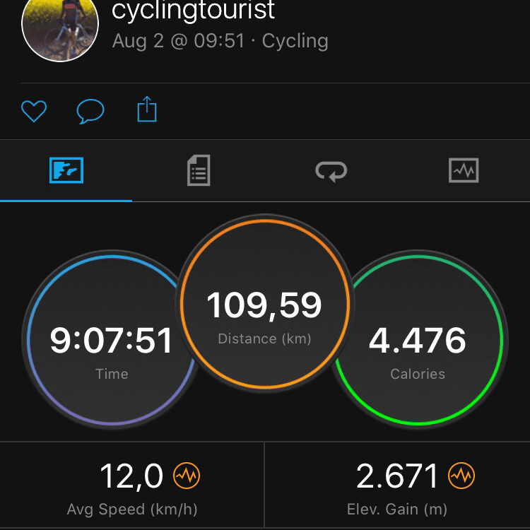
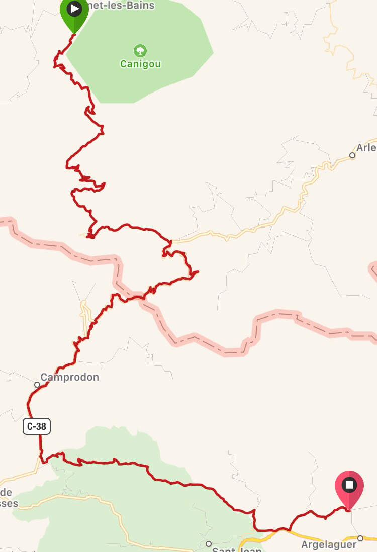
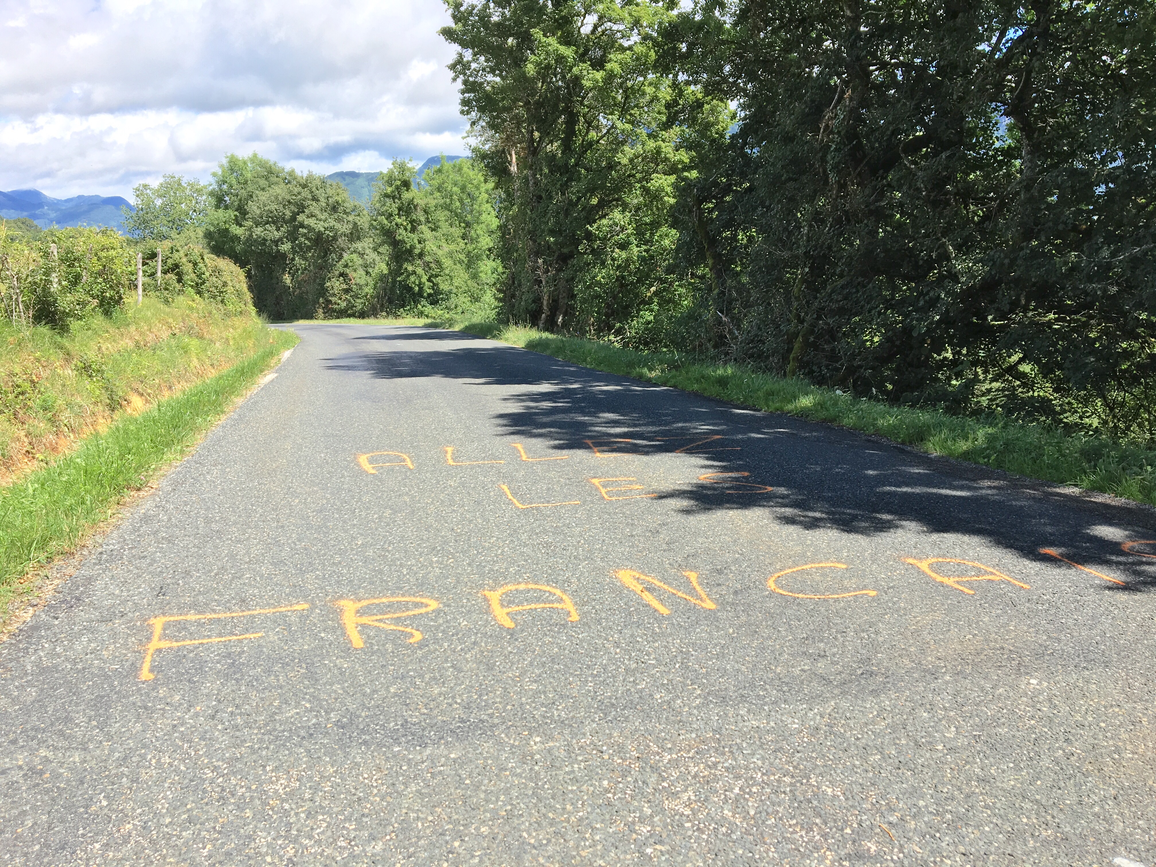
08 Walking over the Pyrenees and cycling down into Spain (110km, 2671m) – reality checks
09 Hot as hell. Tortellà, Costa Brava, Canet de Mar (145km, 1468m)
10 La Final: last 48km to Barcelona & recap. What a tour…
Without any doubt: this stage is the core piece of my entire tour – crossing the Pyrenees. And I am not exaggerating: in some ways it was the craziest ‘cycling’ day of my life. It went from Casteil in France, to Tortellà on the other side of the Pyrenees in Spain, where I would meet close family friends. This day is special to me in at least two ways: 1. it involved a very high degree of uncertainty because I had deliberately picked a truly remote and high summit (at 2350m) to pass, about whose ground, profile, etc. I had hardly any information, and 2. it turned out to be physically extraordinarily challenging to me as you will read. This post will come in chapters and include regular juxtapositions of my prior planning/expectation vs. a corresponding reality check. (This post is about the 2nd of August 2017, written in Barcelona on the 10th of August 2017)
I will deliver this post in the following chapters – feel free to jump to the one that interests you the most (the threads are linked though):
- The night & morning before (or: “Are there bears in the Pyrenees?”)
- Planning & expectations
- The climb & the summit
- Slowest descend evah
- The surprise & its payoff
- (Feels like) home
1. The night & the morning before (or: “Are there bears in the Pyrenees?”)
My previous post stopped in the campsite restaurant after two main dishes and a beer, and before a good-night-Congnac whose order was inspired by that nice Dutch couple at the neighboring table, with who I had a chat. At that point I had not set up my tent yet, even though it was already 11pm or so.
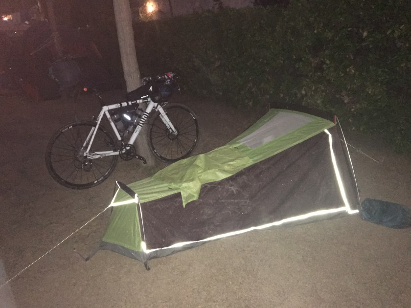
That’s where already some complications for the night started. Firstly, this was my compartment on the site; big and empty:

The campsite was clearly laid out for more permanent visitors with cars and caravans instead of ‘spartanic vagabonds’ like me. It was impossible to pitch the tent: the ground was too solid for the tent pegs. So I spread my tent on the ground as a ground sheet and attempted to sleep openair on it – as if my tiny and erected tent wouldn’t already have been a surprising enough view for my fellow campers. I tried sleeping like that for a while; without success: I had to either wrap my head tightly in my sleeping bag and boil in it, or keep it airy and be attacked by moskitos. That way the first 1,5 hours of sleep were lost.
So I inserted the tent bars in the tent and pitched it – the two most strategic points held in place on the ground by the weight of my backpack and one filled drybag. So instable and slack – but at least I had a shield between me and the hostile luxury campsite wilderness. We’re now 2h into my intended sleepy time.
I cannot really sleep well on the ground in a tent anyway plus I guess I was enthusiastically excited about the next day, so I was in a semi-lucid state for a while. It suddenly got interrupted by an incredible, very deep and low, wild growl or moaning that sounded like it was loud not because the animal that produced it did so very forcefully, but because the animal would simply be really big. I would have guessed it to be ca. 100-200m away, somewhere a bit up the hill. This was not one of the campers’ dogs – too heavy; it must have been more like the weight of a bull. But I’ve never heard a bull like that. I lay there for a while, half-awake. And then… did it just change directions? Was that beast wandering along or even over our camp ground? Also very untypical for caged cattle. It growled every 15 seconds on average, I guess. Are there bears in the Pyrenees? I grabbed my phone for a quick google search (not a smart move btw. in such a situation to turn on the display light, like a marker for the beast to find its first aggressor): “There are now some 20 bears roaming the Pyrenees, with conservationists keeping a watchful eye on the population.” also roughly in this eastern region. Imported from the Balkan. “They prefer thick forests”: check, got one right next to me. “…and altitudes between 1000m and 1500m” – we’re on 850m; that’s not much lower. Damn… I was really quite nervous now, not at last because I was the only one who was not protected by a caravan outer shell, but instead presented as a delicate snack wrapped (loosely…) in some ultra light, semi-transparent, silicon-coated tarpaulin. In the (i still made myself believe ‘unlikely’) case this was really a hostile creature, I’d be the first one it could get. I’m not kidding… these were thoughts going through my head – I’m not making this up.
I also have this usually helpful technique to envision unusual or unlikely scenarios as more realistic and justifiable: I think about how the seemingly odd scenario will be viewed in hindsight after it happened – this way, the impossible or unlikely becomes just an interesting turn of events; one of those turns that make for a good story; and good stories happen all the time. This technique is helpful when trying to find the courage for bold decisions, like career choices, or for example the decision to do this (as you will see) seemingly unreasonable way of crossing the Pyrenees. In this case however, the realistic hindsight scenario was an imaginary news report: German tourist, male, 31, from Cologne, tragically mauled by a brown bear in the French Pyrenees. On the more serious news site the article would last half a day; on Bild and the Sun maybe 3 days – then forgotten forever. I wouldn’t find such a news report very unlikely, and thus such an event wouldn’t be unlikely either.
I just couldn’t believe that I would get into such a situation. There must be a simple answer to this weird situation… I was torn between a high pulse as a symptom of mild panic on the one hand, and being very tired on the other hand – because remember: the exhausting trip to Casteil ended just a few hours ago. Don’t ask me how, but somehow I fell asleep in the midsts of the still frequent ultra-low-frequency growls. ROOOOOAARRR…. *beast heavy breathing*
Around 8am i woke up, after I guess 5 hours of very bad sleep, and slowly moved and packed my stuff together. Brushing teeth, unpitching the unpitched tent… getting ready for the big day. I felt messy and sludgy and moved slowly.
Then Jan, the guy from the young Dutch family that I met the night before, passed by and saw me. He’d go to the bakery in the neighboring village down the mountain – because Casteil does not even have its own bakery (I mean, we’re still in France!). He offered me to bring me something – after some short hesitation I agreed..: a chocolate croissant to start the day with some calories would actually be perfect to give me a kick. With that he also set a good example to be active early and maybe that made me a bit more productive and by the time he returned – with a Chocolate croissant and a mini pizza – I had already packed most of my stuff. He raised the social momentum even more by inviting me on a coffee with his wife and kids at their caravan after I packed. Starting this big day with a coffee and kind company: that was too tempting, I agreed and joined them. We five had chats about all kinds of things… Jan’s cycling adventures (he’s also a road cyclist and brought his bike there), the little zoo they visited in Casteil the day before, my adventures, languages, etc etc. all that was a very motivating and warm start into this big day – I had no idea yet how it would turn out.
I left Jan and his family (not mentioning all names for privacy reasons, but if any of you reads this: hi! : ) ) and briefly dropped by the reception to say thanks and bye. Ah, and about… “c’etait quoi l’animal la nuit dernière?” What was that animal last night? – a prompt answer as if she gets this question all the time: “c’est le le lion” – sure… it was the lion. What? “The lion”?? Yes. In the zoo. The one the kids visited. I felt a bit ridiculous now. But on the other hand: please, which town on earth has no boulangerie, but instead a zoo including a Lion!?!? And: how did it change direction? It didn’t… the Cognac had changed my sense of direction.
First adventure today: Staying in a luxurious campsite.
Status: mastered like a pro.
2. Planning & expectations
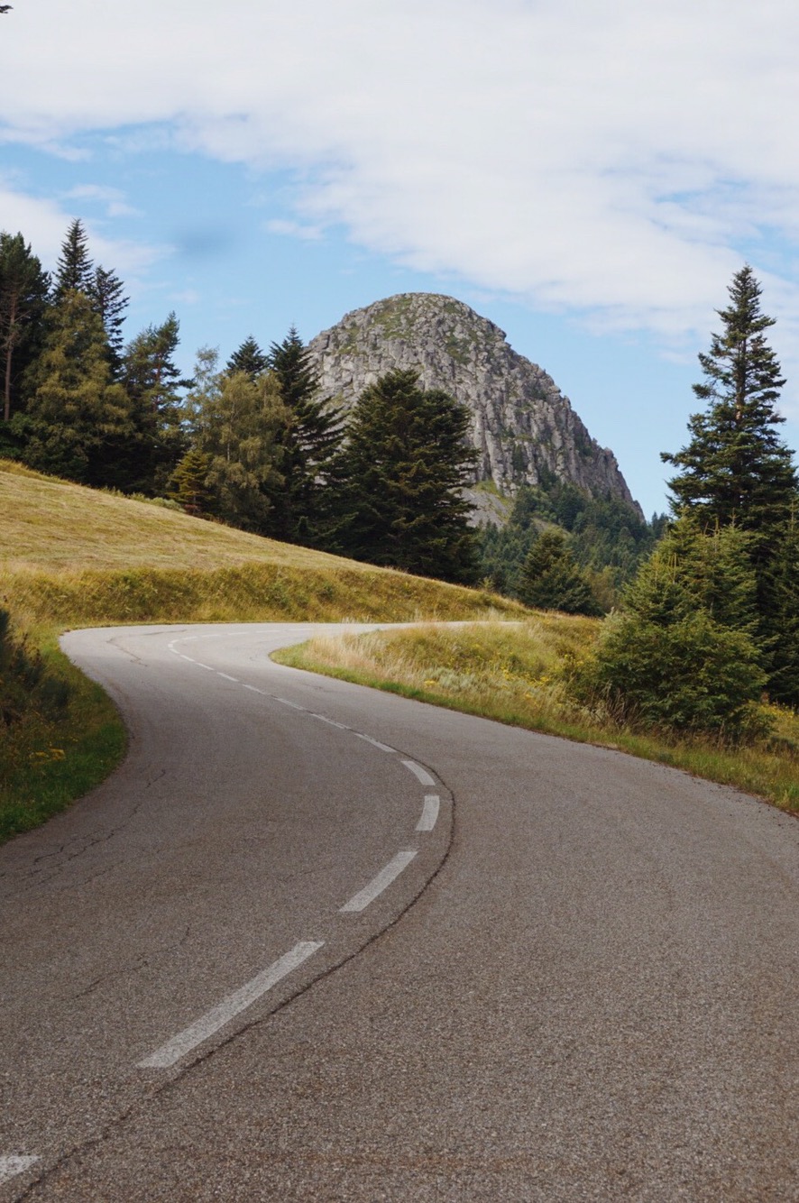
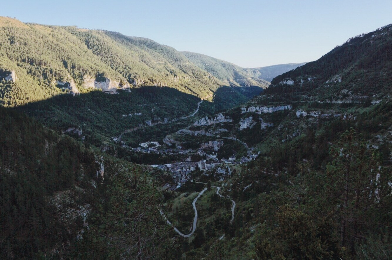
‘Why Casteil?’ you might wonder – this tiny mountain village and deadend in the eastern Pyrenees. The answer: I wanted to cross the Pyrenees somewhere, but I didn’t want to go through the regular passes that are used by cars, too (e.g. the one through Andorra). Instead I had something more adventurous and ‘liberal’ in mind. I wanted to experience real mountains. And next to all the great infrastructure I had at my disposal on every km of my rides so far, I wanted to get even more into the ‘adventurous explorer’ mode that already motivates me on the even most civilized stages – discovering the unknown. And admittedly, maybe there was also some vanity involved… I mean: everyone can cycle over a pass that is exactly built to get you across/through mountains in the easiest way possible. Additionally I did not want to cross the Pyrenees too far West but stay closer to the Mediterranean Sea (where, naturally, my final destination Barcelona is located) – further East in turn (closer to the Mediterranean) would have been too low altitude for ‘proper mountains’, I imagined. But admittedly, there were lots of assumptions and guesswork involved.
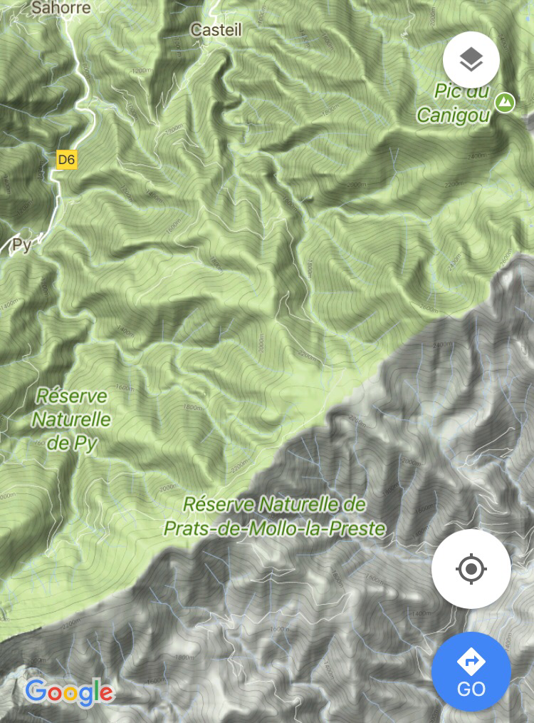
So it had to be somewhere around here. I checked google maps. You really have to zoom in quite a bit to find alternatives to car routes at all. And then search a bit to figure out which ones actually have any connections over, and not just along the Pyrenees. In the following screenshot you have to look closely to figure out the trail – the summit ridge is marked by the change from green to gray ground, btw:
Zooming in a bit further, you see the summit pass here:

And here is a link to the summit location, so you can explore it digitally yourself: CLICK
Clearly this path fulfills all my criteria: it crosses the mountains around the right location, it is really remote, and it goes pretty high. Perfect!
The only problem: google does not offer any information about what kind of ground (or even pavement) these paths have, nor how steep it is. My bike is configured for the road – so there are limits. Streetview ended already in Casteil and starts on the other side only further down the slope. On the last StreetView locations on the route it looks a little… sandy. Satellite offers only some light lines on the ground, like this (couldn’t remove the street overlay now):

And then of course there’s the problem that from above, it all looks pretty flat even though clearly there must be quite some elevation gain.rather late I noticed how high it actually goes.
One last chance: sometimes people upload pictures from up there to Google. I found some in the map. I googled the name of the uploader and miraculously immediately found him on Facebook. A Dutch guy who does incredible adventures – which could have been a warning already as to what kind of path this would be. (Check his YouTube channel!). He kindly replied very quickly, but wasn’t quite sure either if it was cyclable – however, he kind of confirmed the attitude that I had already gained about this path: “I’d just do it”.
In short: everything between Casteil and some place on the other side of the mountains was pretty much a black box to me. Right now, you have exactly the information about that route that I had at this morning of my departure.
3. The climb & the summit
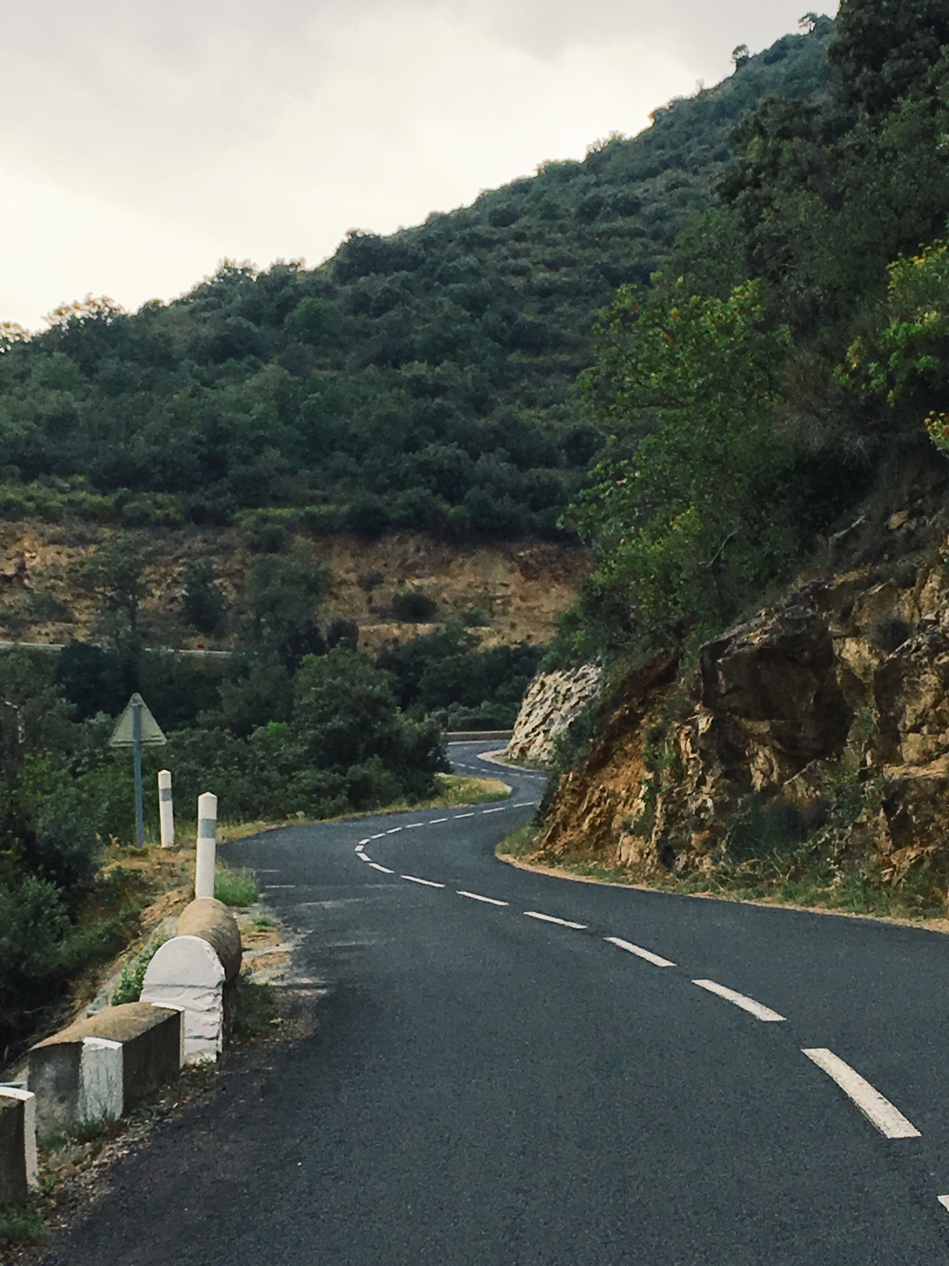
After coffee and conversation, I clipped into my pedals and started the ride. Looking up and ahead into the beginning of the wall I intended to surmount:

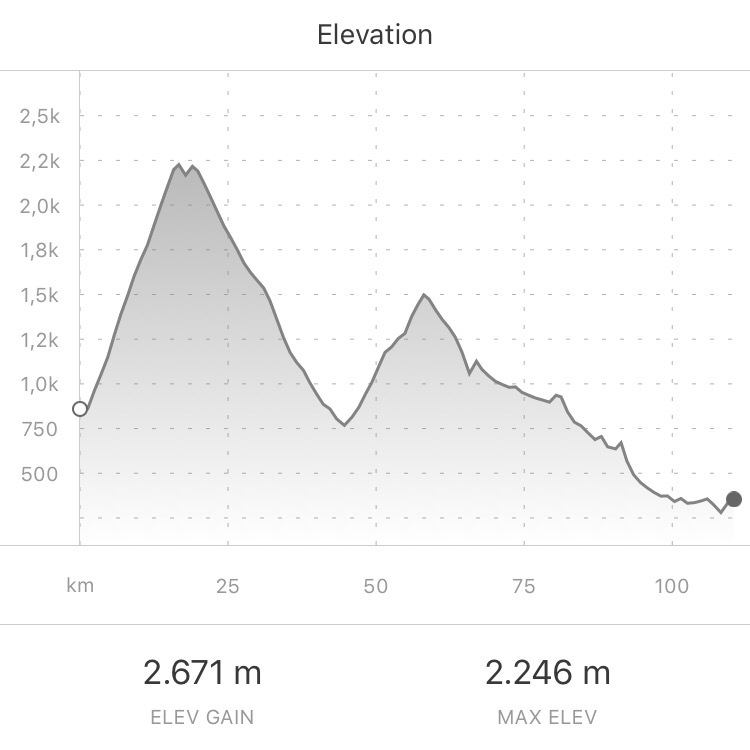
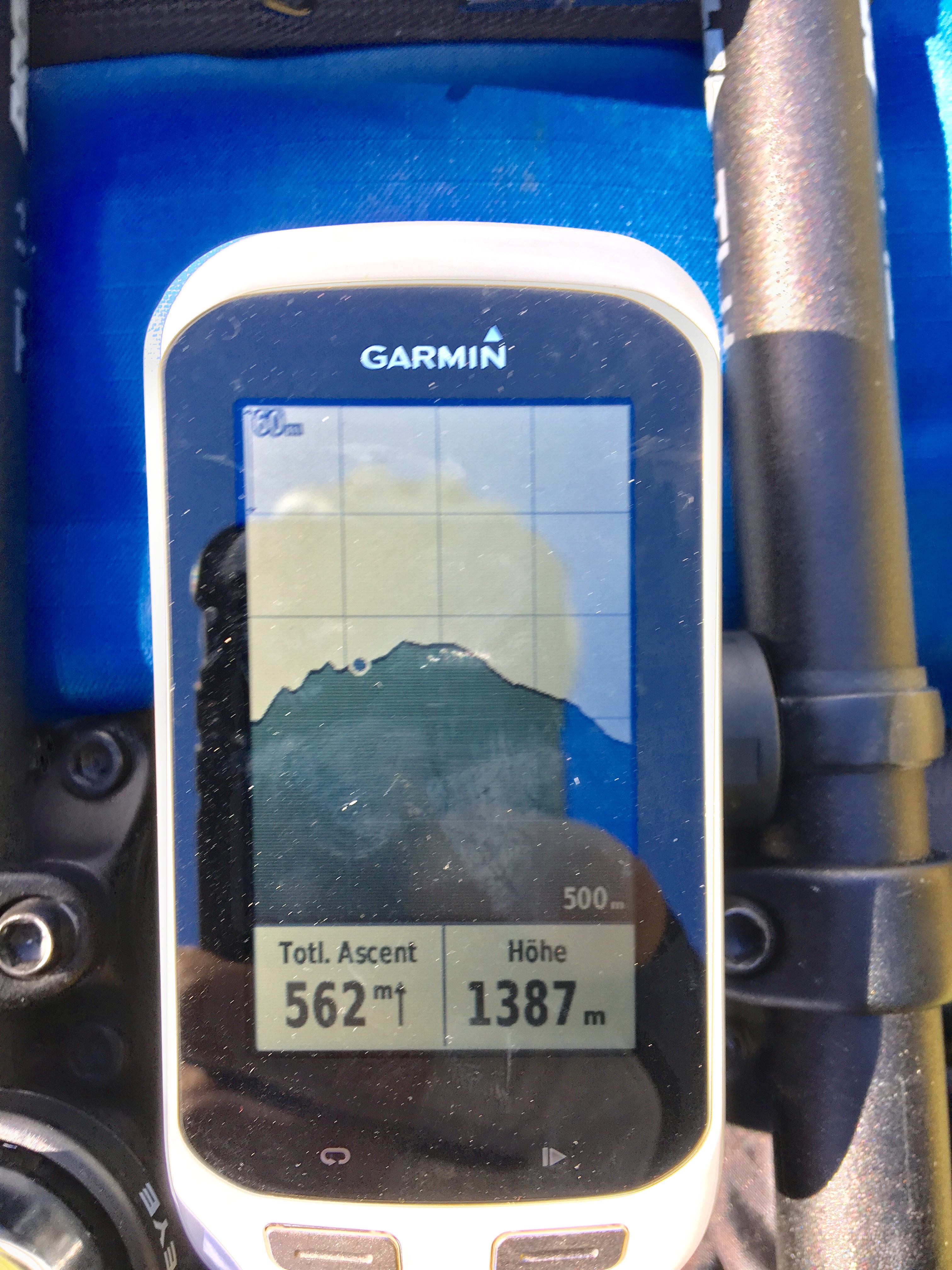
Briefly checking Komoot: 12km horizontally from Casteil to the summit. Elevation difference (and assuming no downhill passages: also the accumulated gain): 1,5km vertically. Just now it dawned on me: that makes a 12,5% average over a distance of 12km.
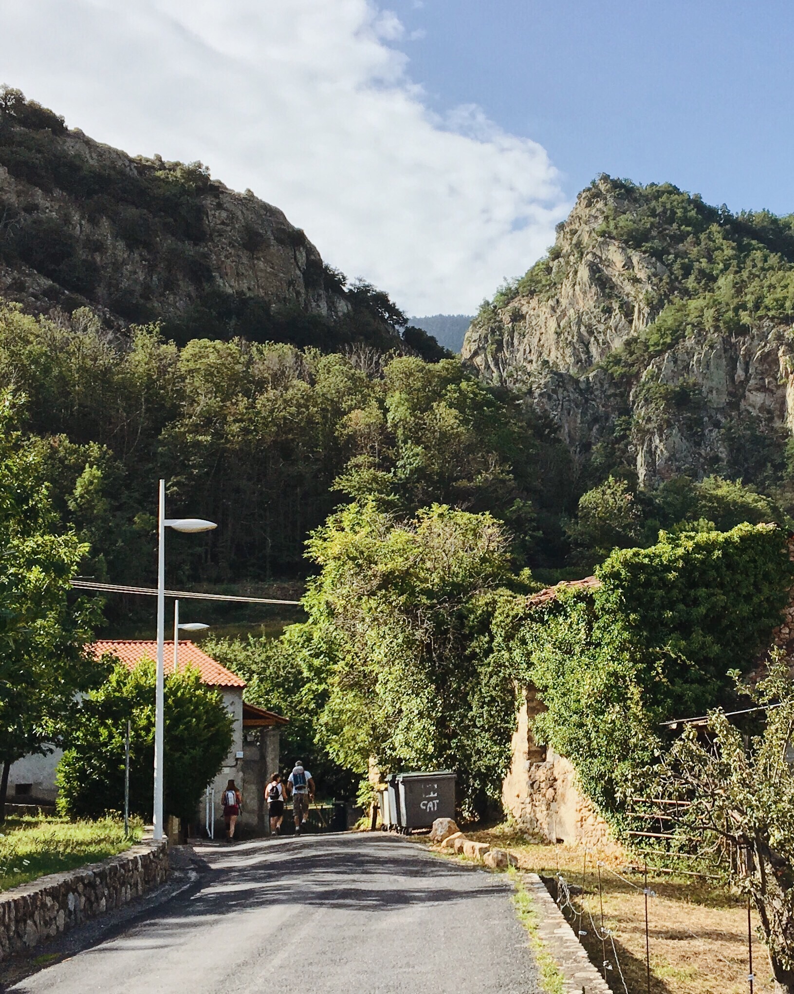
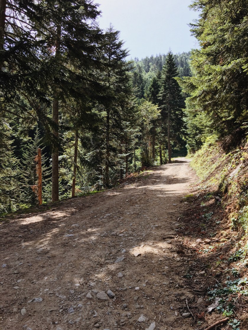
Holy moly. This would be wild. And that with luggage!? Generally I was aware of the option to ‘just’ push the bike if it turns out not to be doable by bike. So I was glad it was ‘only’ 12km and not a multiple of it. So far I was still on a paved road. Already steep though – 8% I guess (but below the average = even steeper than average later). Pretty quickly I reached this point where StreetView stops and where hikers can park their cars as their base to return to:

(Taken from StreetView) As you can see, the road is indeed sandy. It was less even and smooth though, in real. More medium rocks. It was 10.30h and already very warm. I was dripping from sweat already now before the show even started. Just a few hundred meters further behind these cars as the ‘last marker of civilization’ (yes, exaggerating), and the option to push the bike turned into a mandatory reality: too steep – cycling would be extremely exhausting and inefficient. No way I could do this for 12km when I was already struggling with 12m! And importantly: the ground was too rocky and too loose to get any grip or even get into a rolling rhythm. Please not that NONE of the pictures I post here in this entire post even remotely confers how steep it actually was.
The decision was made: I’d have to push it and walk – and hope that there aren’t any other surprises waiting. For example I did not account for the fact that such a route could be closed – I just noticed the possibility when I saw an “Ouvert”-sign for the next section.
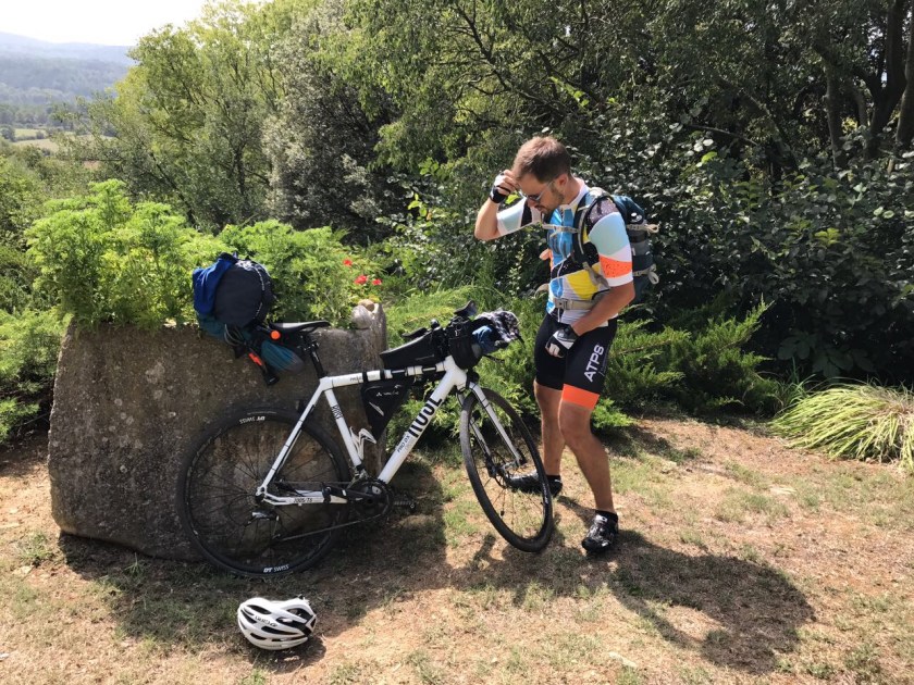
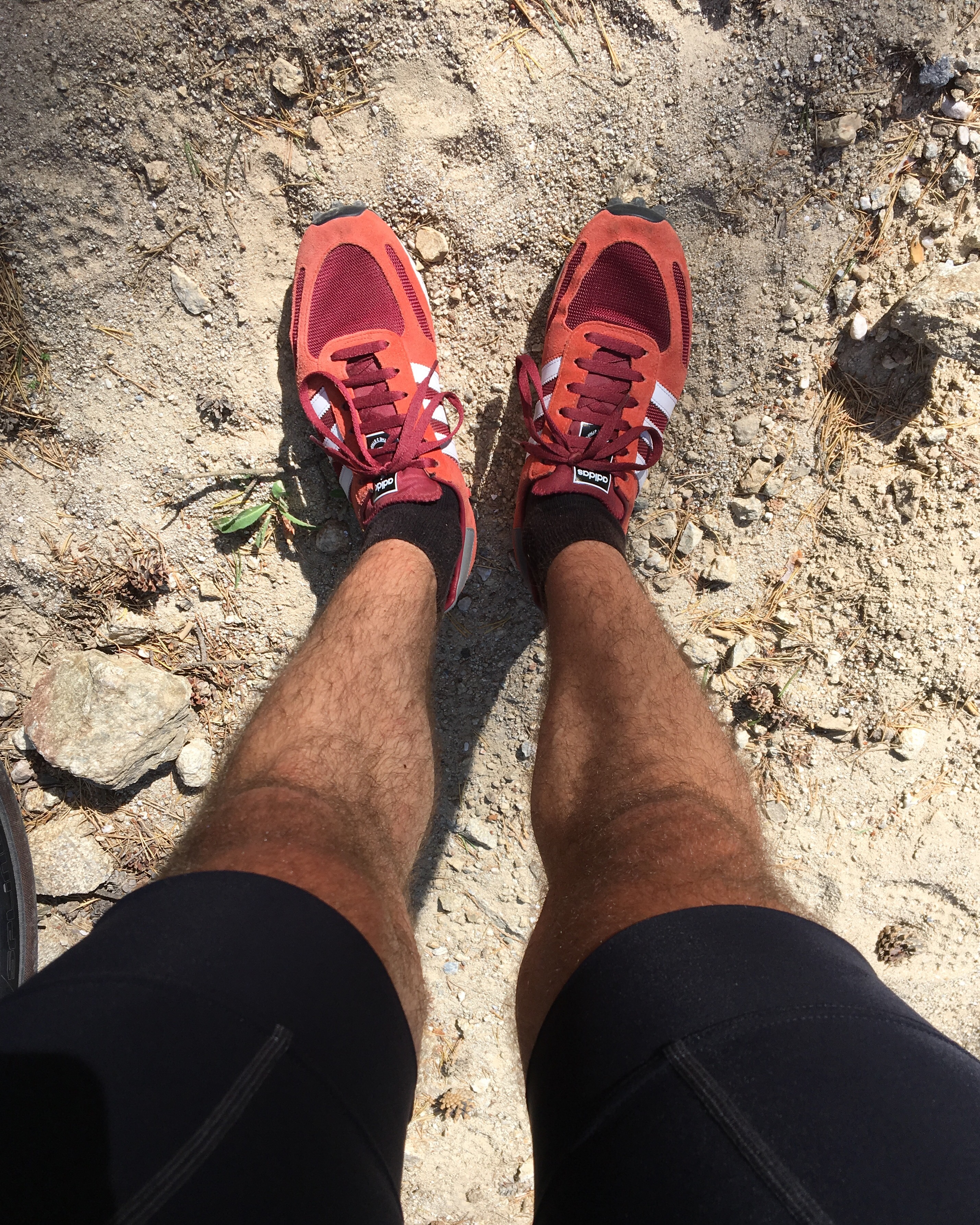
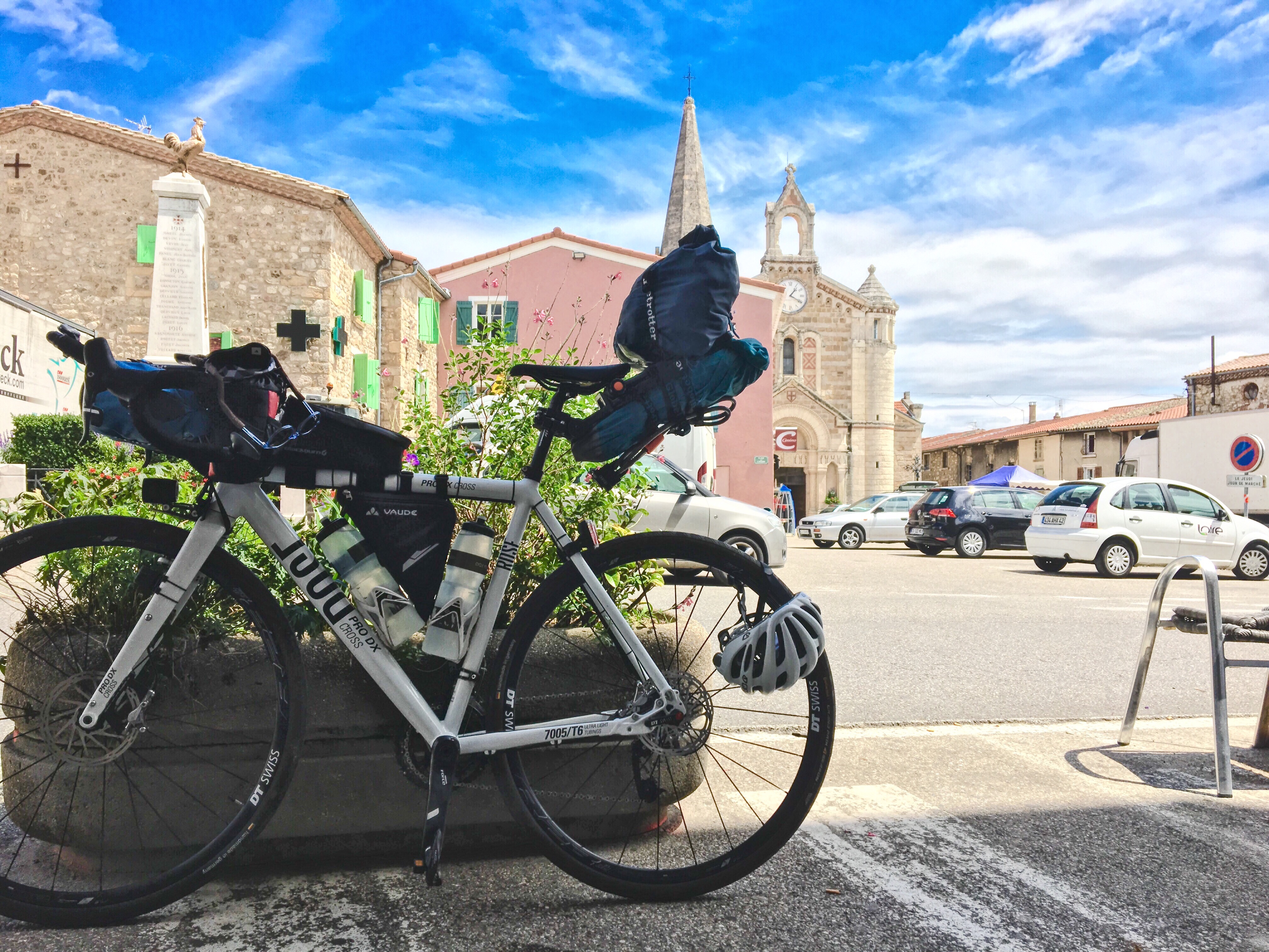
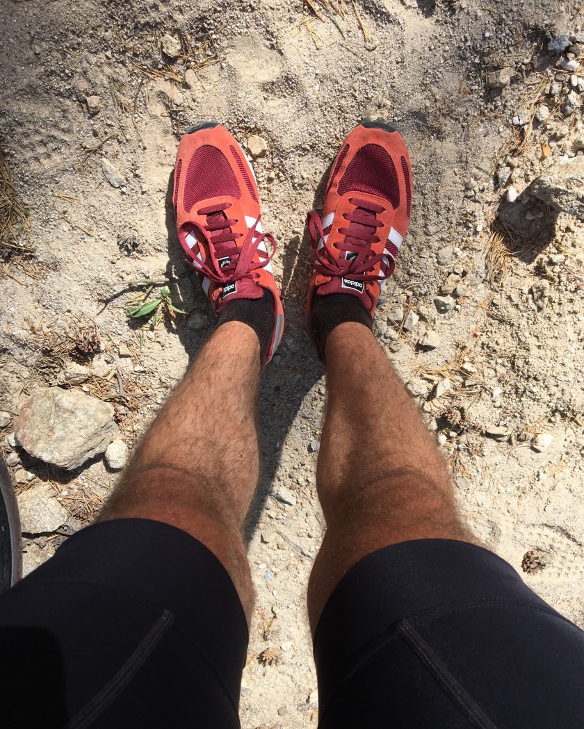
Oh, and of course: I had to change shoes. My clip-in cycling shoes wouldn’t be of any use for the next hours. Here again a piece of my planning worked out beautifully: I had bought these sneakers just weeks before, already with exactly this possible situation in mind: heavy profile and (thanks mom, for the tip!) mesh openings for ventilation that worked out perfectly.
Going on… usually in such a situation I would set some landmarks to work towards. I could have picked the Refuge Mariales – some sort of mountain hut (quite large and well equipped even, as i guess) – and some of the major bends on the way. But somehow I didn’t, maybe because in this case landmarks would just have made it easier for me to imagine how far it actually still was, instead of providing any motivational benefit.
As I walked up I passed several hikers at some points. They looked a bit in disbelief – cause why on earth would anyone bring their bike up there? And there were still cars going up here – like the one of a young couple asking me if there’d still be a parking lot up there.
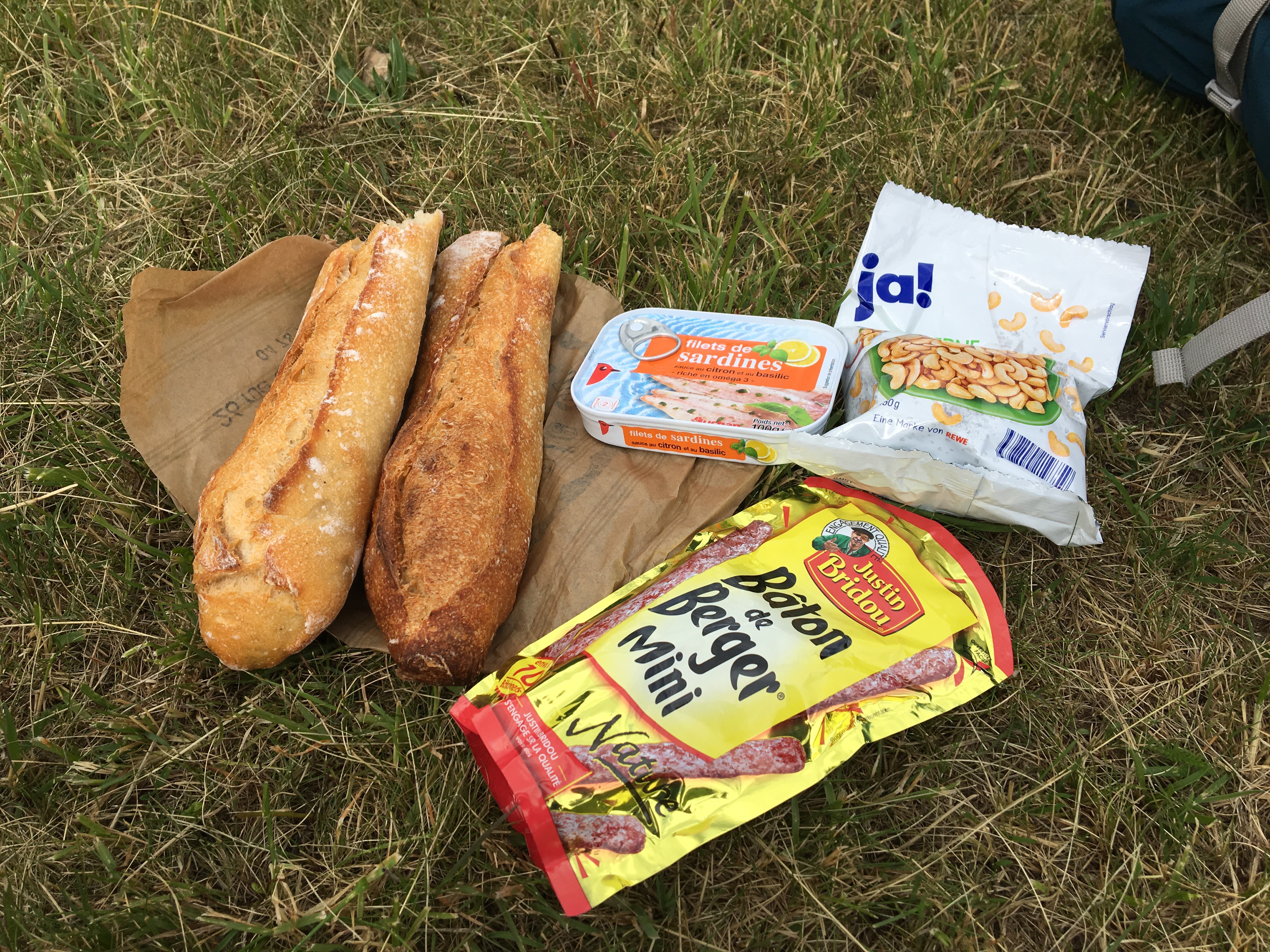
Of course as it was hot and I was really working hard, I had to drink quite a lot. My biggest concern for this day was if I might run out of water – that would have been the only real showstopper I could have imagined. That fear was inspired by the previous day, of course, where I missmanaged my water supply on a climb (see post 06). However, this turned out not to be a problem at all! Because once in a while my path crossed a creek. I hesitantly tried the water, but it was really super fresh and clear and cold, with hardly any dirt in it. So once per, say, 2km I refilled a bottle and got my head wet. Ideal.
I was still on an altitude with rather thick forest so I could usually find some shade to walk – or let’s say: clumsily clump – in. It was certainly above 30 degrees now (I checked in hindsight: 34 degrees). But the vegetation changed at some point. Here you see me approaching the timber line (altitude where the forest stops. Thanks, dictionary).
So I had to prepare against the direct sun and identified my button up shirt (yes, I bring one on each tour) to be perfect: light colour, thick fabric, absorbent (-> sweat).

At this point btw would have been an alternative path leading to the refuge I mentioned. But there was no reason. I went on. And on.
Further up, passed a last parking lot for the daring drivers. A km later, to my surprise a little Fiat 500 approached and passed me from top – incredible that this car managed to get up and down this gradient and rocky surface. In it a young woman who briefly stopped. “Is this a road bike!?!” (“velo de route”) – “yes, a stable kind of road bike” – “I’ve seen mountain bikers just sometimes up here. But this..?!” I mentioned I want to cross the mountains and reach Spain, with the intention that she would then alert me of any issues with the route if there were any. Instead she just wished me good luck and went on. Reassuring.
On and on, step by step. I felt a pain in a tendon in the back of my right knee becoming a bit more prominent. But it felt familiar and I didn’t worry. I passed the mountain hut of the Fiat-lady – strange shape… round, white plastic like truck tarpaulin, garden chairs in front and some empty kind of cattle compound next to it. Good bye last hut! Slowly, with the gained altitude, the air was getting a bit fresher. Up and up. Drinking, stopping, mueslibar, up and up – I still hear the creaking of stones and sand under my shoes and the rattling of the poor, pushed bike on the rocks. I tried to see my bike not as much as baggage that I had to push up and along, but as a kind of walking cane I could lean on a bit. I think that way of fooling myself helps sometimes.
Now probably around 1900m altitude. I thought about the nice morning with coffee and chocolate croissant. And the night, where I couldn’t sleep properly. Yet, strangely, I was very awake right now; that was probably because every step asked for my attention and I constantly needed to plan where exactly to place the next ones as to get the least resistance. Last night… now quite amused at the fact that the roaring was ‘just’ a Lion in the next door zoo. But now for real: Are there bears in the Pyrenees? Crap. If I would now encounter one.. what would I do? Nothing. I had pepper spray with me, but that would hardly impress a brown bear. There would be nowhere to go. Getting a little nervous again. I heard cracks in the scarce vegetation to the right of me, up the hill. Suddenly I was more aware of all sounds, my pulse a bit higher. I know it’s ridiculous – but it was all a somewhat unusual situation for me.
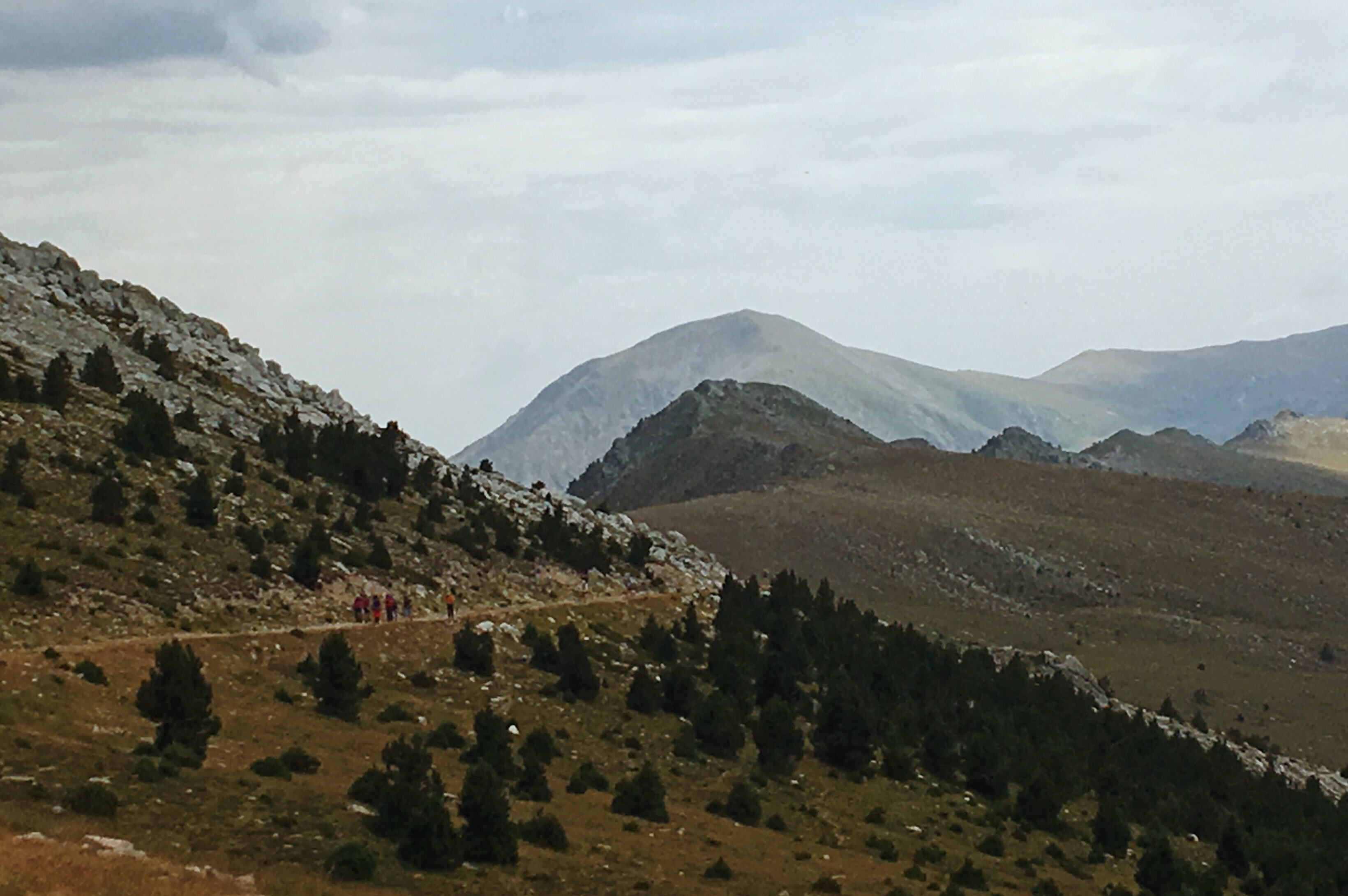
Luckily: Slowly I approached what I later recognized as a summit cross, which was odd, because it was clearly placed at the bottom of another slope. No idea what it meant. In any case I bumped into a group of hikers up there who were about to descend. This must have been at 2000m. We had a very brief chat, looked up the mountain and they reassured me (more with gestures than words) that it was getting a bit flatter soon. “Ah! Cyclable?” I asked hopefully. “Naah, not so sure” one of them said accompanied by a wide smile that seemed to stem from his internal comparison of my naive optimism with the rocky reality he saw up there. Bonne journee!
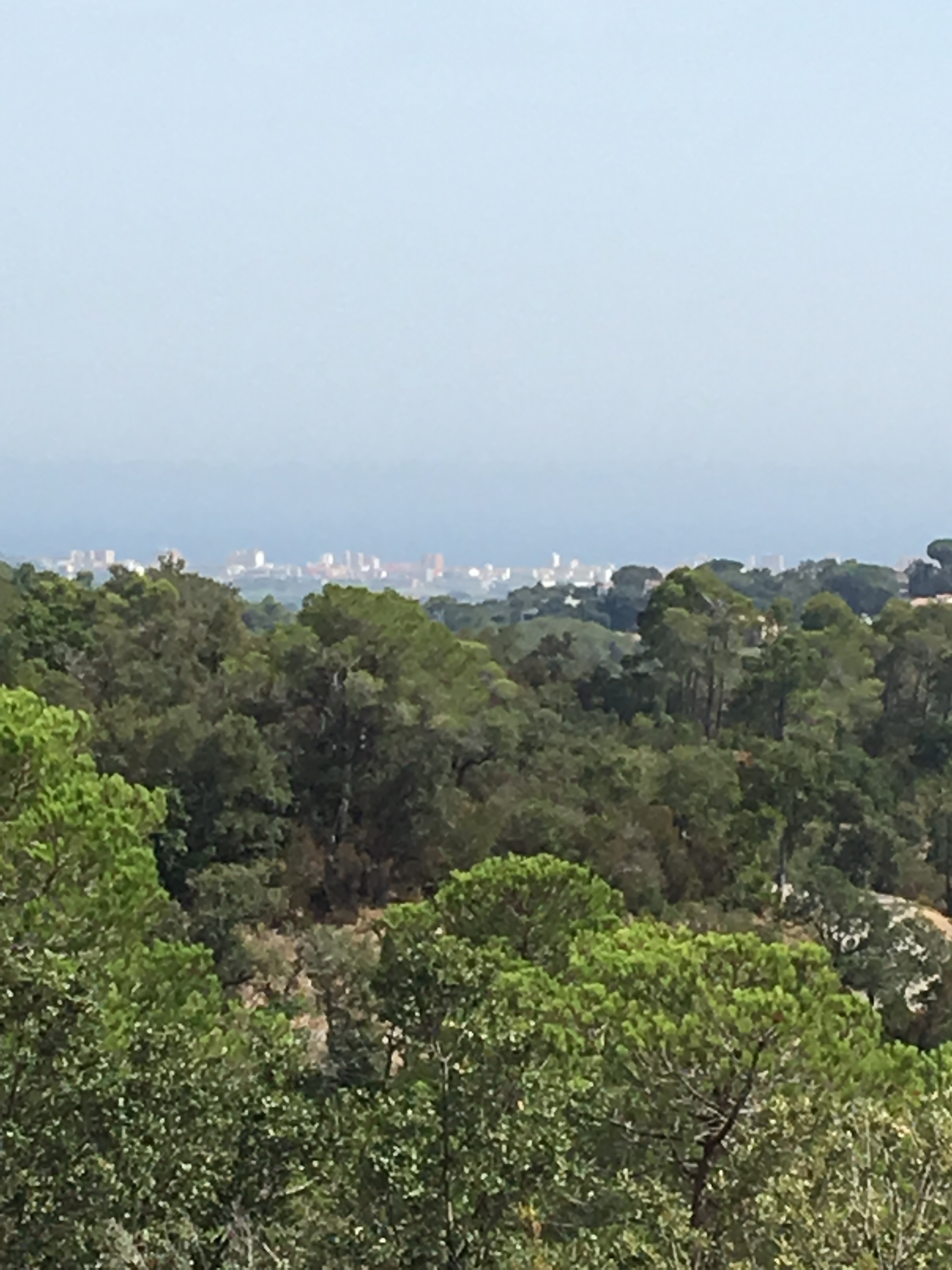
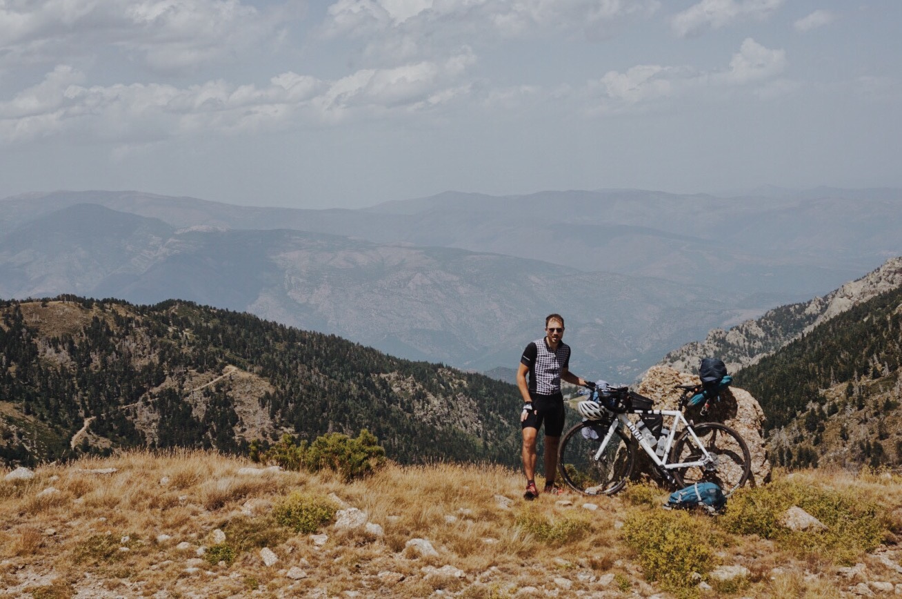
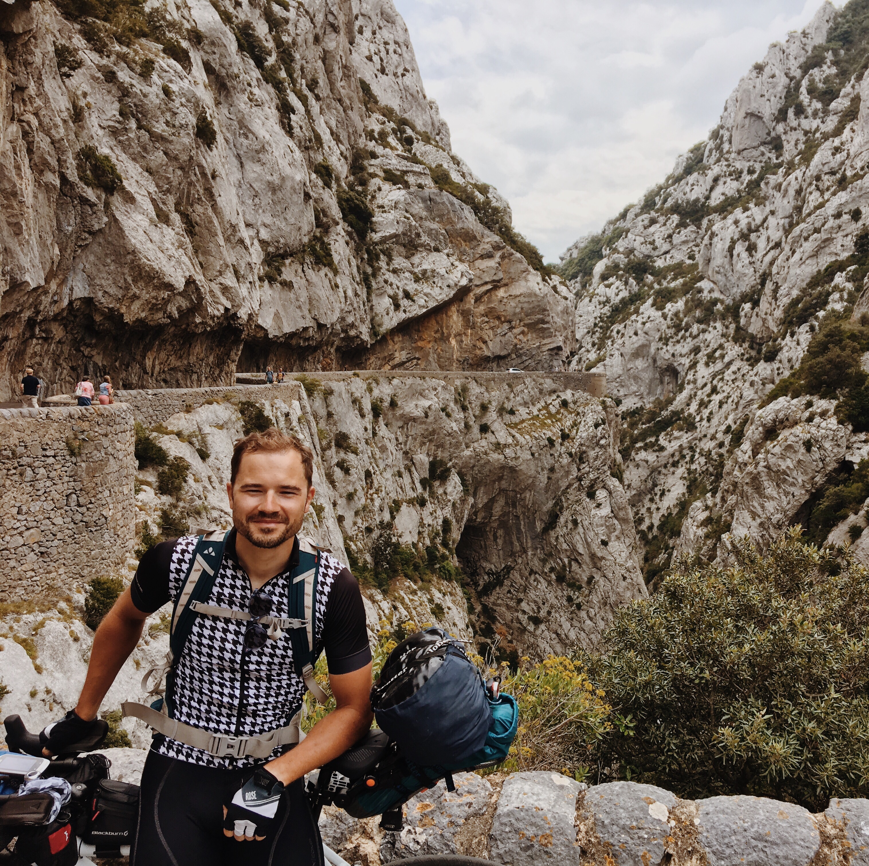
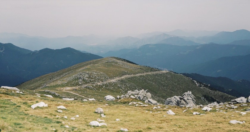
And further up. Still thinking a bit about the bear thing, but really: there was not a trace of a forest and I was above the general bear zone (probably I was never even in one). Should be fine. The next bend I knew would be the last one before the summit. I took a picture – the camera is facing back into the valley I came from – somewhere down there must be Casteil; down on the left you see the path I had come from. (Camera placed on a rock, with timer)

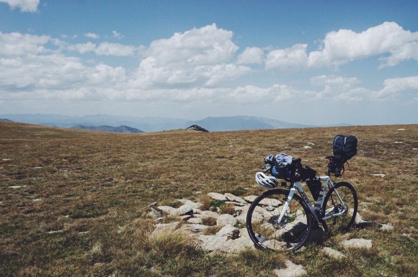
And going on, indeed the path became flatter but not in the slightest more rideable. And since the terrain was getting flatter overall, what I call “the path” was actually rather like a visual suggestion where to walk, but not really any more walkable than the surroundings. In fact, I noticed it was now much easier to move on the grass covered rocks next to ‘the path’. Anyhow, now it didn’t matter anymore anyway. The top turned out to be more a kind of plateau, which is not so surprising since there were some other higher, more peak-shaped (but inaccessible) summits many hundred meters next to this one in both ridge-directions; so this was really some kind of pass. The 2350m high bit was a smooth, wide hill situated right next to the rocky path, grass-covered and soft in shape and look, but not smooth in terms of its actual surface. Because of these hill-features, ‘climbing the summit’ was a gradual experience and not so much a situation of ‘now I’m there’. In fact, it was not so easy to distinguish which was really the highest point here.
Anyway, the moment of truth, around 14.15h:
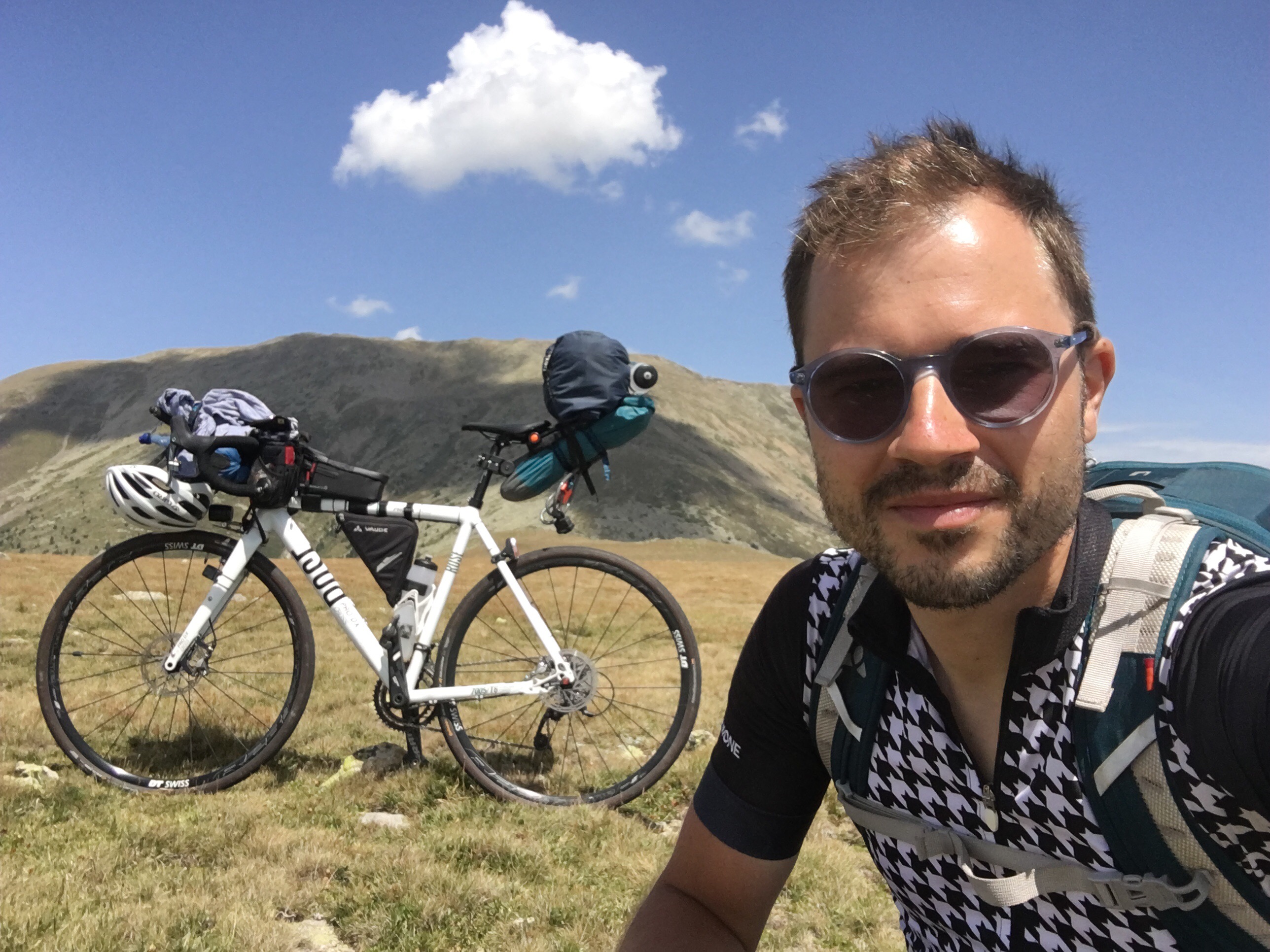
And here an obligatory summit selfie:

I took a greeting video for my family. And spent quite some time up here. Maybe half an hour. This moment was the central part of my tour. It was somewhere in the back of my mind throughout every km I cycled before through Germany, Switzerland and France. So I had to wallow in it for a bit. My ‘old valley’ to the North, and my ‘new valley’ to the South.
One technicality: here I had the first and almost only material failure of my entire tour: my bottles, each 1 Liter (= 1kg) were putting the bottle cages under such stress during the wild, bumpy and lengthy ascend, that – while I put down my bike on the ground – the front bottle cage broke off completely, and I noticed my rear bottle cage was broken, too, at the bottom, so the bottle had slipped through it. (See the summit selfie) There were two things somewhat ironic about it, in the Alanis-Morrisette-sense: a) that this failure happened exactly on the summit instead of at any other point. And b) these bottle cages were the only part of my bike and equipment where I deliberately picked the cheapest and simplest option – falsely thinking a simple thing as a bottle cage wouldn’t require special attention. And they failed. So from there on I’d strap one empty bottle to the rack, and put one in my backpack and still had a smaller bottle strapped to the aero bars. Could be worse.
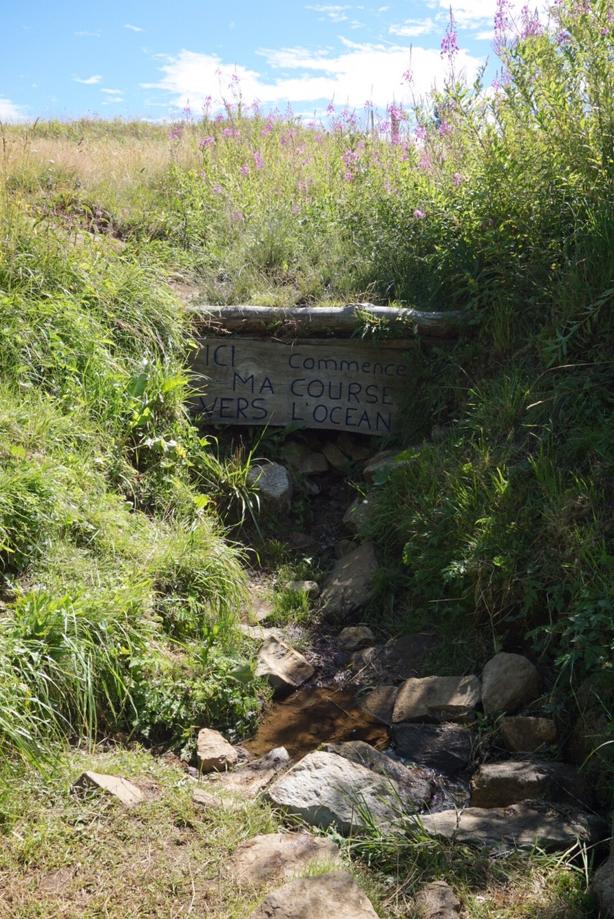
Back to more essential things: A theme that really struck me up there, which I anticipated already, was: loneliness. In fact my desire to experience this sentiment was one major reason to cross the mountains in this way at all. It might get a bit sentimental now, but: up there, that was true loneliness. Only me. Some rocks and wind. No one in the surrounding kilometers would be higher than me. And to get here, to get me, there’d be some way to cross through all 3 dimensions and more obstacles. It was a moment of escape. I was hidden from ‘the world’. No one saw me, I saw no one. My current state only counted for and to me and itself. Importantly: yes, the loneliness was prominently presented to me here… but was the basic feeling really different from any everyday situation? Aren’t we always lonely in a way? I will not go on with this now – if you like we’ll have a personal chat about it, that’s probably more interesting and appropriate. Let me just say: all this was a moment of happiness, satisfaction, positive prospect and beautiful memory. Pretty touching, too. But most of all it was just now.
4. Slowest descend evah
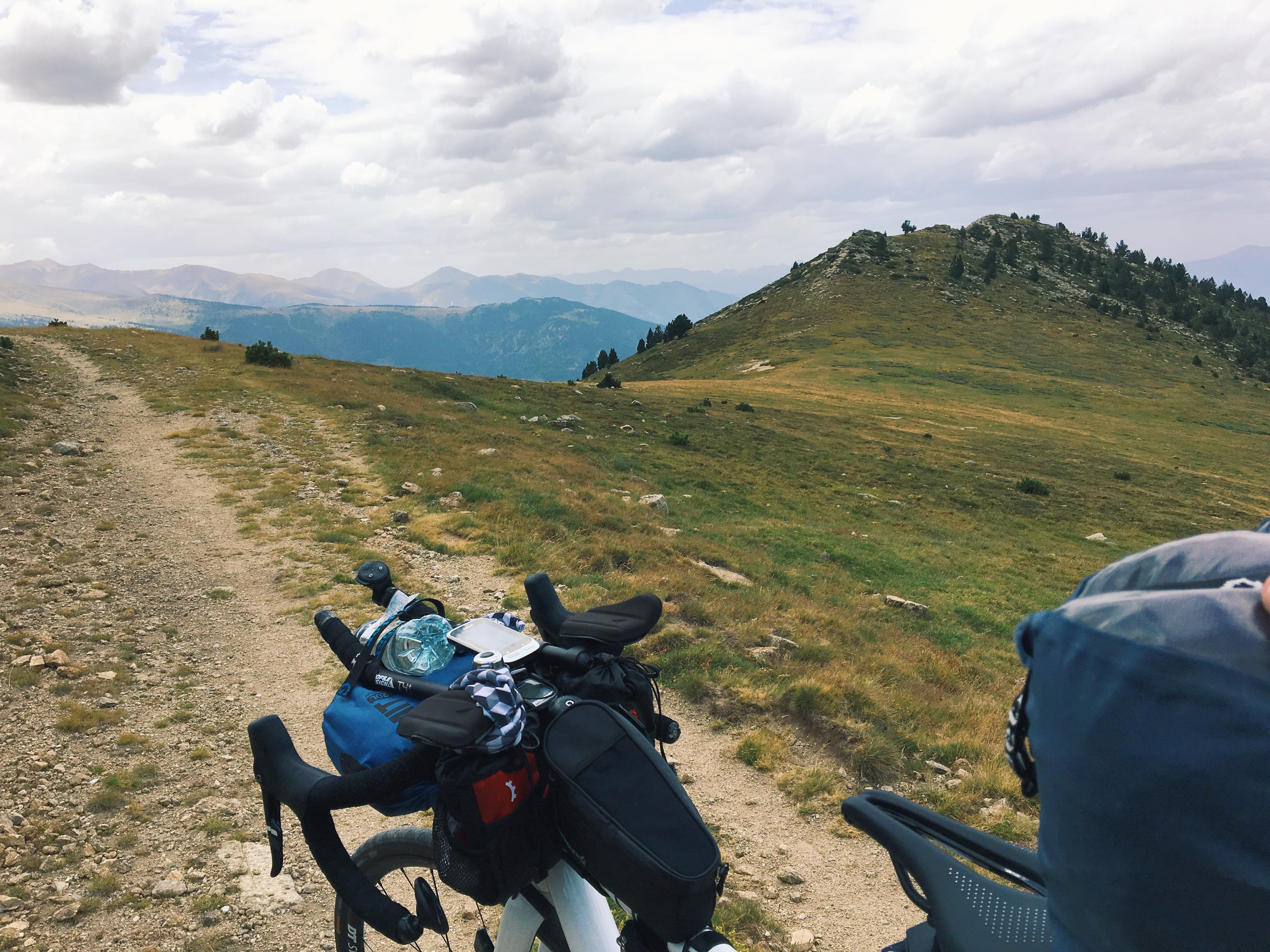
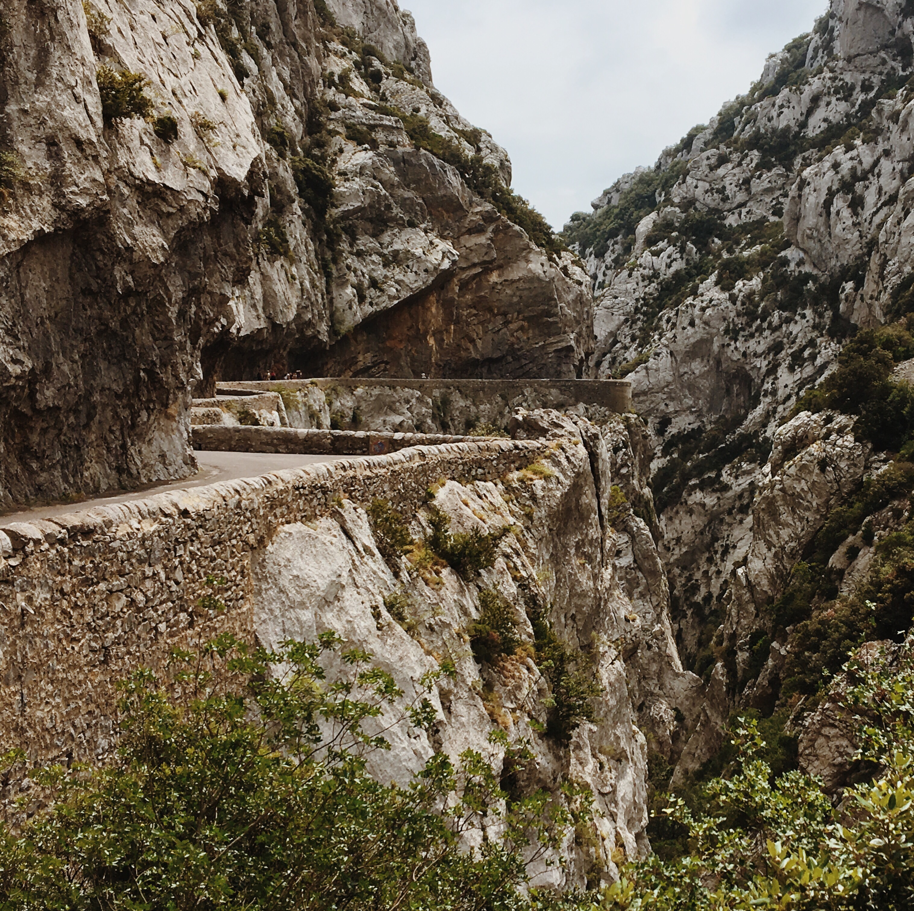
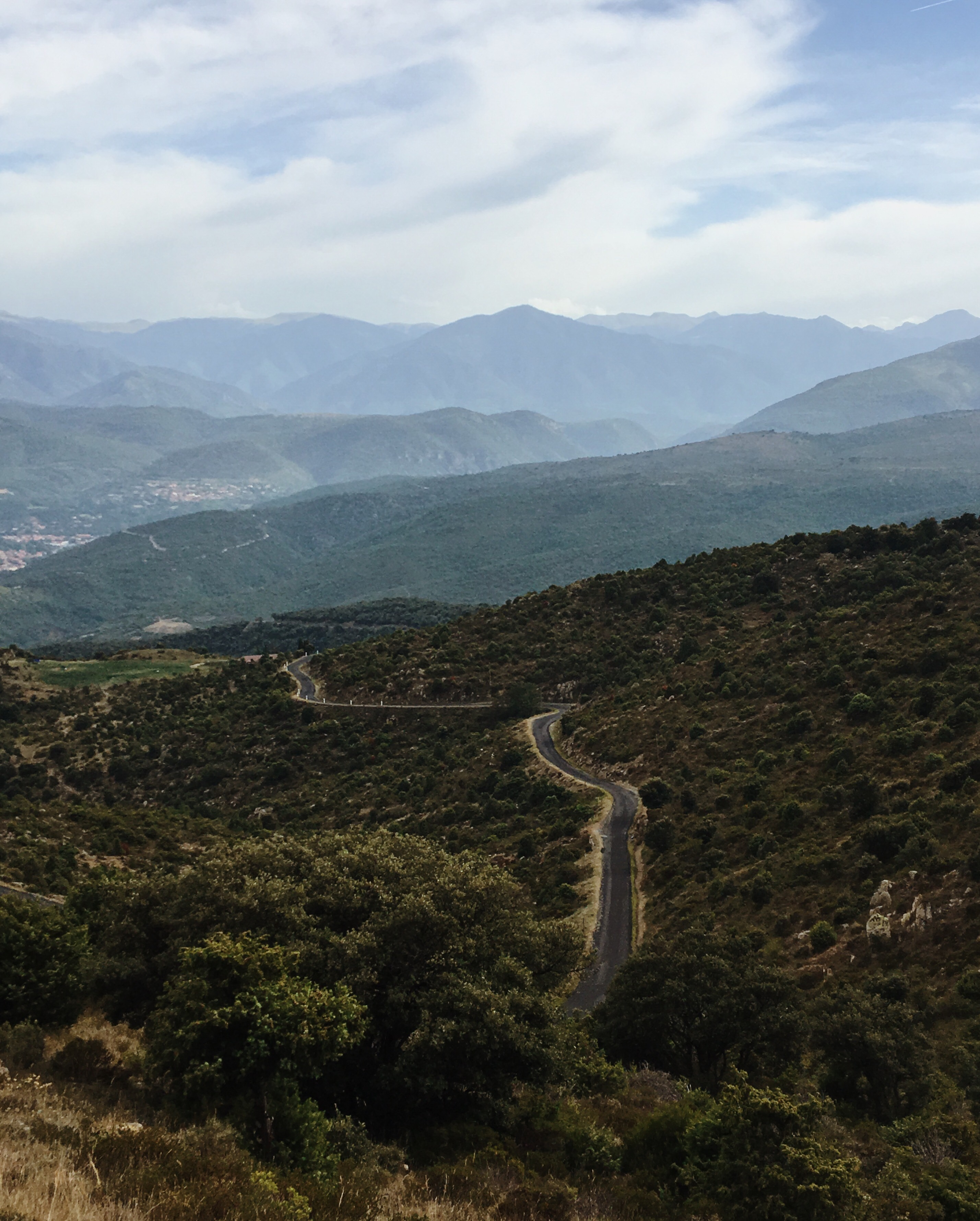
I declared the official summit moment to be over. It was already around 15h. But keep in mind: all that text before was referring to only 12km of horizontal distance. I wanted to arrive in Tortellà in Spain in the evening, which was over 100km further. Continuing on the rocky path, for a while it seemed like the mountain could not decide yet whether to keep me on the ascend or finally put me on the descent. It guided me around another hill, opening up the view into a new valley. Going uphill again. In the meantime I terminated some attempts to cycle: still way less efficient than walking and pushing.
Going along the mountain ridge:

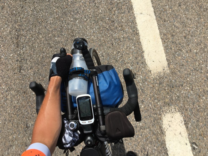
POV:

Up to the summit I had been primarily occupied with the struggle of getting up there. And I used the following heuristic with which you’d probably agree: “up = difficult, down = easy”. But Pustekuchen (look that word up! ; ) ). After another turn around a rocky hill it was clear: now it’s going only downhill. I mounted my horse with enthusiasm, optimism and full of energy. A state that lasted for about 5 meters when I noticed: the path’s surface was at the best marginally better than on the other side of ‘the Pyrenees’. Sure, I did not have to invest any more energy into propelling myself upwards – getting ‘up’ is a very simple challenge, it only requires energy, but not so much thought. Instead I was physically challenged very differently now: I had to a) absorb constant shocks, so I could only stand on my bike and not relax any of my muscles at any point. Constant tension. And b) I had to steer my bike with a precision of less than centimeters over and through the stones, rocks and sand. A mountain biker would have known this before. But I’m a road guy, and I completely underestimated this. Also: I had road tires: 28″ slicks, 5,5 bars, 32mm wide. This was a job that did not require just raw energy, but challenged my fine motor skills under force – continuous attention. Of course, previously I had envisioned my descend to be rather smooth and rapid, but now realized: 8 km/h downhill would be my average speed until I’d reach paved roads again – and that would be several km from here (not sure how many exactly).
This meant: the descend would not be much less challenging and only a bit less time consuming than the ascend. How could I have been so foolish to underestimate this? Maybe it had been a motivational and protective psychological mechanism to simply neglect it.
Somewhere on the way:


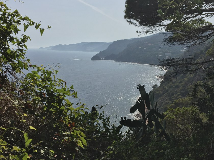
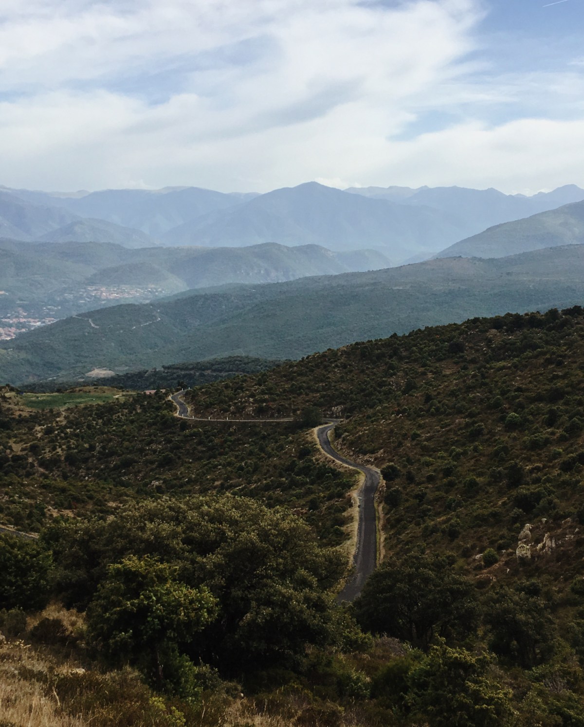
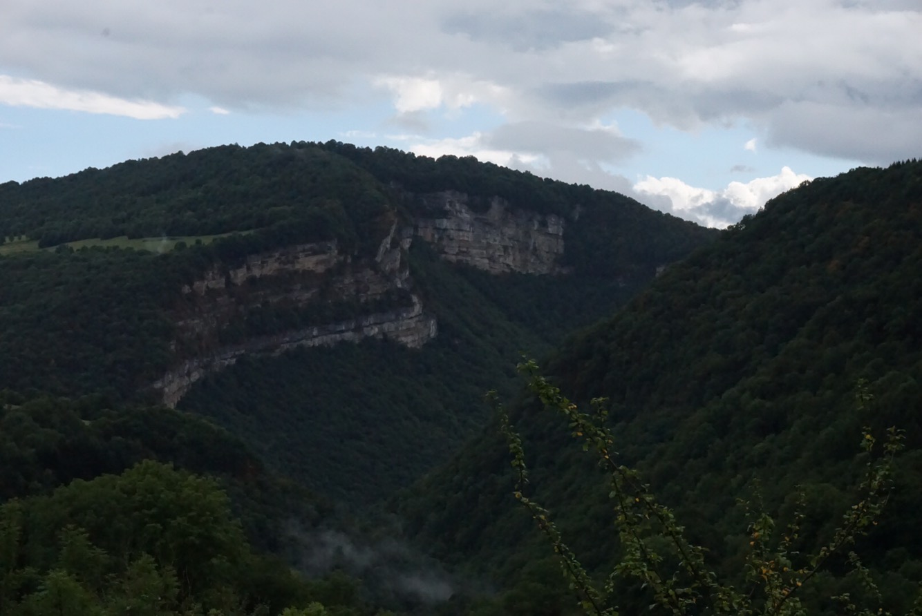
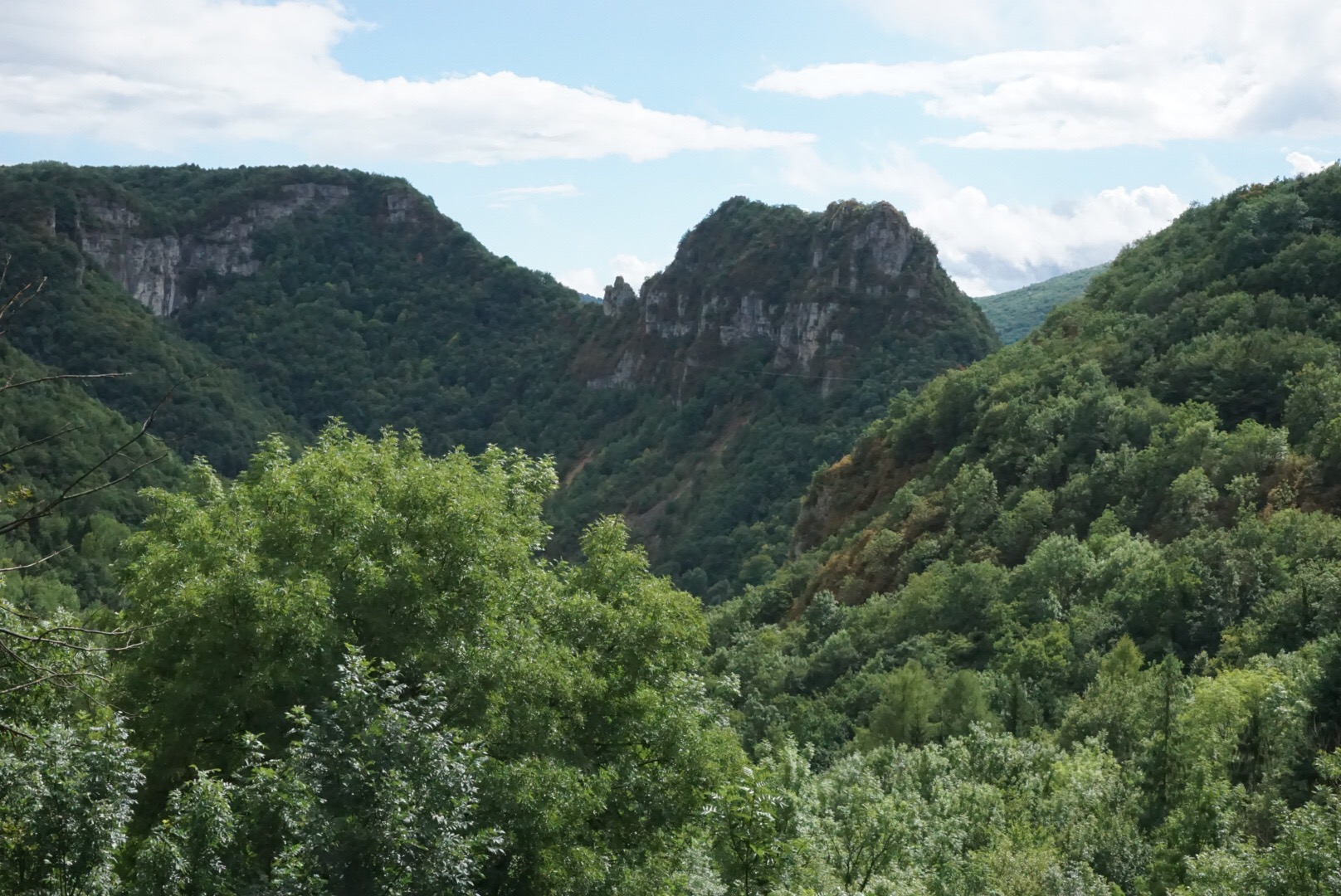
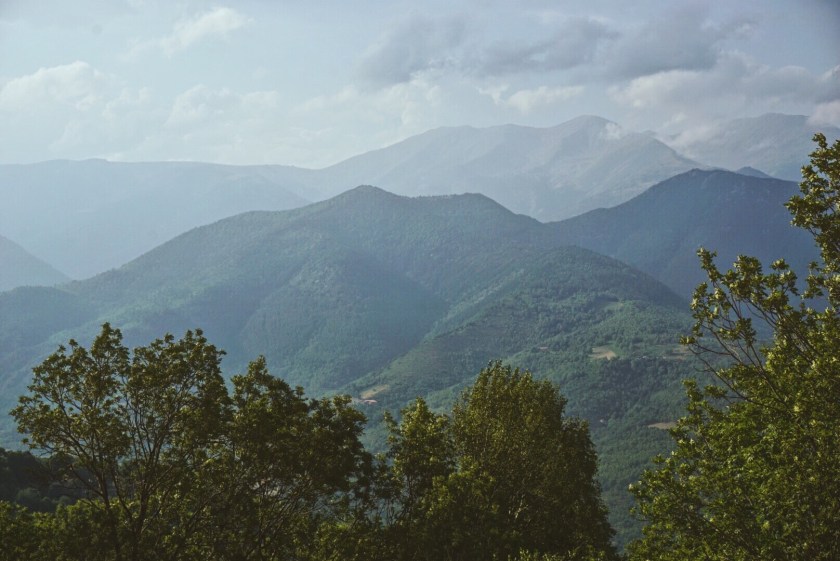
And like this I continued for a long time… at least I had some spectacular views on the way. Very interesting, exactly around the summit the colour of the mountain changed. You remember the map-screenshot further back? Where the summit ridge was represented by a change from green to gray? This was real! While the north side (facing Casteil) was characterized by rather thick green and warm sand colours, this South side looked much ‘colder’. The rocks were grayer, dryer, rougher and it looked more alien and hostile. This surprised me, because I would have assumed the South side to be more “friendly” and alive, since it was facing the sun.
My path downwards:
The whitish, ‘cold’ stone on the South side:

The descent took ages. Sometimes more sandy, other times more rocky. Constant rattling, shock, absorption, missing a rock, sliding away… You know that feeling when a body part gets numb. I had this in my left arm.That tickling sensation indicating a obstructed blood flow or pinched nerves or something. It feels a bit like tiny water droplets sprinkled of your arm, hardly noticeable. Well, surprise! Or: reality check! My little water bottle between the aero bars was leaking. No worries; my arm wouldn’t die; it wasn’t so bad. Instead as soon as I realized it was the water, I embraced the refreshment.
FINALLY at some point pavement began!!! Very shitty pavement, but in that moment it felt perfect like the surface of a velodrome track! Time to change back shoes. This was the first time since 10.30h in the morning that I could get on my bike and execute more than 3 or 4 normal turns of my crank. It felt fast. And great. Because to me it meant:
I have crossed the Pyrenees.
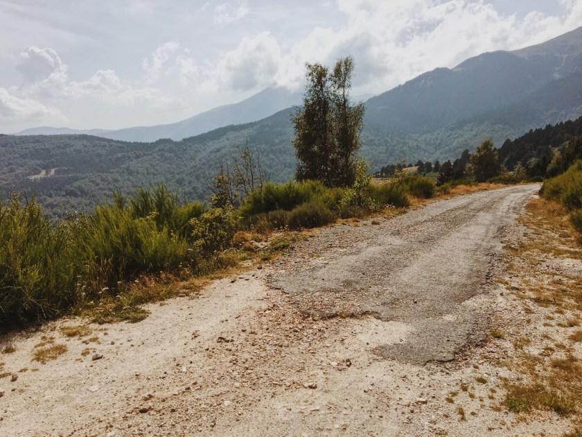
pavement begins!
5. The surprise & its payoff
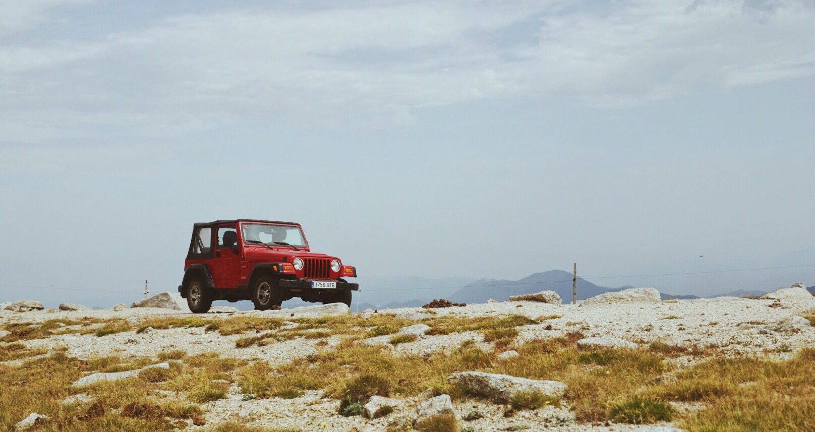
Of course now it was a long downhill ride. The road was getting gradually better. At some point I was surpassed by the red jeep that you saw on one of the pics and that belonged to two hikers who I saw and who saw me shortly before the summit. They new what I had behind me and gave me some friendly and encouraging honks.
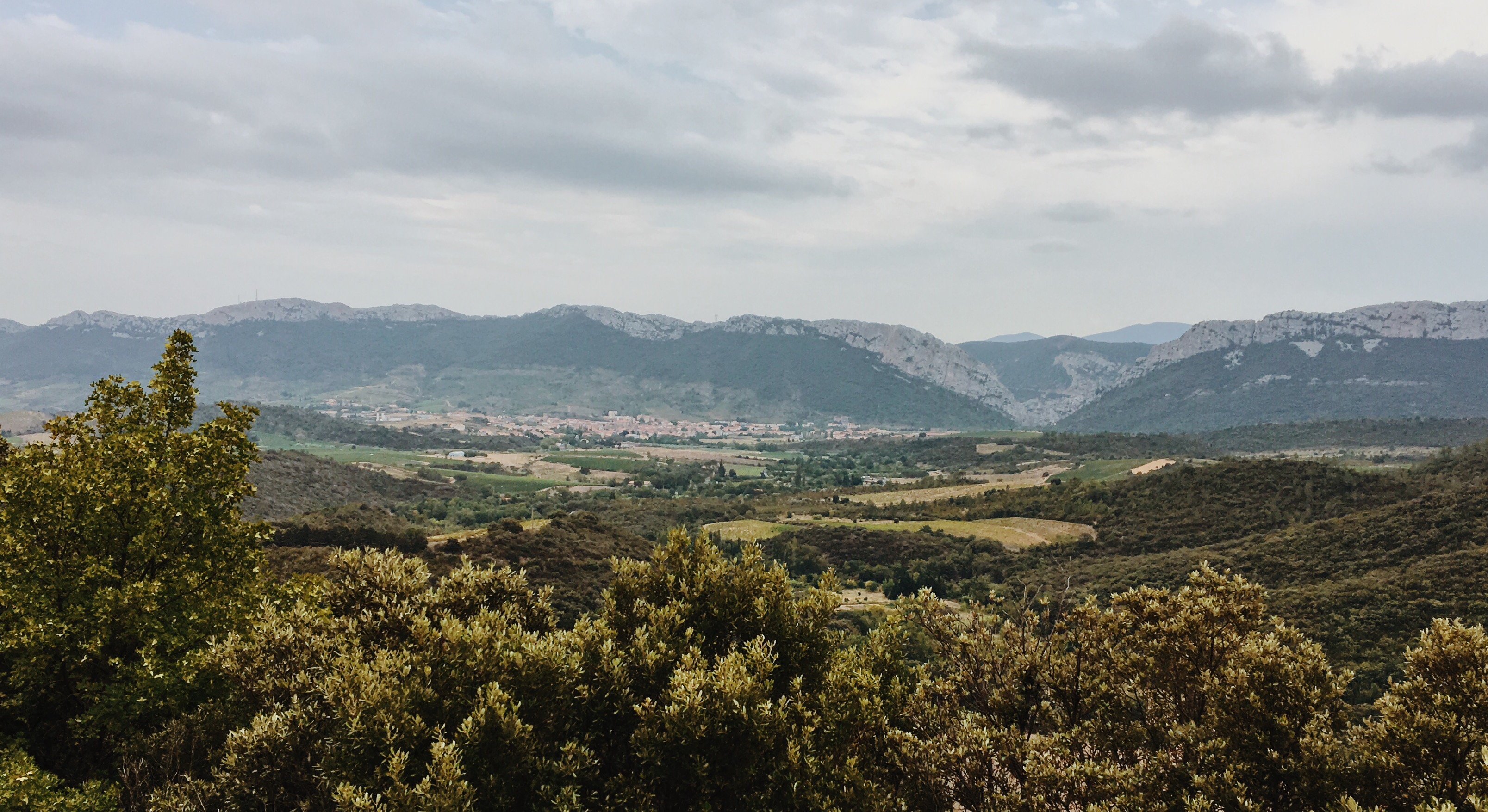
The route now lead me to Prats-de-Mollo-la-Preste, the first village to pass on this side of the Pyrenees. I did not have water left, so I refueled my bottles there in a Café. I was damn tired. And still had to process how the day went so far. Holy shit. I just walked over the Pyrenees – to put it a bit dramatically. Through a scatter of rocks, uncertainty, memories, anticipations, pain, exhaustment, views, all kinds of shallower and deeper thoughts. I was really quite done now. Somehow the real exhaustment waited to catch me just now as if I was numb about it before, similar to the pain that sets in only a while after a severe physical damage and after the danger of the injury-moment is over. I had 80km left. So despite it being such an eventful day already, I had only covered less than 1/4 of the distance. There were two things that kept me motivated now: a) the idea that I would arrive in a hotel later and meet my family friends Marion and Thomas – a motivation that was present already all day like a light but constant breeze (to emply some romantic metaphors here). And b) the (presumed) fact that it would be mostly downhill from here. I mean, it would be downhill, right?
It took me just a few hundred meters to realize: no. It would not be downhill now. In fact I read something of another ‘col’ (pass/summit) on a sign. ARE YOU KIDDING ME?
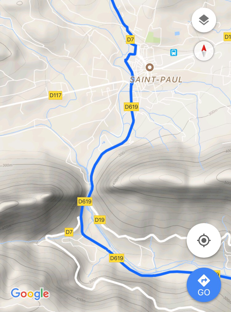
I stopped the bike at the side of the road. Immediately began dripping from sweat again, because it was still hot (34 or so degrees) and this was back down at 750m – lower than Casteil! I checked GoogleMaps to get an overview. And realized my so far heaviest route planning error: while planning I had assumed all those curly streets behind Prats-de-Mollo to go down to the Spanish border. Instead they would go up! The Spanish border would be on top of a pass.
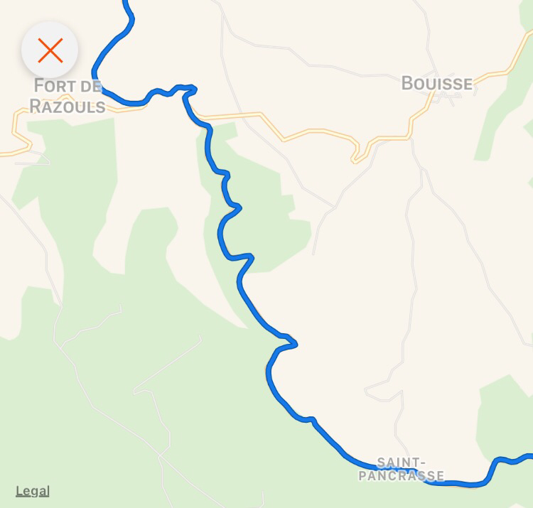
This is the part I’m talking about: the D115 from Prats-de-Mollo up to the Spanish border which you see in the bottom left. Sure, now with the elevation markers it is obvious.

Facts and figures: Prats-de-Mollo is on 750m, the Spanish border is on 1500m. Distance: 12km. Consequently an average gradient of 6,25% but really with most of it above 8%. This is a killer. To me at least, after that kind of day.
But is there anything I can do? Yes: do it. So, I sent a brief message to Marion and Thomas that my arrival would be delayed; just “another climb of 700m”. Getting back on my bike. I spent most of the climb standing. The short parts of ‘only’ 6%-gradients made for excellent ‘relief’ phases. Had to stop several times; actually this was one of the first times on my tour so far that I had to really stop because my body uncircumventably dictated it – my muscles, my circulation, my temperature, or the burning sweat in my eyes (that was actually the biggest problem)… many reasons to stop many times. I don’t think I had a climb of that quality before – and its timing wasn’t good.
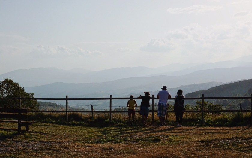
One last view back onto ‘my Pyrenees’ before penetrating the border ‘wall’ to Spain:
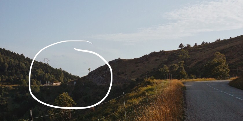
At some point I approached the last 4 short, but pretty steep bends and stretches that culminated in a last straighter stretch towards what I’d now call the “gate to Spain”, cause, if you look on the above map, that’s really what it is: a gap up in the mountains through which you first look down and then ride down into Spain.
The gate to Spain (marked) as seen from 1km or so away:
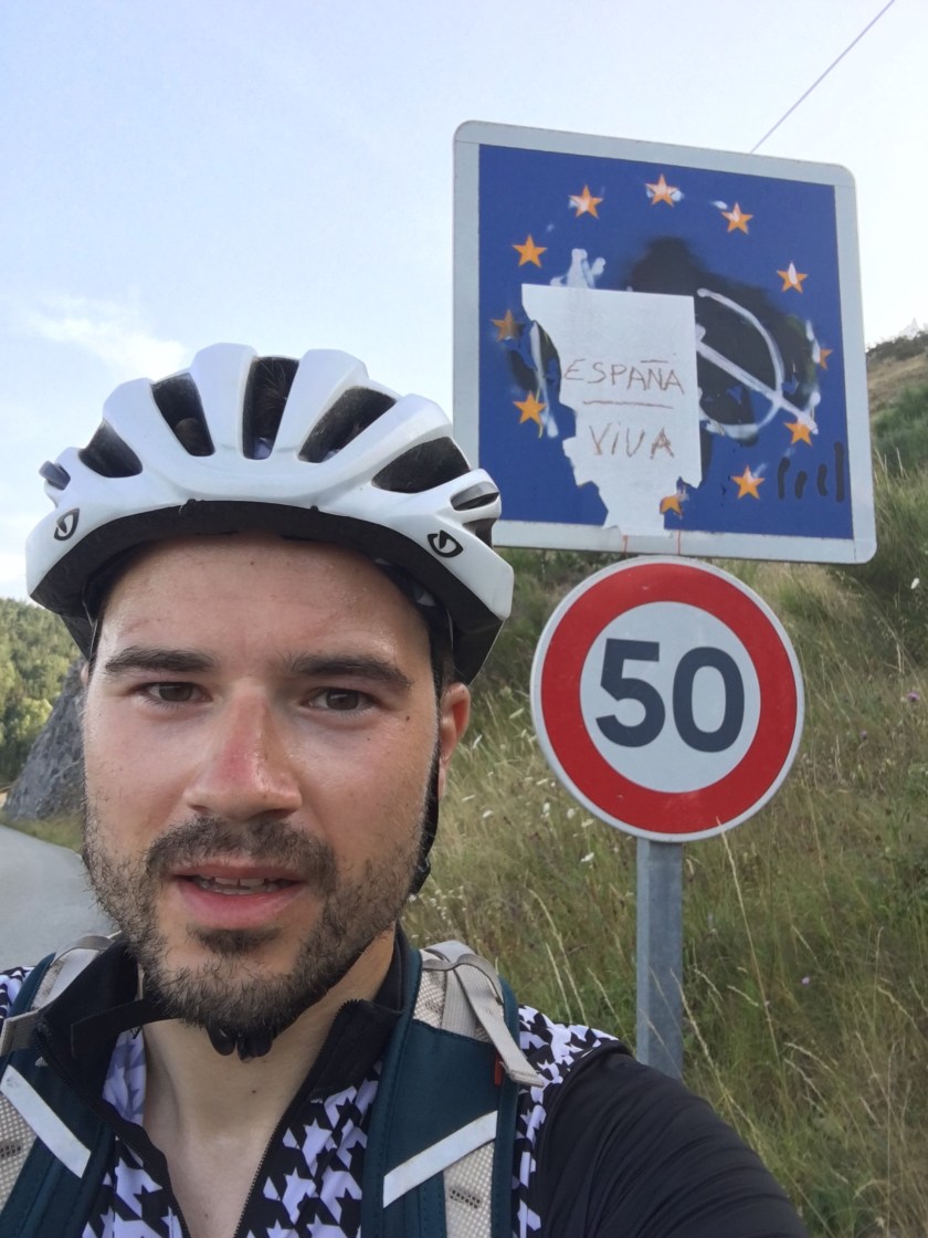
Spanish border, basically on top. I guess you see the exhaustion in my face (and some traces of the Catalan independence movement – not in my face though, but on the sign):
Looking back into France…

…and looking literally into Spain. A pretty ‘magical’ moment to me:
On the border and the viewing platform there was a Dutch family. The dad carried his son on his shoulders and said to him in Dutch (assuming I would not understand him): “Look, Bouke, that guy cycled all the way up here!” – how right he was. I had to smile.
Ok, this was tough. You read it. I remember it. But let’s move on. The day wasn’t over yet. Still about 65km to go until my arrival in Tortellà. To briefly summerize the situation now:
- I was now in (or on the border to) Spain.
- I had finished all climbs for the day (I promise. I checked!)
- It would go almost exclusively downhill from here
- The weather was warm, but since the sun was already low, the temperatures were getting better
- I could now anticipate an arrival in a hotel (=shower and clean clothes!)
- And most importantly: I would, after this crazy crazy day of loneliness in foreign terrain be united with two very familiar friends. As I mentioned, a recurring theme of motivation today.
You’ll agree that all this sounds perfect. And it was. Superficially it was almost as if the rest of the day had never happened; but certainly all the past events of today heavily shaped my inner and outer of the moment. The first descend started. I didn’t take many photos, but some videos instead, because taking videos while cycling takes less time and it also captures the atmosphere better:
Right after crossing the border:
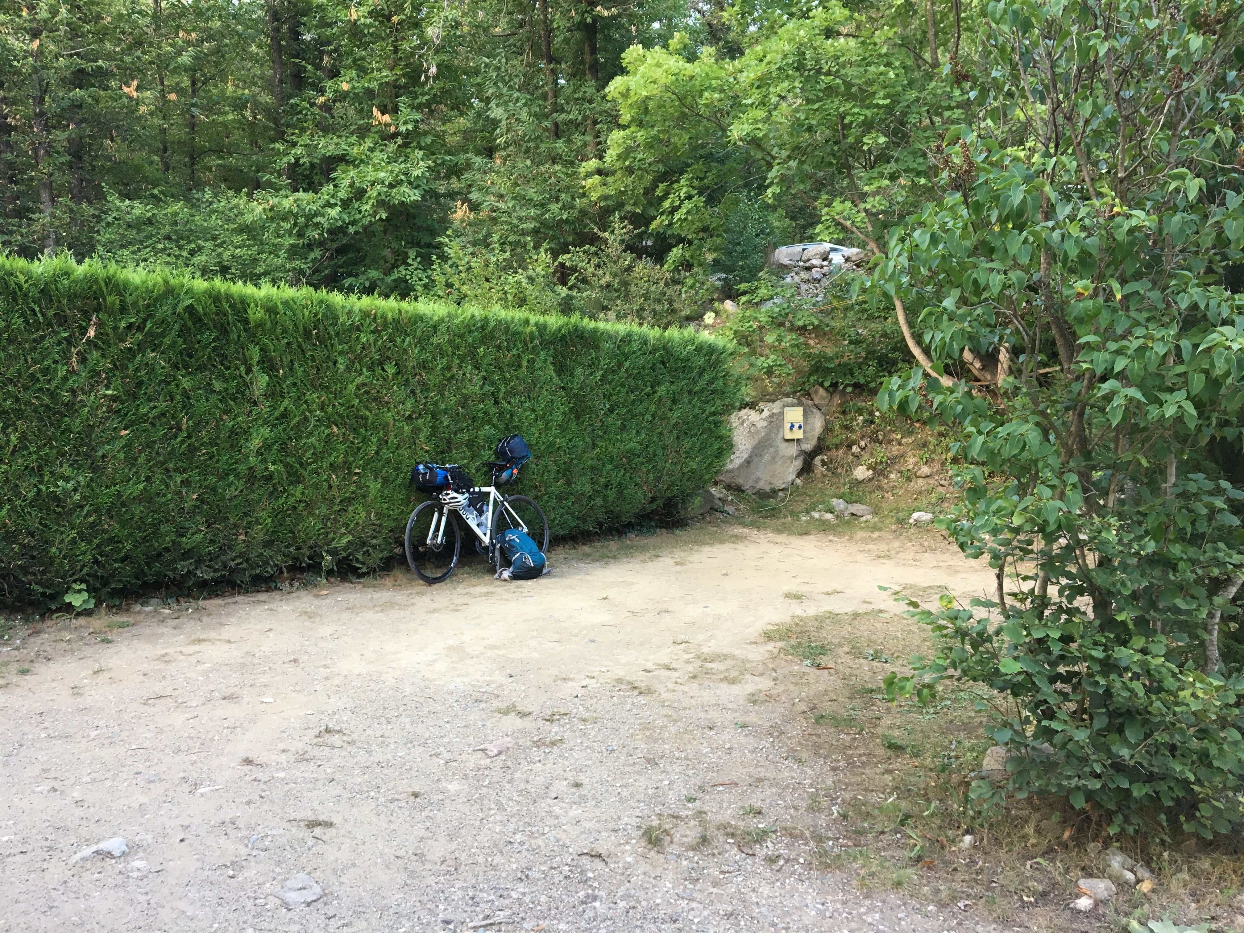
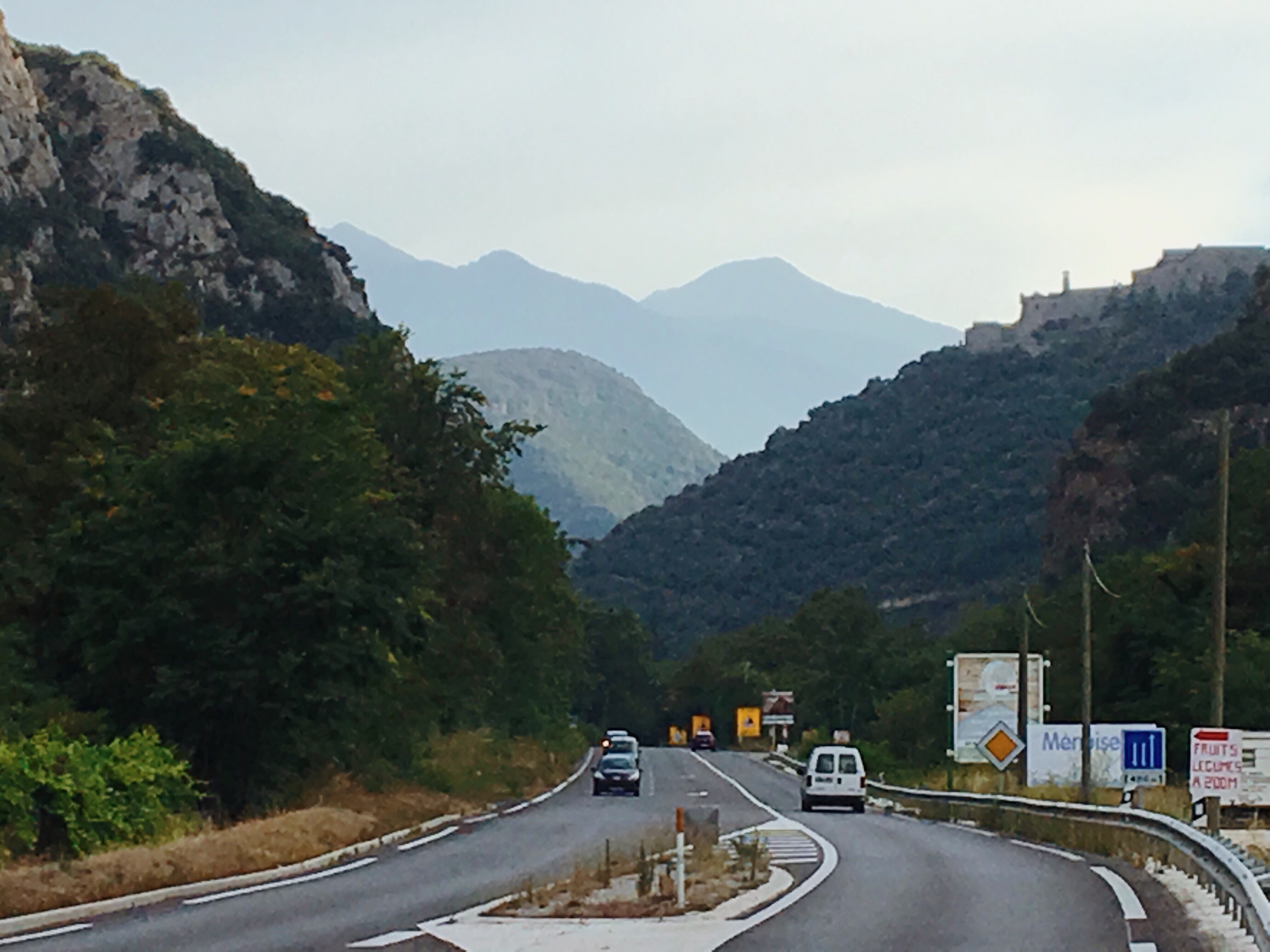
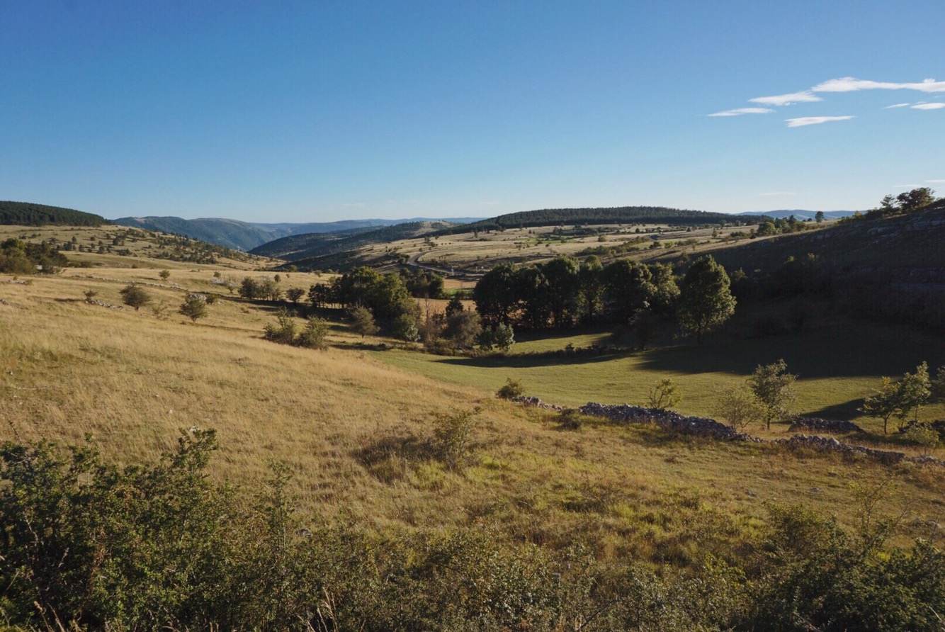
It turned out my route planning worked out excellent now. Instead of following the main ‘veins’ I branched off East earlier at Sant-Pau-de-Seguriès into a very quiet valley with only one but perfectly paved(!) road. This way I would remain rolling downhill without going lower than my final destination – and thus without ever going uphill again today. It was a beautiful ride:
At some point I was already very close to Tortellà, and it was getting dark. Time to switch on the Christmas tree:
Entering Tortellà:

Witnessing the first signs of real Spanishness – older people hanging out outside very late:
Arrival at the hotel:
6. (Feels like) home
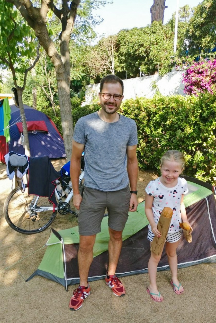
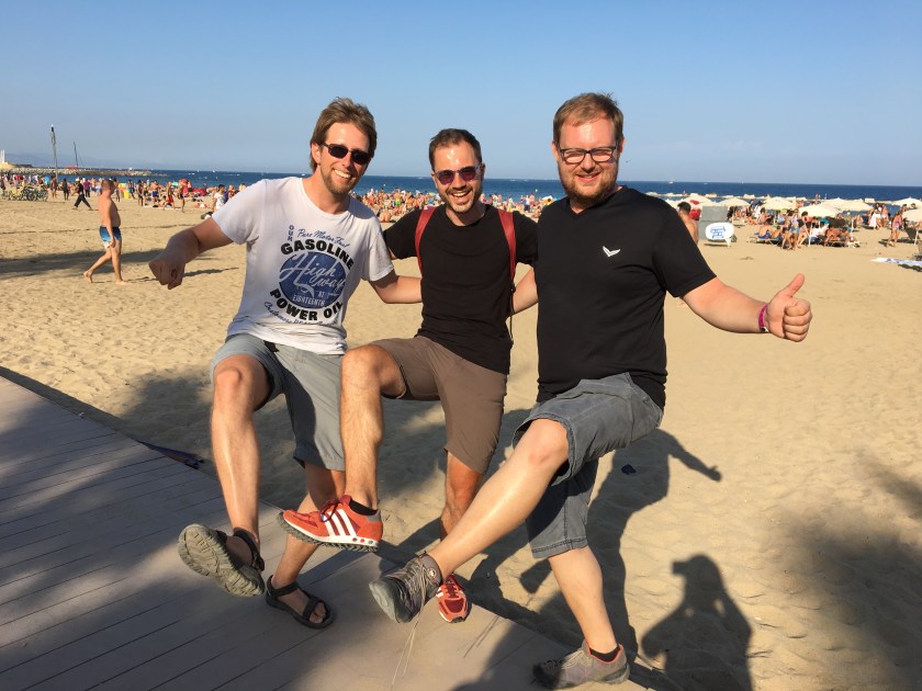
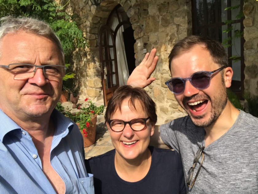
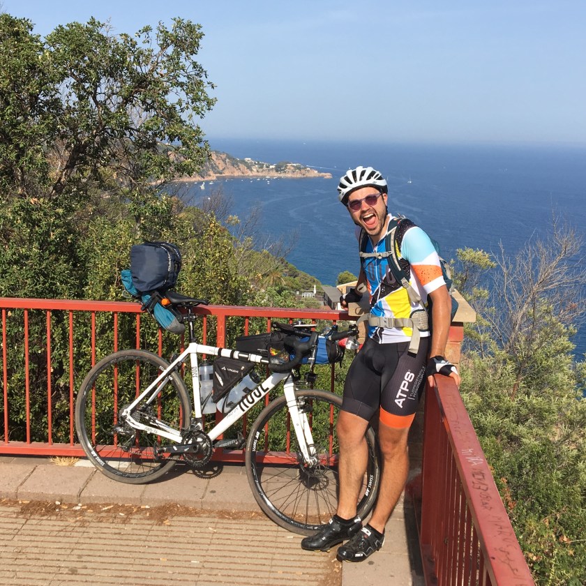
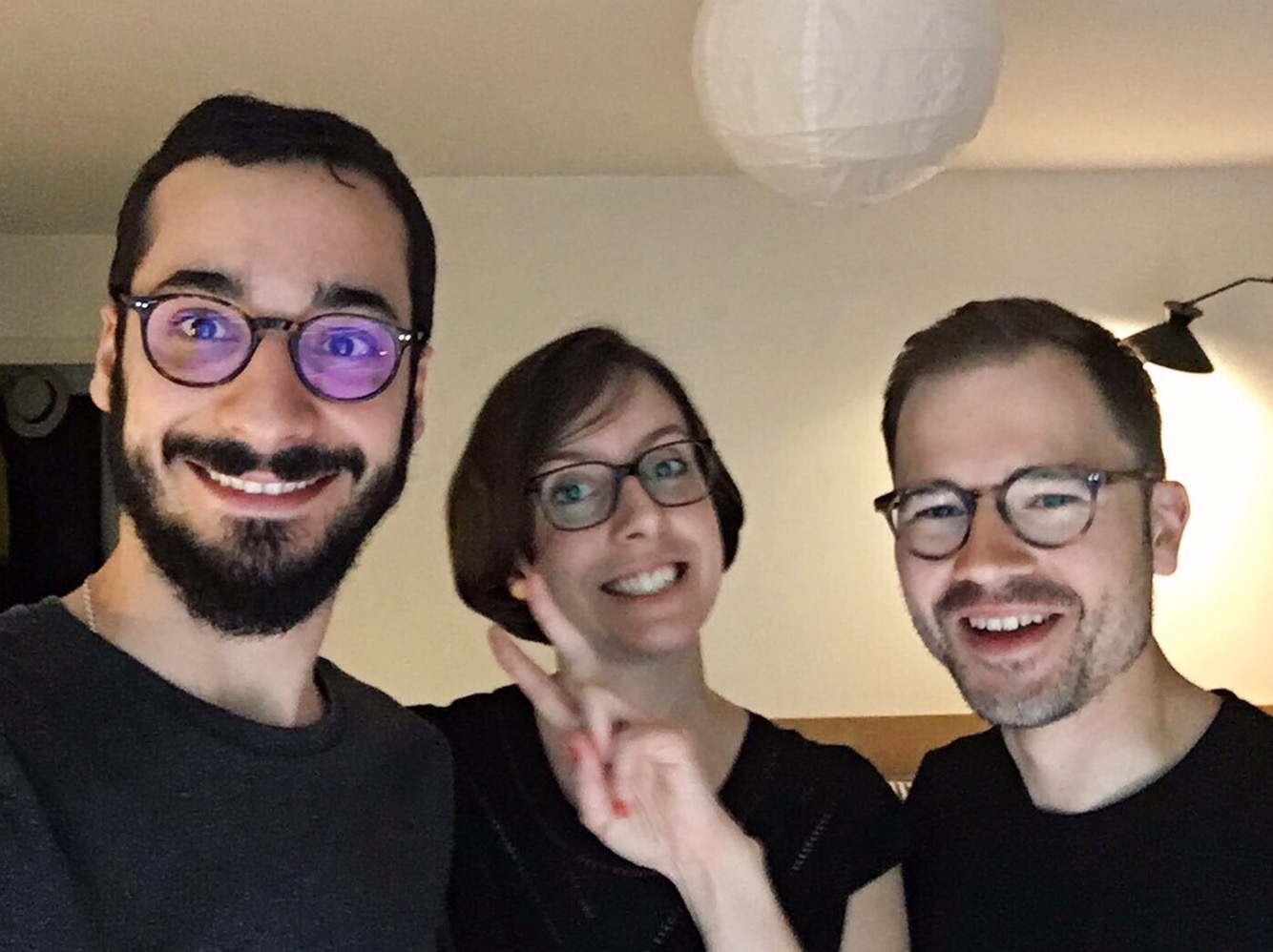
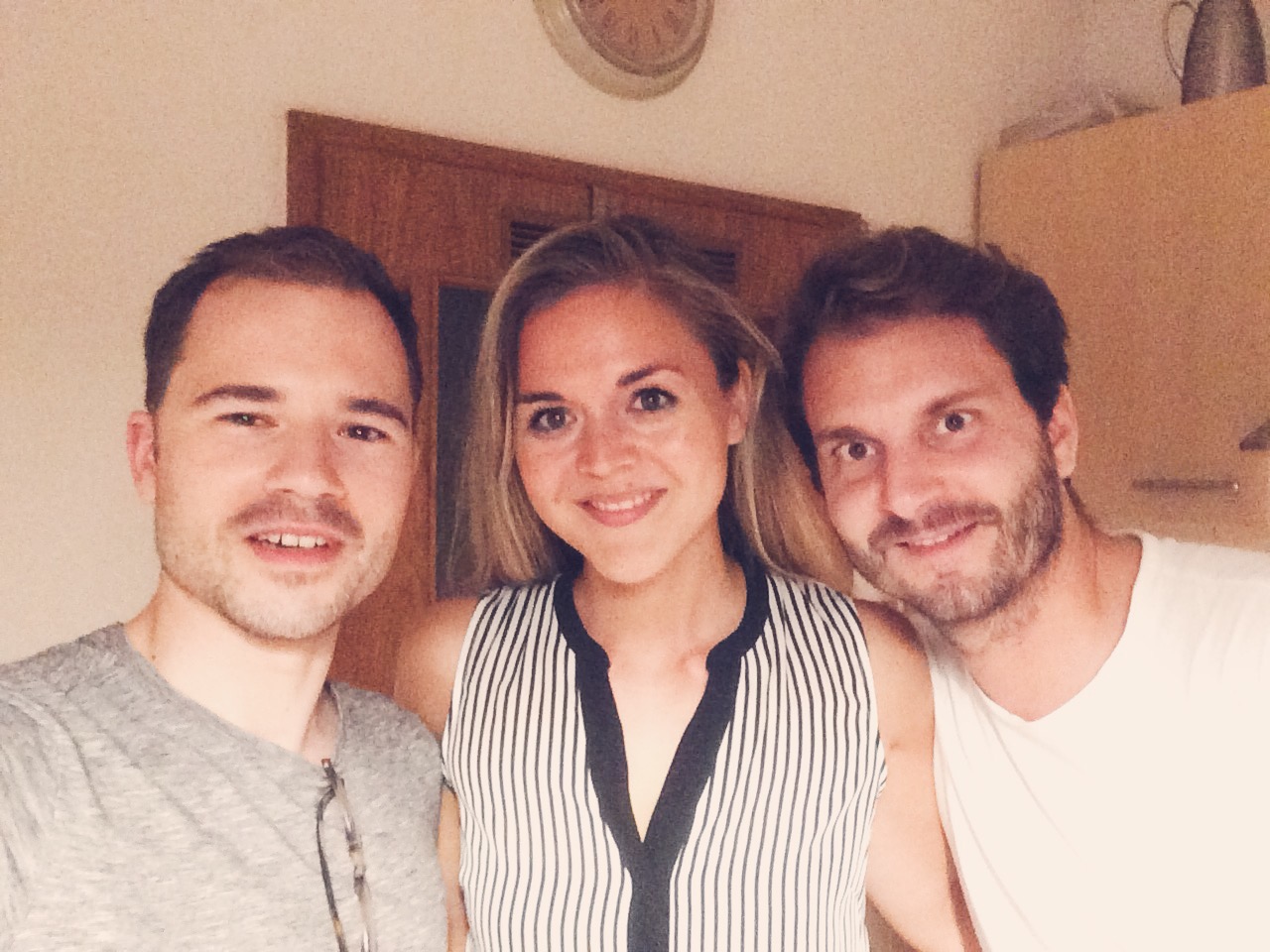
I was now in a country whose language I mastered even much less than French. But somehow the communication with the lady at the hotel worked out. In the process Marion and Thomas arrived but it was a bit too hectic for a proper ‘hello’ yet. The hotel lady was very funny and lively and nice. Certainly an example for how the Spanish are very different from the French (not judging though! both charming). A quick shower in this really excellent hotel room. New born. Then went downstairs where I was welcomed by Marion and Thomas who took this photo of a clean and happy Malte:

Now I was in a presentable and huggable state: HELLOO you too! Immediate familiarity. How nice this was.
We got into their car. A modern VW. A CAR! I was sitting(!) in a relaxed position while covering many km at high speed. No sweat in my eyes. The smell of new and clean leather. Perfect climate. Casual, effortless conversations. Miraculous. This felt very alien to me. Such a contrast to the rest of that day. Villages, road signs, street lights – things that would usually really occupy my mind, demand my attention and be crucial for my route and arrival – now zipping by almost unnoticeably. Surreal.
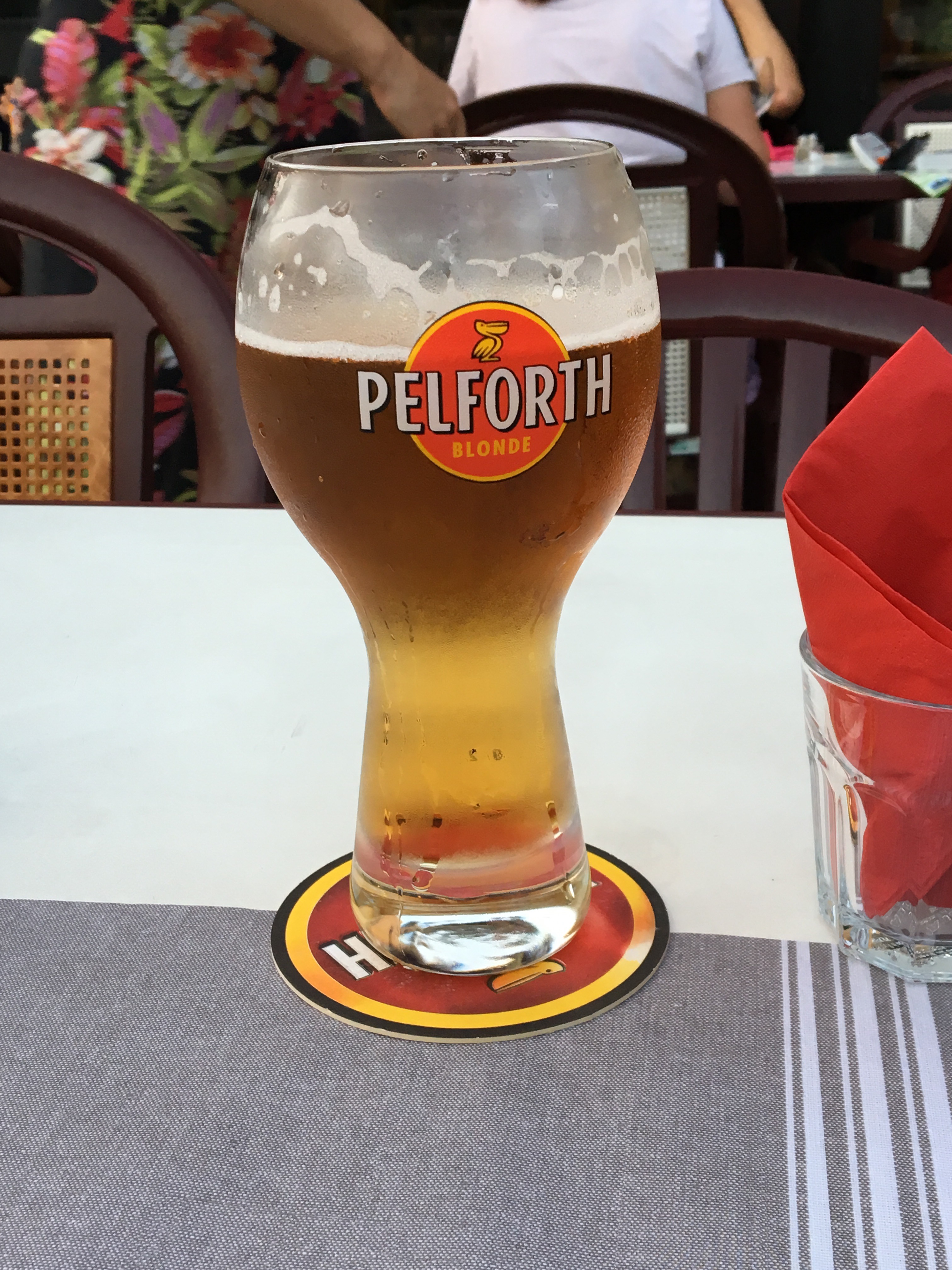
We drove to Besalu. A town further South, with a midevial city center. It had become so late already by now, 22.30h I guess, that most places didn’t serve the so much needed food anymore. We found a touristy restaurant on the main square though. Everything works. Lord… that beer – so refreshing. Thanks, you two, for that evening and invitation!
Of course I told Marion and Thomas about my day. But I was very happy that they also told me about their holidays and we talked about my friends (their kids) Lena and Helen; because I had not really processed this day sufficiently yet to give any explanations. All day I was occupied with so many internal and external impressions that this was the ideal conclusion – a perfect moment to get accustomed again to a pleasantly more normal state.
The day was full of what I called ‘reality checks‘ in the title of this post: where reality hit my expectations or filled gaps of non-expectation. Now this was a ‘reality check’ in a different sense – and excuse me if that sounds a little far fetched; I thought quite a bit about what made this situation so special and I believe this might be an explanation: Somehow it felt like here I got presented with my usual and predominant, more familiar reality of myself: two kind and familiar friends who are a reference to all my past life (because I have known them for as long as I can think) and in that way the situation pointed towards the entirety of my person. All this in a civilized and very comfortable environment. That is much closer to how my life usually is, and how most of this day was not.
After this great dinner (for other reasons than the food) they drove me home – it felt less alien this time. I went upstairs and fell asleep.
STRAVA: Click