You are now at post Nr. 07 out of 10 for this tour.
If you want to read the post of that trip in order, voilà:
00a Freiburg – Barcelona preparation
00b Freiburg – Barcelona READY to go
01 Freiburg – Lake Neuchâtel (206km, 1200m)
02 Lake Neuchâtel – Geneva (119km, 968m)
03 Geneva – Lyon (167km, 1585m)
04 Lyon into the Cevennes – on climbing and descending… (157km, 1885m)
05 Lac St. Martial – Tarn (187km, 2900m) Prototype of THE cycle touring day
06 Tarn – Carcassonne (203km, 2683m) – A long day in 3 dimensions
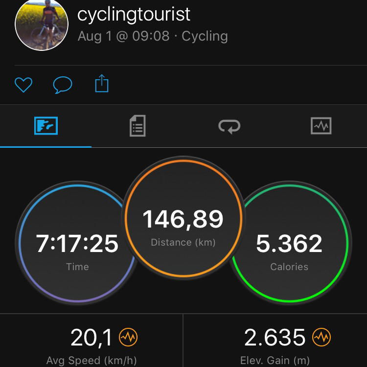
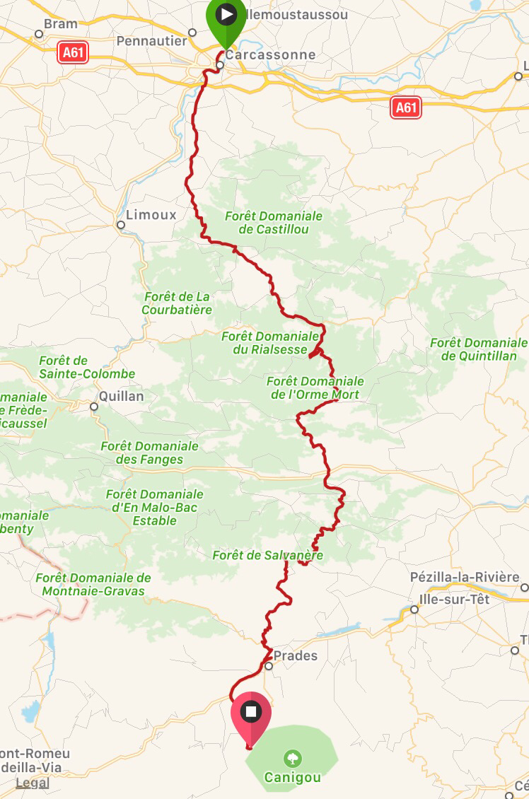
07 Carcassonne – Casteil (148km, 2635m) Arrival at the ‘base camp’
08 Walking over the Pyrenees and cycling down into Spain (110km, 2671m) – reality checks
09 Hot as hell. Tortellà, Costa Brava, Canet de Mar (145km, 1468m)
10 La Final: last 48km to Barcelona & recap. What a tour…
After three days to Lyon and three days through the French Massif Central, with this day, my tour enters its third third and the Pyrenees/Spain section of my tour. The day trip takes me over 150km from Carcassonne to a tiny place called Casteil in French Pyrenees at about 800m altitude and where the paved roads transition into hiking paths ‘of some sort’ (more on that in the post after this one). Casteil will be my ‘base camp’ from where I’ll do my uncertain trip over ‘my’ Pyrenees summit. But first this blog entry on a fantastic(!) ride into new terrain! (about the 1st of Aug. 2017, written on 6thof Aug. 2017)
I was going to start this post with something like “This was an exhausting day, Blabla…”. But I had to realize at the latest now: none of the days are easy to me, despite a very(!) noticeable trainigeffect over the days. There’s always a lot of sweat, exhaustion and sometimes also some pain involved – that is my currency for the distance and/or elevation I cover and places and things I experience. The same holds for this day: it involved a lot of climbing that – in that moment – felt as if it was the first time I experience that kind of challenge; it always comes in a new context – a new destination, a new surrounding, a new length or a new kind of prospect for relief. And what I received in turn? Spectacular views, deep canyons, and also some to me quite symbolic places: Here’s a short prequel to that day – flashback to 1/2 year ago:
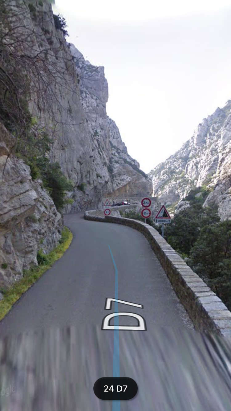
In my very first post (00a) I had explained to you how I got to the idea to do this tour to Barcelona this year – that I was doubting whether to do a bicycle trip at all (because, you know… it’s kind of exhausting : D ) but then in January or so, I had casually and randomly zoomed into some places along the route on StreetView and was blown away by how beautiful these just randomly selected spots were – already on StreetView! How crazy would it be in real!? One of the first random spots that was mainly triggering my decision process towards doing the tour would be on today’s route: A ‘kind of canyon’ on a short country road (D10) before Saint-Paul-de-Fenouillet, which in turn is in a valley half way to Casteil. So, all my subsequent route planning – even the general decision whether to go along the french Mediterranean coast or through the inner country (Cevennes) – was based on the ‘fact’ that I just ‘had to’ go through this landmark on the D10 road. If my random Streetview-beaming would have placed me at some other place (e.g. closer to Perpignan or Toulouse) my route would have looked considerably different.
Outcomes of my streetview session half a year ago:

That was enough prequel, but I thought it is a relevant piece of background story because it set’s the tone and importance and expectation of that day.
Now to the current day: It started off around 8am with a surprise: I thought, now that I was in more Mediterranean airs, I could count on hot summer weather. Instead it was raining a bit and consistently clouded:
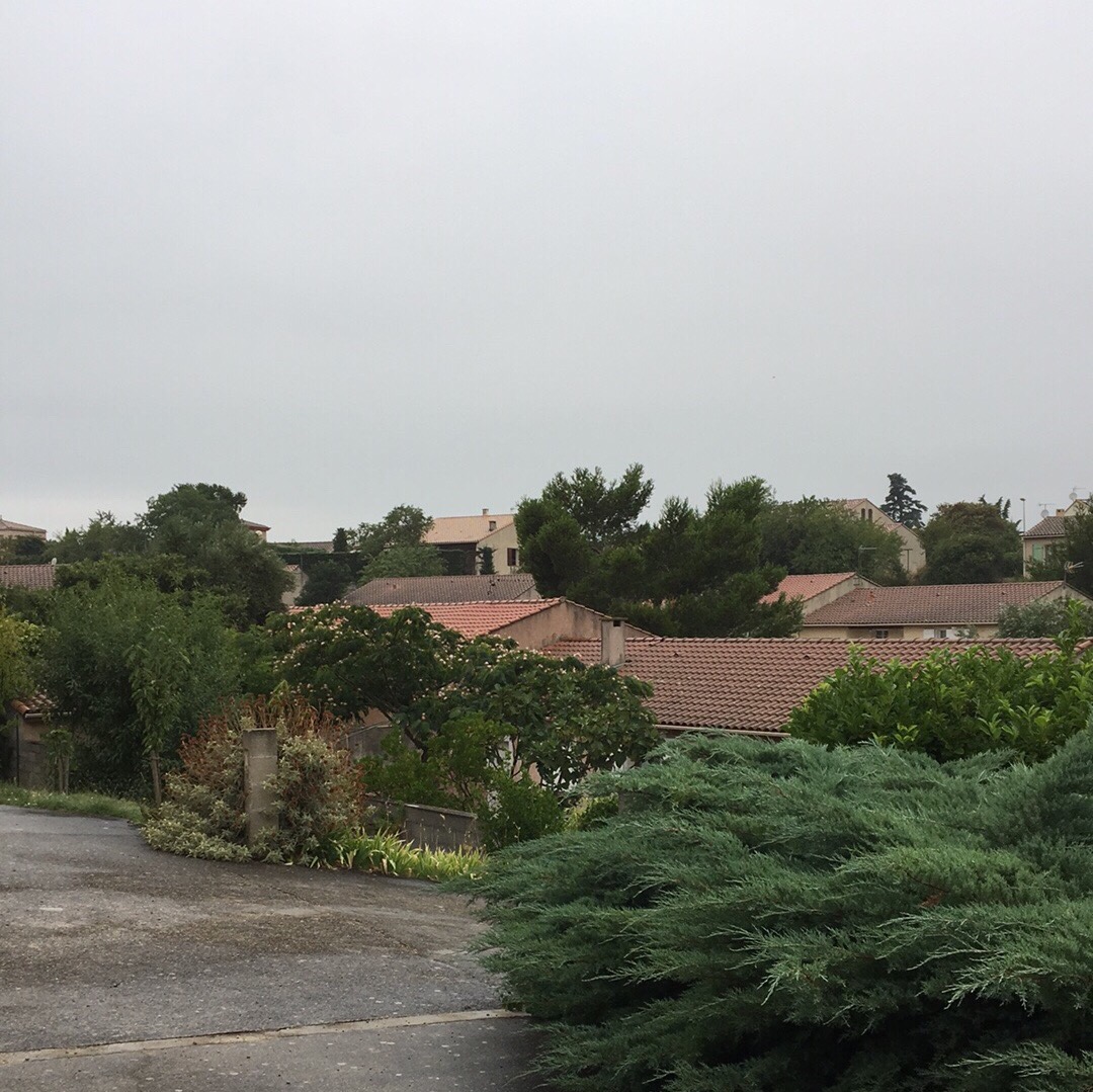
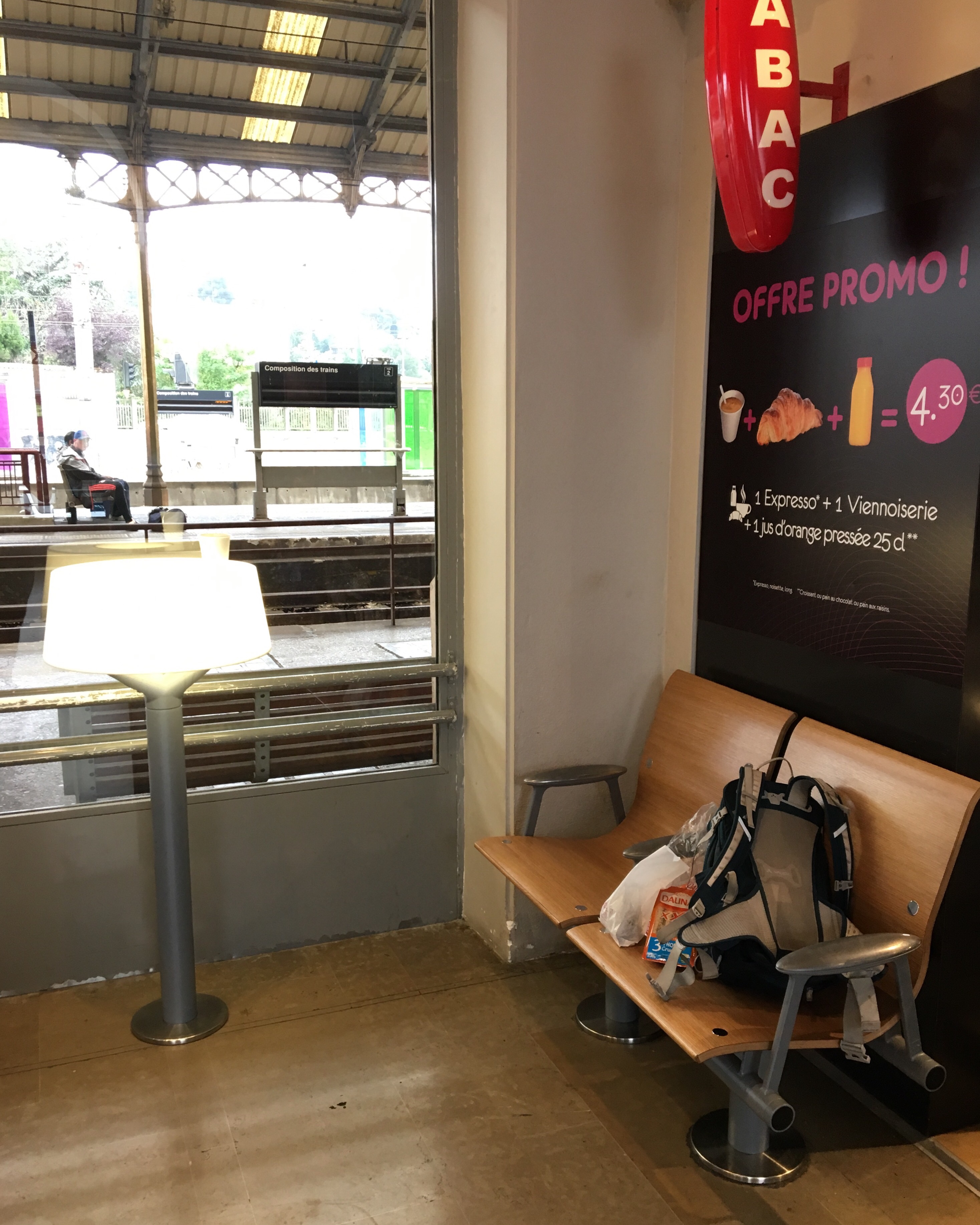
It was just little enough rain that I decided not to put on my rain gear that I had – the night before – so carefully locked away in the depths of my perfectly packed dry bag. I got on my way, catching a brief breakfast at the central station. This was one of the places in Carcassonne where I felt the most comfortable – not kidding (I had mentioned in my previous post that I would deliberately skip any account of Carcassonne itself, because this is a GREAT vacation)
I went on, again following the beeps of my GPS. Firstly: my optimism about the development of the weather turned out ok: it was actually quite refreshing: a little rain sometimes on the skin, mild temperatures, no blinding sun or sweat – felt perfect actually!
And secondly: it was again an interesting experience to compare how I had imagined this landscape South of Carcassonne to look while I planned the route, and what I actually cycled through. Because, just like on the previous stage, there was no one obvious route (besides the main motor way), I spent a lot of time trying different road combinations. Therefore I was surprised how quickly all those places I so thoroughly looked at on the map zipped by in reality: Saint Hilaire for example – I memorized it as the first land mark town, but in fact I was there so quickly and it was so small and unspectacular that I hardly noticed it.
I had imagined this stripe of land to be rather dry and rocky, but instead it was covered in thick green bushes and forests which was emphasized by the slightly wet weather. And: there was a clearere pattern of climbs and descends than I had imagined. At first it started out very smoothly. For example with an interesting road that guided me along the slope of a mountain on a more or less constant altitude; the road then perfectly draws that altitude slice of the mountain which looks like this: (the mountain is in the east/right)
Or this stripe of land on a moderate altitude (#morecowbell !!!)
Then followed a climb…
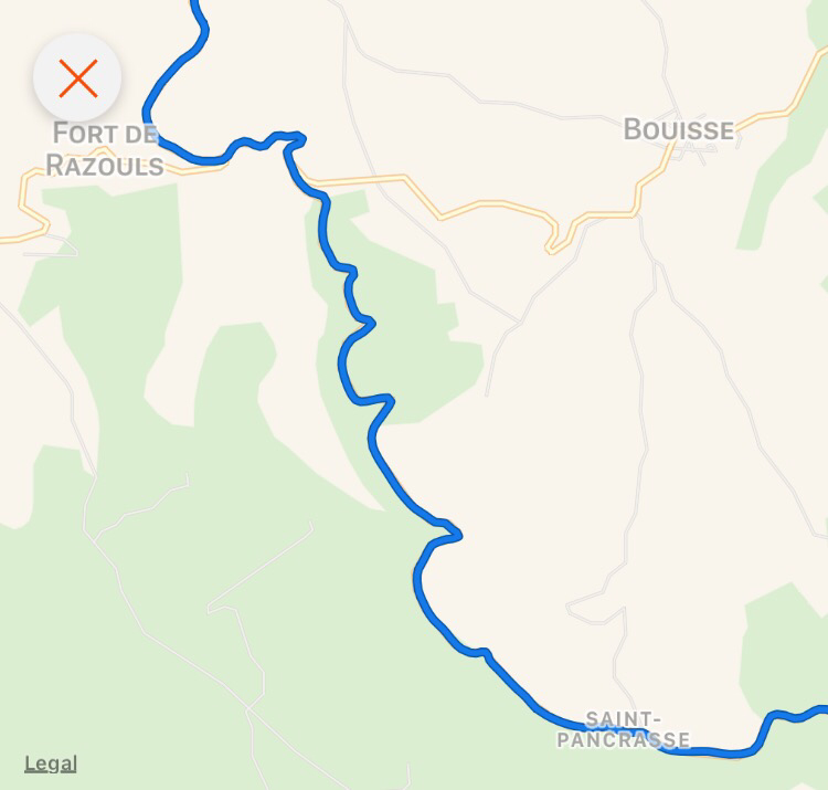
…that made me pass Auriac, a midevial mountain village with a fortification:
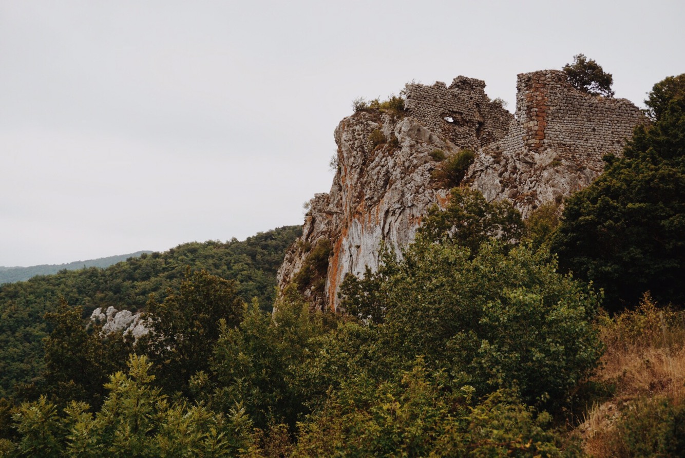
Up there lives a middle-aged woman, who has a little shop selling home made confiture and juices and a little kind of visitor center. I think she didn’t expect anyone up there in the middle of nowhere under these weather conditions and the busy sounds of cutlery in use indicated to me that I was disturbing her at lunch time. But it was too late: her dog already smelled me and barked an alarm and she came downstairs. I had a glass of delicious apple juice and a quick read in the information folder about the village. 23 inhabitants (down from 150 around a millennium ago), first mentions in 1028 or so. Old!
She also showed me on an elevation profile that I had a little more to climb and would then slide down to Saint-Paul-de-Fenouillet (the place I mentioned above, behind the D10). And indeed: after some more climbing I reached the needle eye that was carved into the rocks (similar to previous video) of the pass and after which the landscape opened up again.
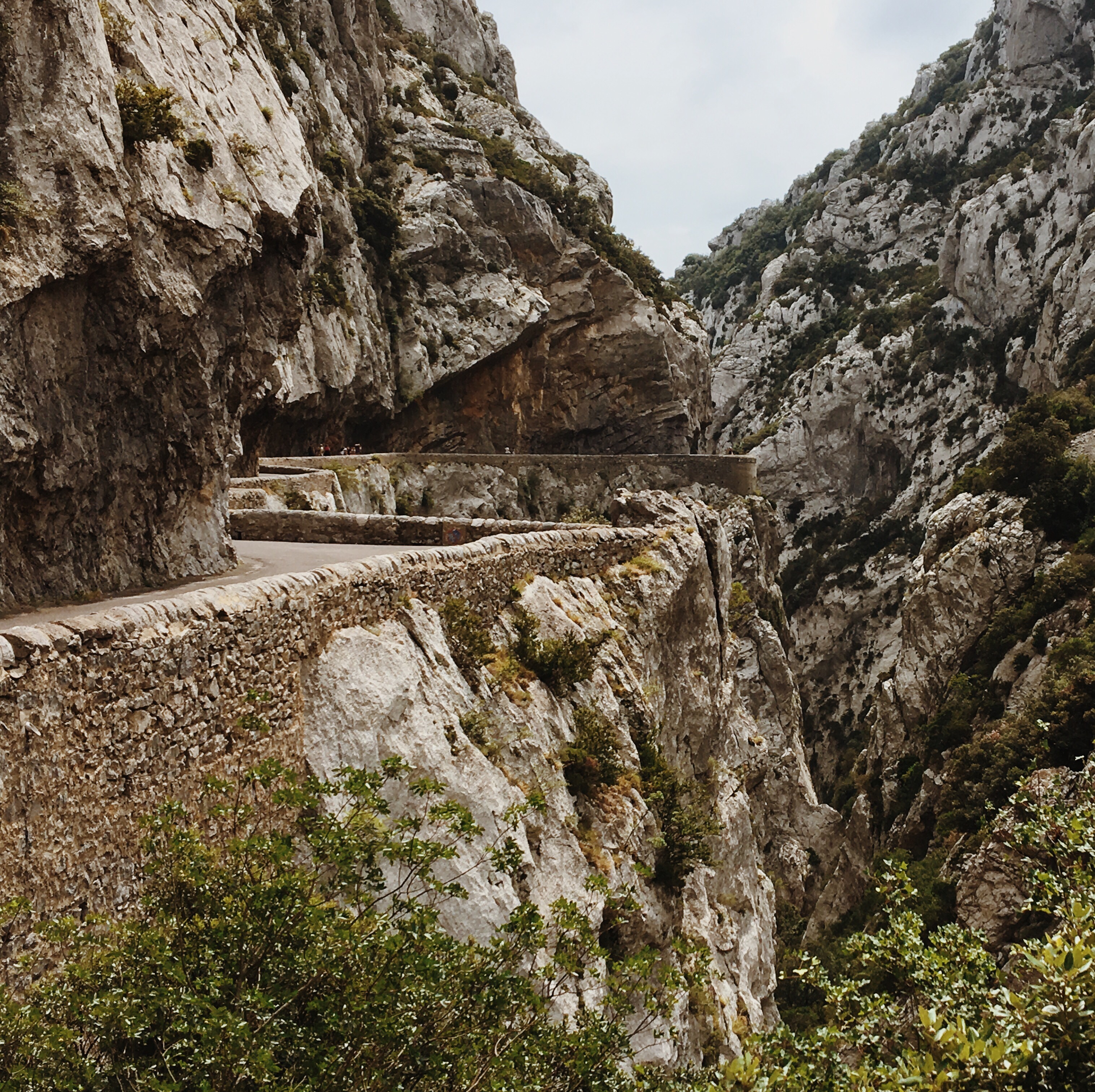
Surfing South, downhill to Soulatgé and then westwards through the valley to a village called Cubières-sur-Cinoble. Here I saw a bar where I had a quick coke and a refill of my bottles and spotted signs to some “Gorges de Calamus”. Sounds interesting, I thought. “The Canyons of Calamus” – like some modern fantasy fairytale (sry… tautology?) about the wizard Calamus, emperor of his mystic canyons and ruler over its tribes of elves and leprechauns. Would there also be a secret door magically displacing me straight to the other side of the Pyrenees? Those were some silly thoughts that occupied me while slurping on my lemonade until I realized: It’s the D10!! My indeed kind of mystical phantasy place that – up to this point – could still have been just a fictional fabrication of the GoogleMaps and StreetView mafia.
I bumped into a trio of girls with heavily packed touring bikes who were travelling from Toulouse to the Mediterranean. They were also heading towards the “Gorges of Calamus” and the way they talked about it it sounded like it was a real thing – like it’s obvious that the only reason to visit this area, and in fact this bar, would be a visit to those Gorges. And, you guessed it… the Gorges were the thing on my StreetView pics.
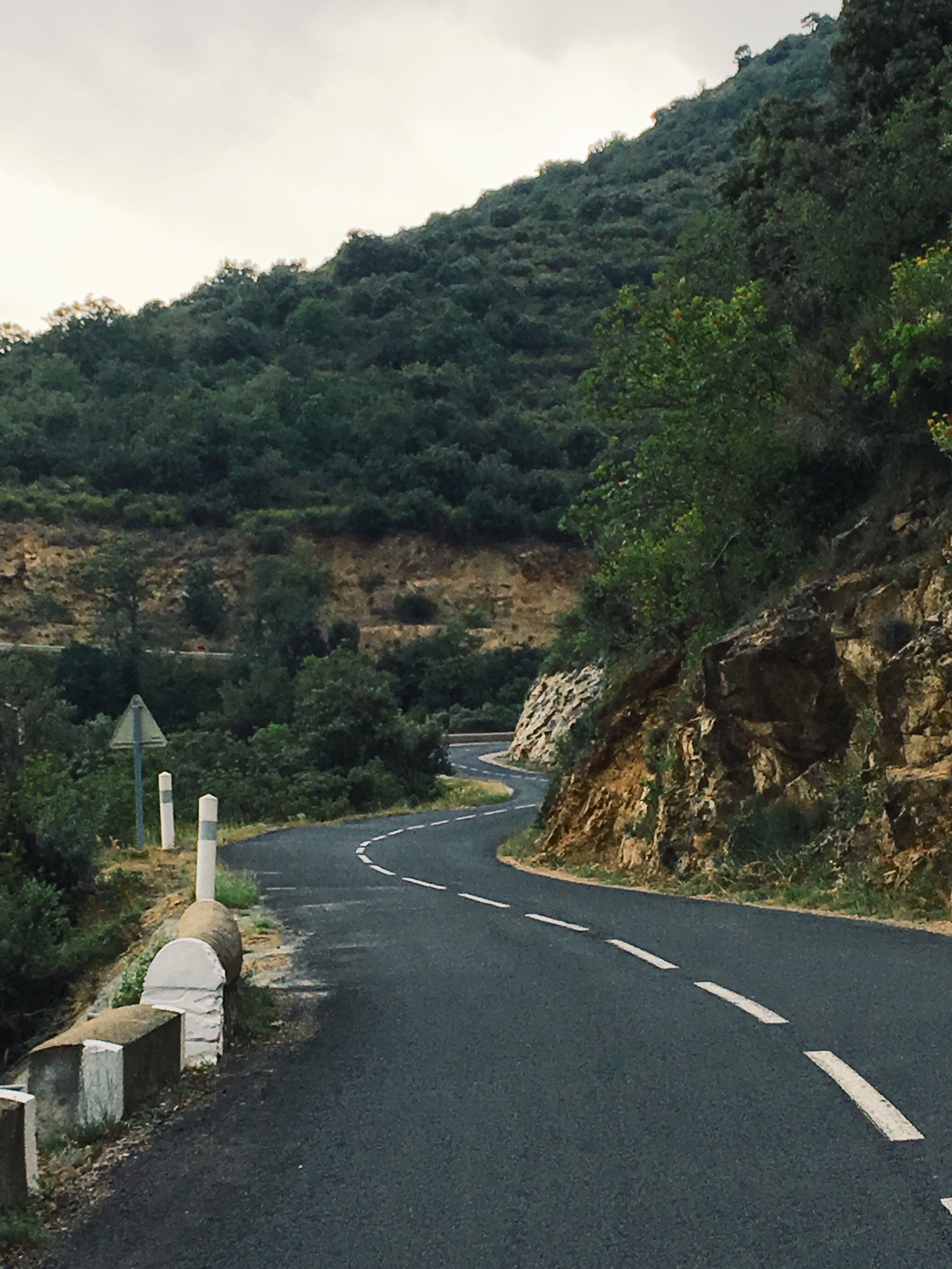
I followed my route, the D10, that was straight heading into a wall – rocky mountains – the way to it was embedded in thick, green vegetation.
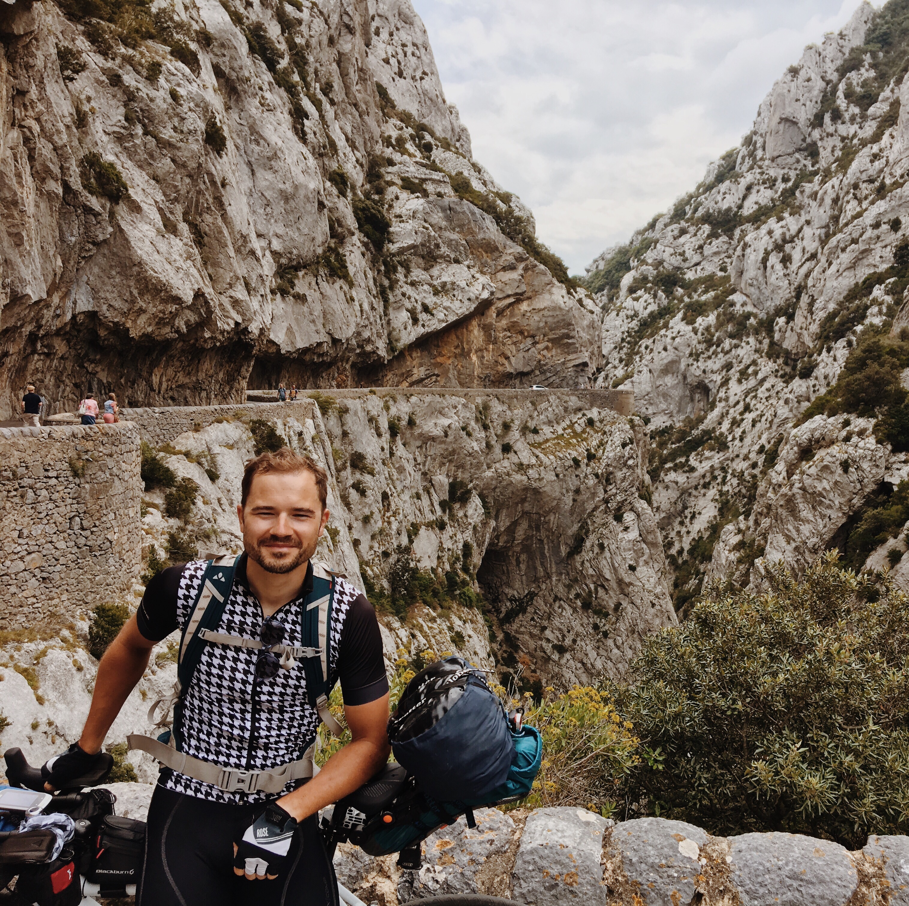
At some point behind a corner the Gorges unfolded. On those Streetview pics it looks like a very small gap (see yourself above). In reality, I guess the road that was going along the left (South) side of the Canyon was about 20m above the at times pretty wild stream at the bottom. The rocks surpassed the road by I’d assume 3 times as much.
Because it is such an attraction there was substantial traffic, that was concerted to only travel every 15 through it in one of the two directions – formally that held also for bikes, but if I would have followed that rule none of those photos could have been shot:

(better photos from my proper camera will follows these are iPhone pics)
So, very clearly: this went way beyond my expectations: instead of a couple of meters of road going through a small cut in the rocks, I was basically cycling through the massive geological history of this part of the pre-Pyrenees: monumental.
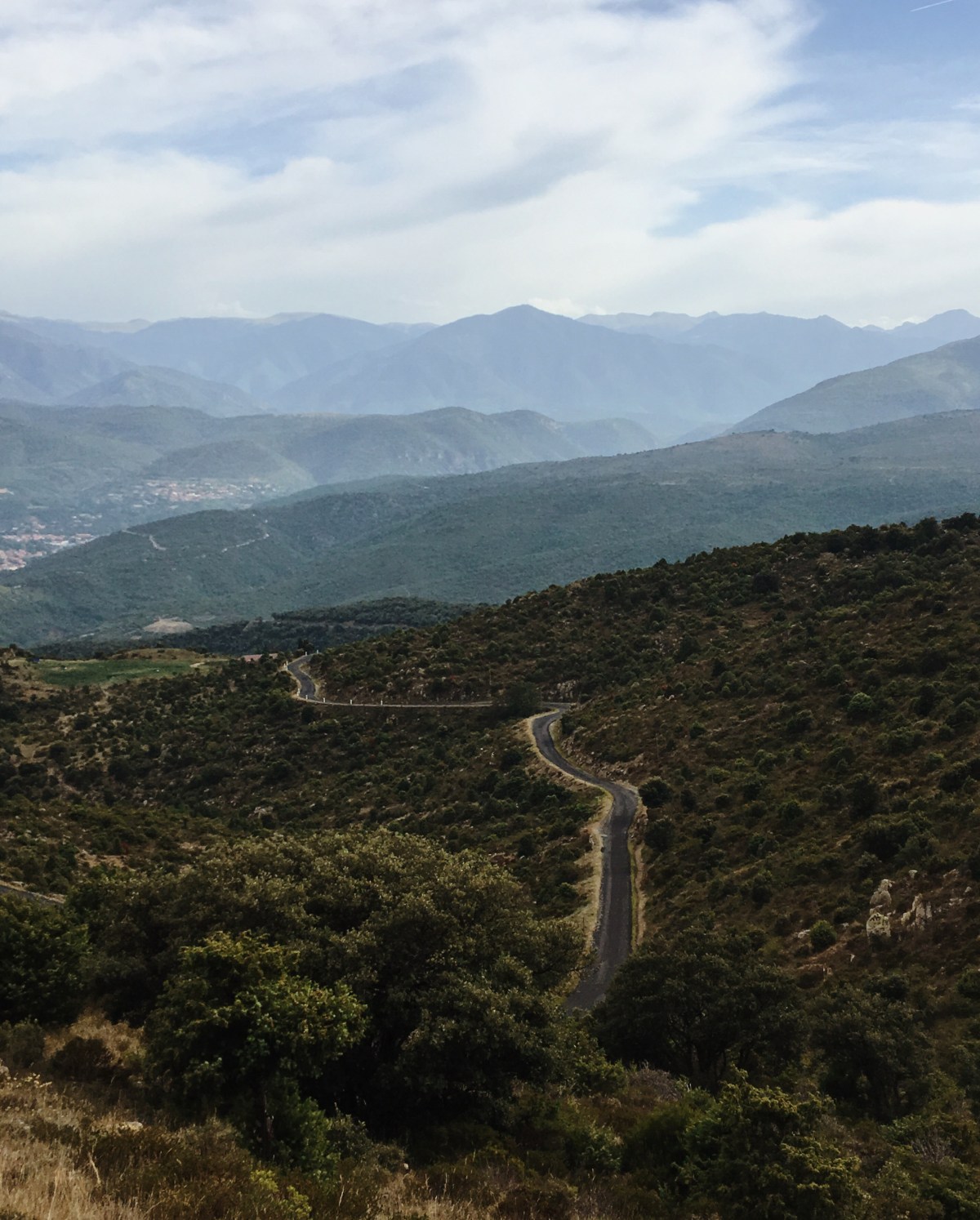
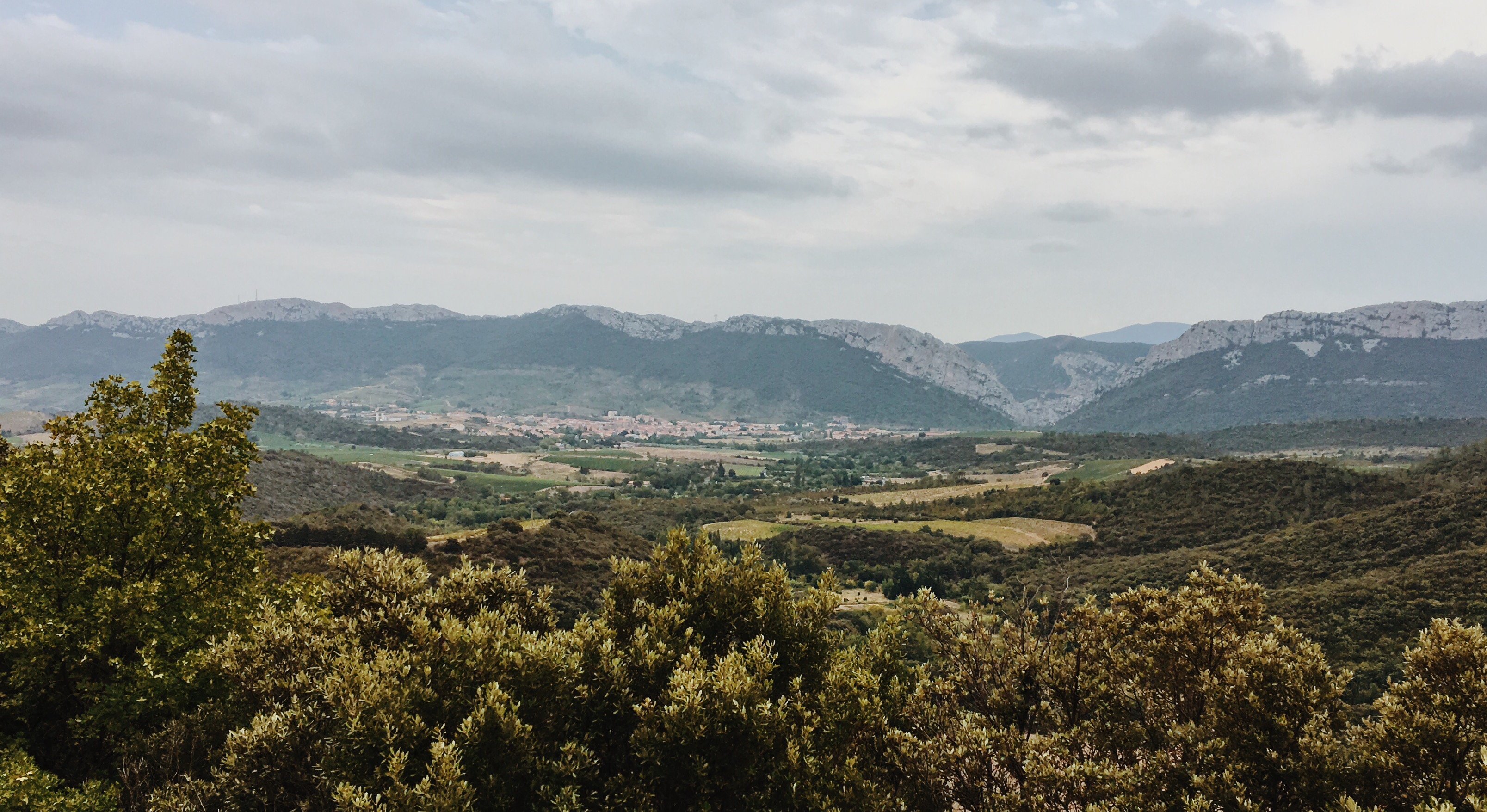
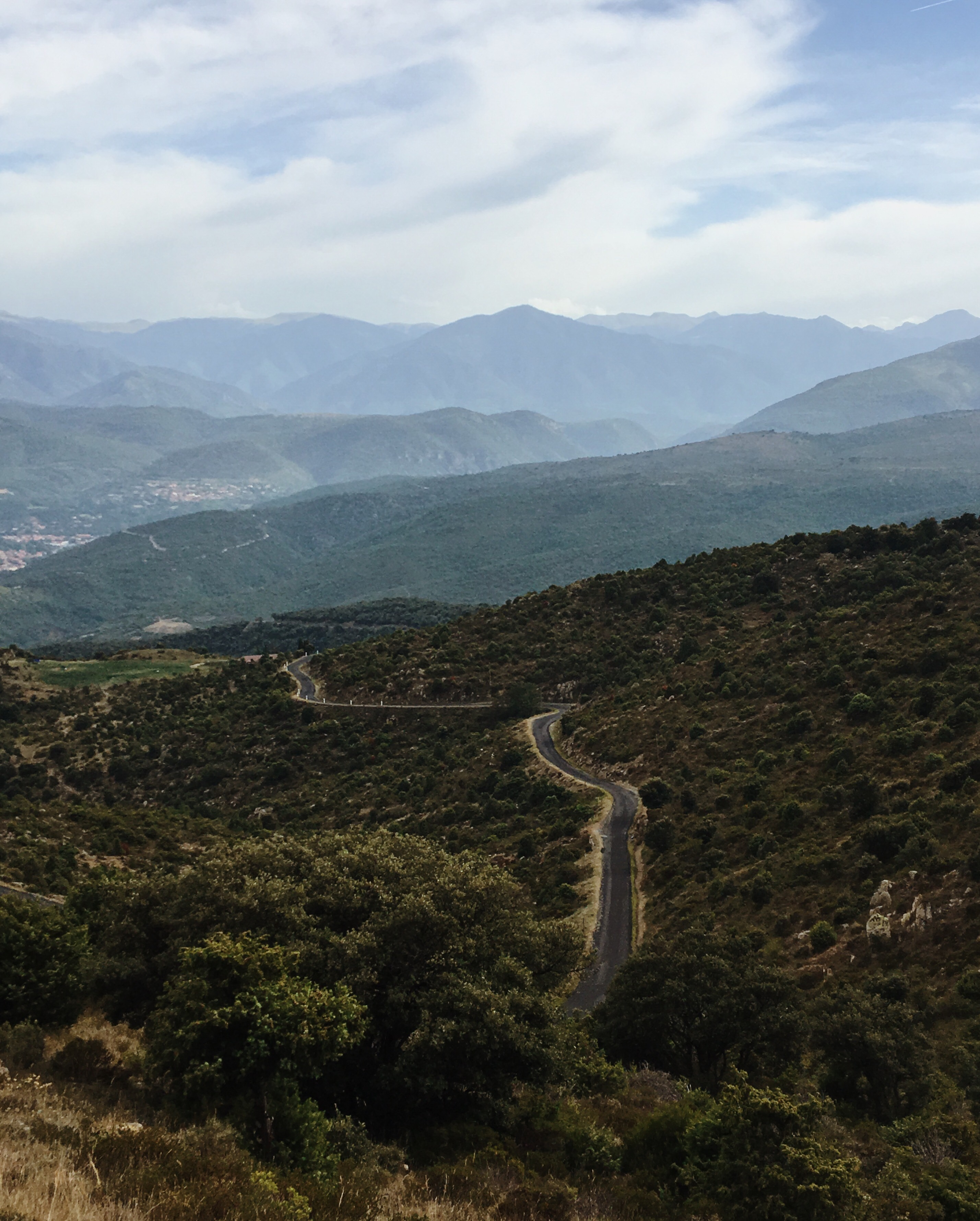
Upon exiting the canyon, the valley in which also the aforementioned village Saint-Paul-de-Fennouillet is situated (almost literally) unfolded in front of me. But where there’s a valley, there are mountains – so I could at the same time see the next (but not last or highest) level of Pyrenees dreadfully waiting for me:
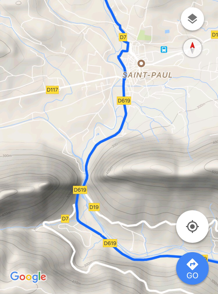
I went on, down into Saint-Paul which – just like Saint Hilaire – did not turnout as important as I invisioned it in it’s landmark role. As I went on I passed something that I in that moment declared “the gate to the Pyrenees” which I later saw looks like that even on the map:
Now came a bit that I thought in my planning would be the beginning of the final climb, simply up to Casteil. But surprisingly it went on pretty much on a constant altitude along a stream. At some point a flock of heavy motor cyclists surpassed me – German number plates, Harleys and other heavy machinery. Cool, somehow… my biker friends! : D A few kilometers further, behind another bend, I met them again while they all stopped at the side of the road, lined up and having a short break, snacking bananas. Somehow I found it really nice, almost cute. It looked a bit like some boys (and one girl) on a school trip. While passing them I wished them ‘Viel Spaß’ and they kindly returned it.
It went on like this for a while but slowly transitioned into a solid climb up to Sournia. I should really have studied this segment of my tour better: because in Sournia I thought now it would go just downhill to Prades. So I finished almost all of my water, believing not to need it on the ride down. Two more curves, and it was clear: another climb. I did not know yet that this would be the real climb of the day – from the yet rather cute 500m NN to 1000m NN. Otherwise I would have turned back to Sournia to refill my bottles. Instead I went on.
The weather: more cloudy again. A little rainy and very humid. Normally rain comes from above, sure thing. To me however it felt as if I was cycling through exactly that air where the rain was created, coating me evenly and thoroughly from all sides like a Schnitzel that is being prepared for the crumbing. Very dense and so saturated with water that sweating had no cooling effect whatsoever, so that I sweat even more. Additionally, the higher I climbed, the hotter and dryer it got. I got more and more dehydrated and was actually a little worried – checked how much longer this climb would go on. 1/3 of a Liter left in my bottle which I had to treat very economically. Of course it was not getting dangerous yet. But really strong thirst does not make for a comfy ride, to put it mildly. I think I got the most out of those last drops. The bottle was empty by the time I arrived on the top – at only 990m altitude; nothing spectacular usually.

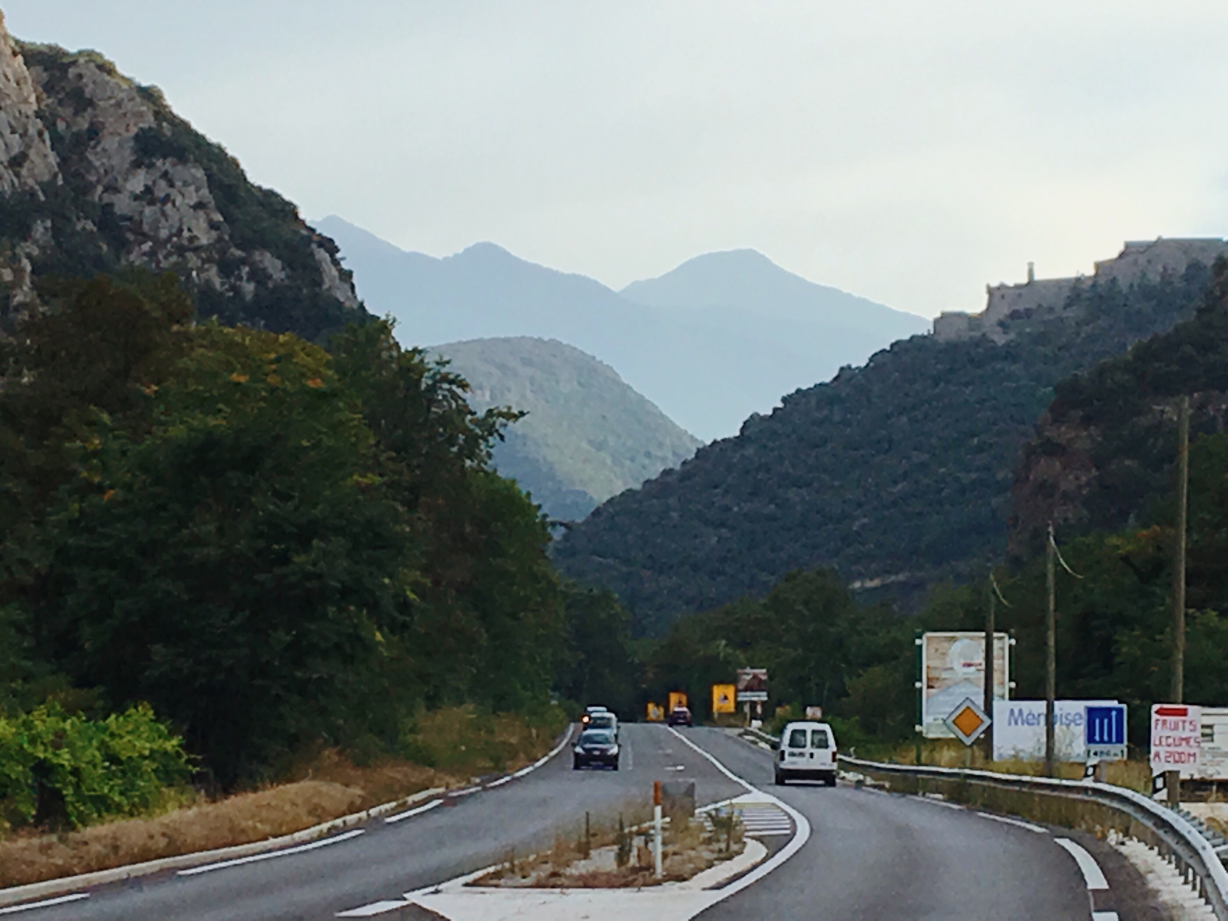
From there I had a clear view down on Prades (see previous pic in the left), and the long downhill roads leading there (see next pic). In Prades I was now not only going to do some grocery shopping to prepare for the next day’s adventure over the Pyrenees top, but also going to put myself back into a state that would allow me to properly finish the upcoming really last climb of the day from Prades to Casteil. But first: dowwwwwwwn!
In Prades I did a quick detour to a huge Super U supermarket; I parked my bike in a way that I later realized made it very vulnerable – even forgot my phone in the food pouch while shopping. I really have to be more careful. Speaking of it: By coincidence there was also an ‘Expert’ electronics store where I finally got a multi-USB charger to replace the one I got stolen several days earlier in St.Martial (so long ago!) and that would make my electronic life easier again.
Refuled with a cold Coke (sry, but CocaCola is just so good) and Orangina (for a change) and icecream and Müsli bars and a sandwich…. I was ready for the last bit to Casteil. Prades is at just under 400m alt. And Casteil just over 800m. So, calculating optimistically, that’s a last 400m climb. It started smoothly again; hardly noticeable that the gradient was already in the positive.
Here you see the road leading into the main mountain ridge of the Pyrenees; Casteil would be somewhere in between the mountains in the back.
(last stretch to Casteil)
I was a little worried even, because I had only 15km left, and every single meter at a low gradient would mean that in the end I have to climb up much steeper roads. Indeed it got up to 8-10%… but somehow it all went rather quickly. Also because I luckily deviated a bit from my GPS route in order to maintain every little altitude gain and not to cycle downhill anymore.
After some friendly, motivational honks by a line bus driver (and all the united passengers, as I vividly, but certainly falsely imagined), I was up there in Casteil. Turning left into a final few dozen meters at >15% to reach the entrance of the campsite; heavily breathing, soaked in and dripping from sweat… The lady behind the the restaurant bar gave me some empathic looks that somehow created a very immediate, personal bond through the chaos of our (well… ‘my’) verbal language barrier. She opened the office and showed a lot of patience while I constantly interupted the formalities with a reach for my camping towel.
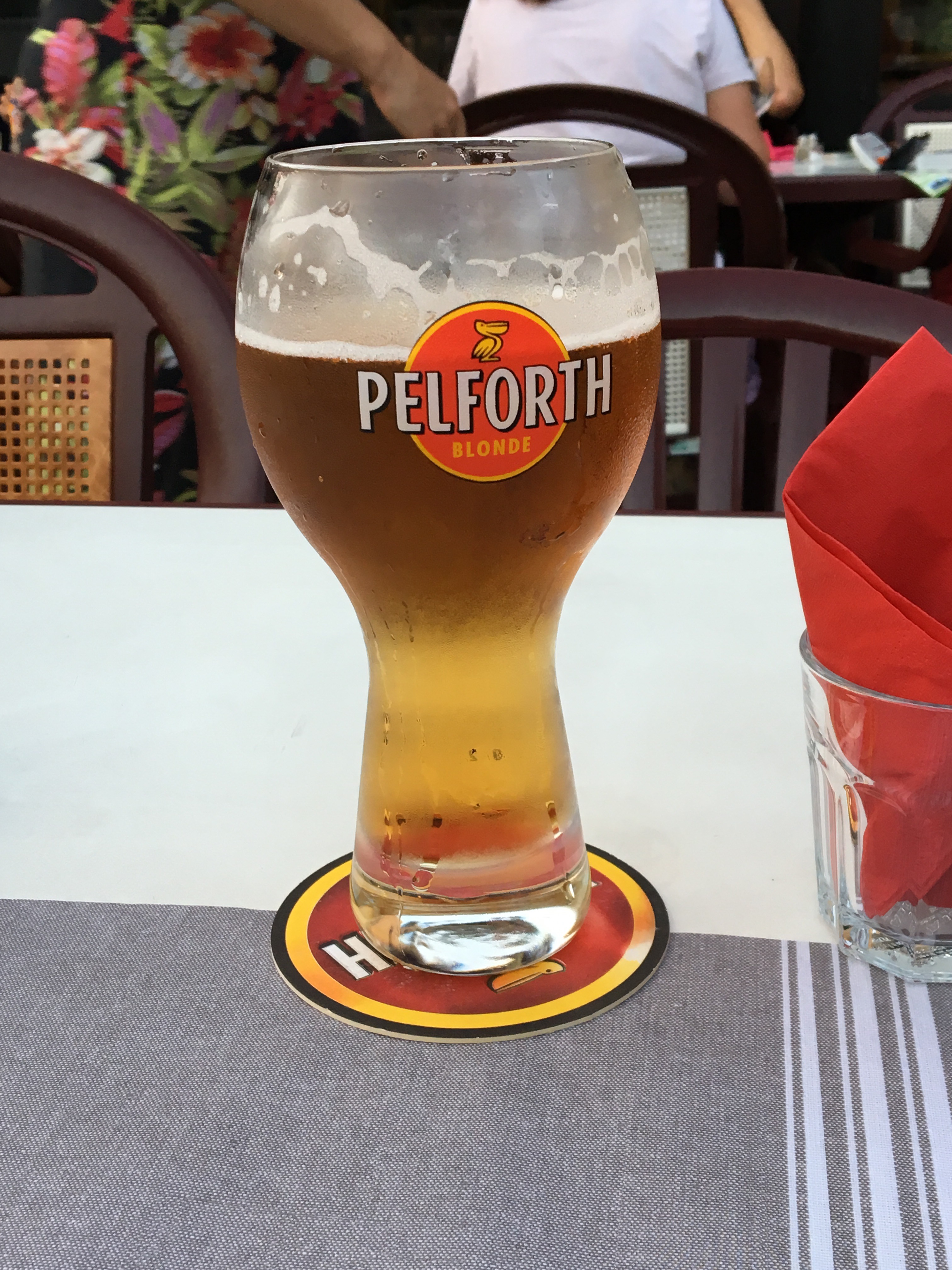
A (as usual) heavenly shower and changing session later, I found myself in the campsite-restaurant, nipping on a beer and ordered and devoured a large main dish. And a second one, to the astonishment of other guests sitting on the restaurant terrace by the pool. This is where a great social encounter with a super nice, modern, young Dutch couple and their kids picked up.
I’ll leave it at this ‘cliff hanger’, as the next day would start in exactly that social setting. I now arrived at my base camp; and as you know, the base camp is the last moment of rest (or peace?) before the madness; tomorrow would be the central climb over ‘my’ Pyrenees summit and a very eventful day full of uncertainties, exhaustion, happyness… all features that already characterized today’s trip. It is all a bit overwhelming to me, I must confess. So much stuff happening in, with and around me in just the course of a day. Life is pretty dense these days…