You are now at post Nr. 06 out of 10 for this tour.
If you want to read the post of that trip in order, voilà:
00a Freiburg – Barcelona preparation
00b Freiburg – Barcelona READY to go
01 Freiburg – Lake Neuchâtel (206km, 1200m)
02 Lake Neuchâtel – Geneva (119km, 968m)
03 Geneva – Lyon (167km, 1585m)
04 Lyon into the Cevennes – on climbing and descending… (157km, 1885m)
05 Lac St. Martial – Tarn (187km, 2900m) Prototype of THE cycle touring day
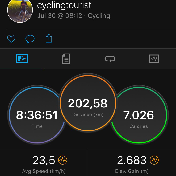
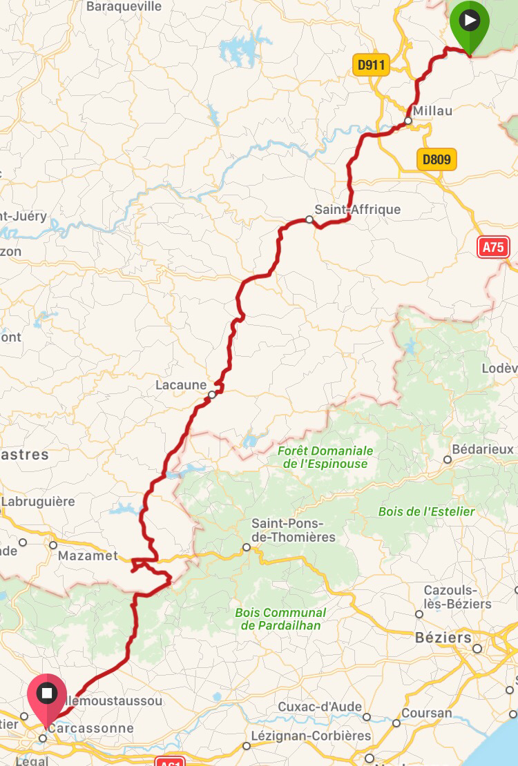
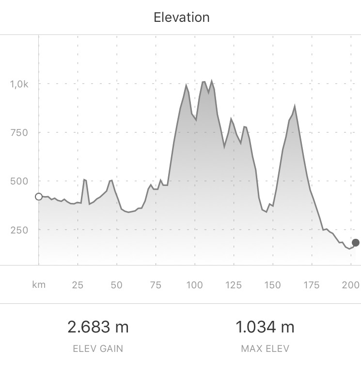
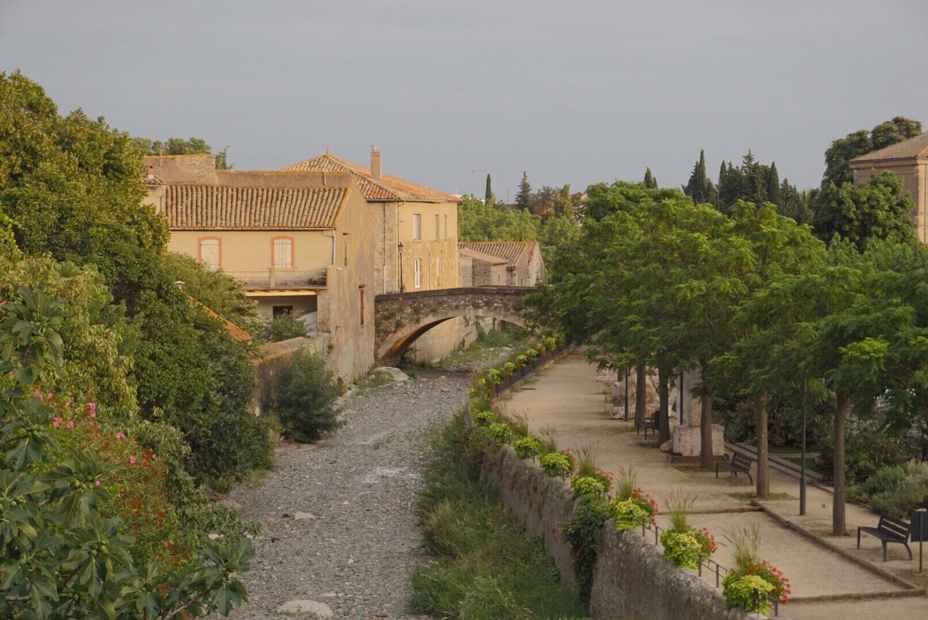
06 Tarn – Carcassonne (203km, 2683m) – A long day in 3 dimensions
07 Carcassonne – Casteil (148km, 2635m) Arrival at the ‘base camp’
08 Walking over the Pyrenees and cycling down into Spain (110km, 2671m) – reality checks
09 Hot as hell. Tortellà, Costa Brava, Canet de Mar (145km, 1468m)
10 La Final: last 48km to Barcelona & recap. What a tour…
This is the last day of my tour’s middle section leading me to Carcassonne. It concludes the rides through the Massif Central/the Cevennes. I started after a relaxed rest day at the river Tarn (swimming, eating, hiking, reading). The route lead through the south west end of the Massif Central before reaching the flatlands that stretch from the mediterranean through Carcassonne. In the planning this route was tricky because there were no obvious valleys to follow which lead to a lot of accumulated altitude. (about the 30th of Jul. 2017, written on 5th of Aug. 2017)
Of the 3-day-stretch from Lyon to Carcassonne – 549km in total – I had finished 346km in the two previous stages; so for this day from Rozier at the Tarn to Carcassonne there were 203km left. These numbers I established now in hindsight – I originally thought this trip through the Massif Central would have 100km less in total (3 x ca. 150km). That is certainly a distance that would occupy me all day, but what made it trickier: There is no one obvious route to take. No long-stretched valleys in the direction of travel; instead, several mountain-rows to cross (two main ones) = many accumulated meters of climbing – 2683m in the end.
I had considered changing my route going south around all the mountains (passing just North of Bezier), but I figured the convenience of having a prepared track to follow (on my GPS) is worth more + it would have been more km in distance (like 280… thanks, no, not today) + I trusted my past self (the one that prepared the route) to have taken all things as well as possible into consideration.
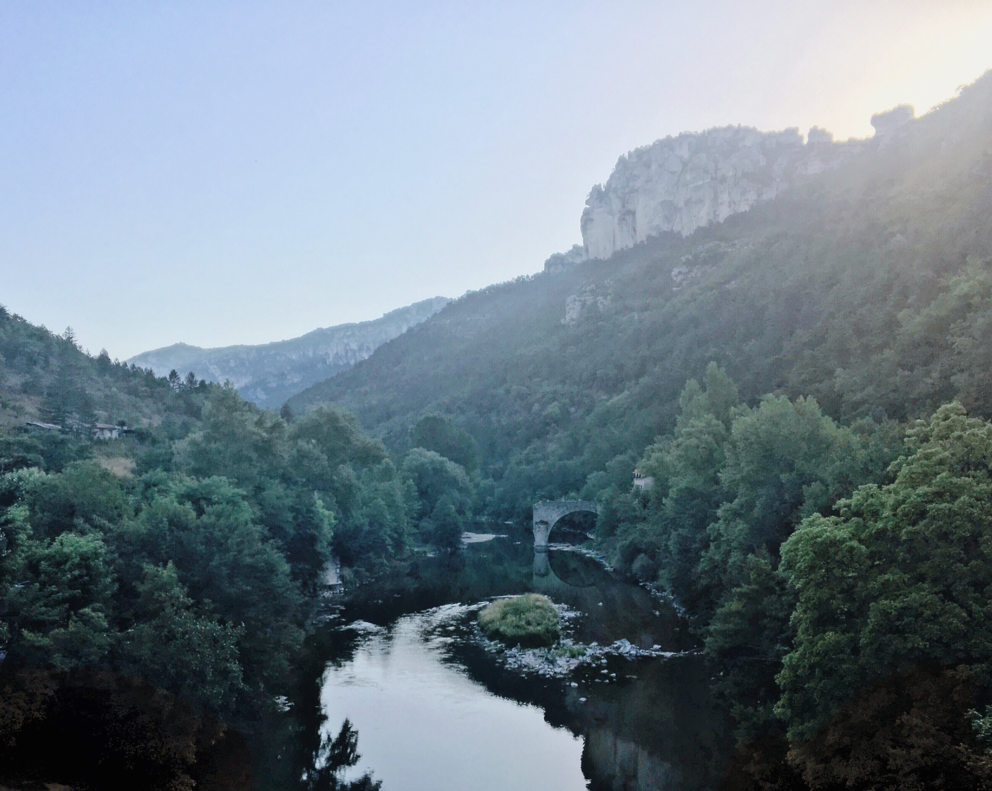
It started of course at the Tarn in Rozier: Packed my tent and stuff around 8 in the morning. Got into some fresh cycling gear and headed off along the Tarn to the next bigger city Millau.
Bye bye Rozier (taken from it’s Tarn bridge):
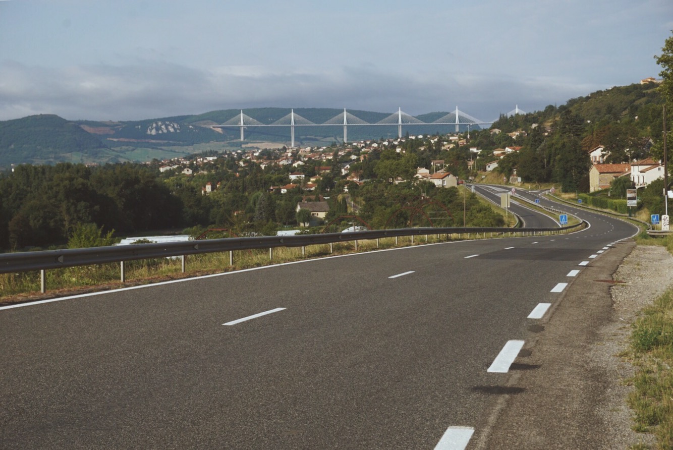
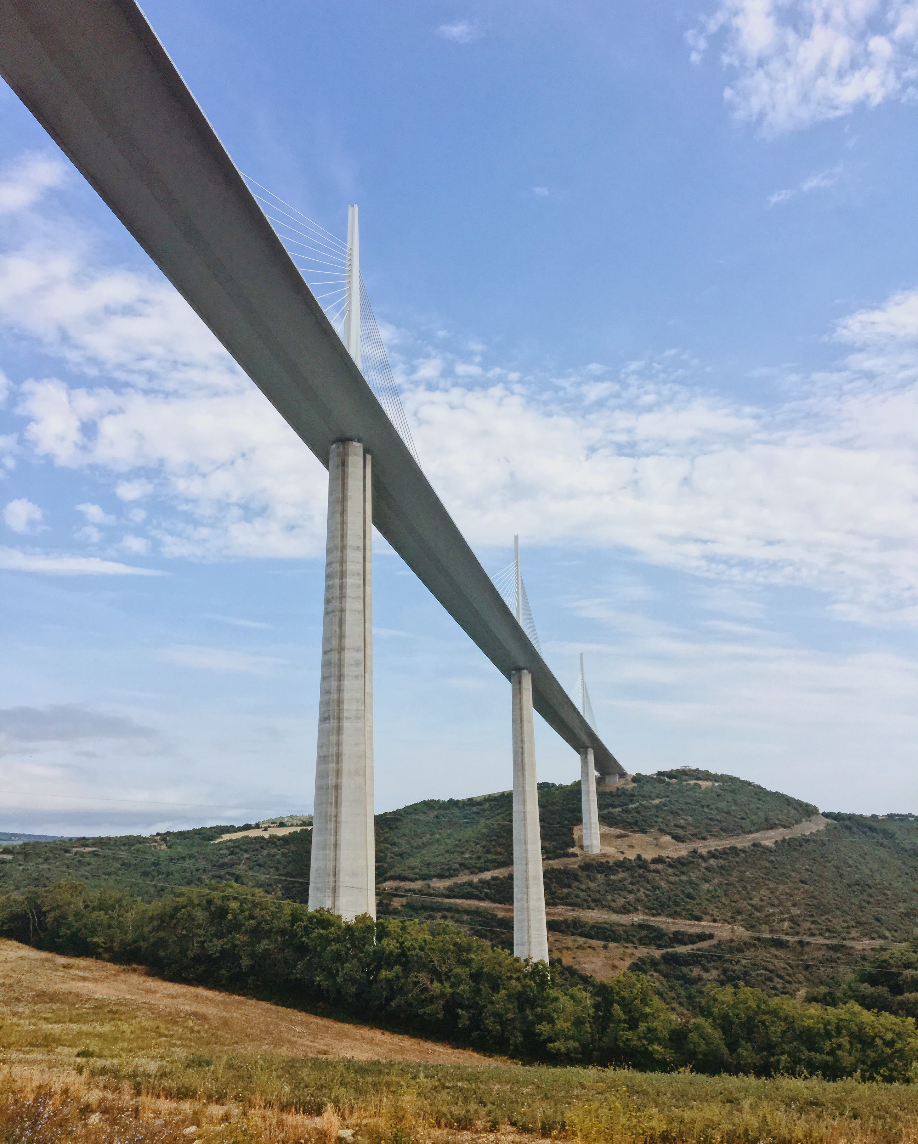
There I added a little breakfast to a banana I had earlier – very nice café with very good music (“smooth rock” I’d call it). Millau was the warm-up milestone about 30km into the ride. Now would follow a longer stretch, slowly gaining altitude before reaching the first real mountain row. It started with one warm-up climb that made me pass under this apparently famous bridge which they call a viaduct.
Viduct As viewed from before Millau…:
…and after Millau:
I continued towards a place called Saint Afrique. On the way I noticed one thing again: It is hard for me sometimes to visually tell if I’m cycling slightly uphill or downhill. All the way to Saint-Afrique and beyond, visually it looked like I was on a completely flat or slightly descending road (0 or -1% gradient). The more surprised I was how hard it was for me to keep a normal flat-land pace of 28-30 km/h. Instead I was crawling around at 22km/h. Only my Garmin would remind me that I was climbing.
I had envisioned this first part on the D992/999 to be very long and tiresome; maybe because I spent a lot of time with it in the planning, because it was a bit tricky to find a good route connecting Rozier and Carc.. At some point – after Montlaure – I turned left into a very wide flatland, passing an airfield that I remembered as a landmark (again: surprised I was there already) and at Belmont-sur-Rance (see photo) started the first real climb – from 450m to 1000m of altitude.
By now it was pretty hot and the afternoon started. After the arrival on top I surfed quite a bit downhill into Lacaune (see elevation profile; the first dip on the first high top). I was very much looking forward to a cool coke, refilling my bottles and having a bite to eat. In Lacaune it turned out there was some local street-“festival” going on: Many Cafés were open, people sitting on the streets, a fleamarket. That might all sound very idyllic to you – but it wasn’t to me. I was tired, hot, it was Sunday, so apart from the Cafés nothing was open, and the Cafés were severely under-staffed. it was quite dirty, crowded, loud. I was not in the mood. At some point managed to get a cold coke, found a fountain to fill my bottles, and then escaped the town – it took all much longer than I had planned or hoped. Outside the town, the next climb started, back to the previous 1000m(alt.). But before, I sat down on the first pole after the town-exit-sign and made and ate some sandwiches and stretched my legs. Then ready to go.
And then again, on top, followed by a well needed descent to a large water reservoire. Another ascend and descend to the village Anglès, and one more ascend. Finally the cascade-pattern of my descending was broken and I was about to have a long and smooth run down to Lacabarède.
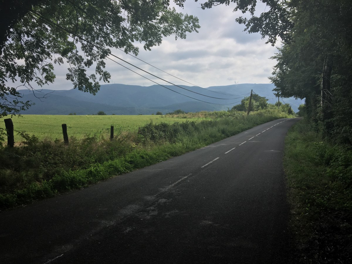
The following picture was taken on top of that last… top – probably around “Le Rec”. You look to the South and the wide view indicates a long downhill ride. But you also see that mountain chain in the background? Yes – that wall was still between me and Carcassonne. So: I was already pretty beaten by that time, and really had to force away any thoughts about that last “super-climb” coming up in order to enjoy the long descent first.

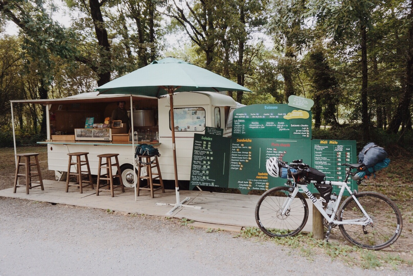
At some point I arrived in Lacabarède. Here it turned out that apparently I was a bit sloppy in my route planning 2 weeks earlier: My GPS would have lead me straight up the mountains on some unpaved and presumably super-steep paths. It looked like an extreme shortcut to the long car-route that was going over the mountains at a healthy angle. No way; so I had to improvise a new route: Simply follow the main road for the cars (which – as usual – later turned out to be a normal, rather quiet country road). I feared I’d run out of energy for that climb. So while I was cycling westwards through the valley towards the entry of the pass through the mountains, I suddenly came across this extremely cute little caravan-bar on a parking lot. As if it was sent from heaven. The owner was very nice. And after some other custumer – who had a very obnoxious way of speaking to me and referring to my Germanness – had left, we had a charming chat about e.g. the fact that he was there with his Caravan bar – from 1970, self-refurbished – two months every summer at this parking lot, serving passers by with all kinds of snacks. I had fries with chorizo and lemonade and a coffee. Perfect!!
That really made me feel fine again. I thought I was ready for the climb – still wondering which route exactly to take. The app Komoot (which I sometimes consult because the planning interface is pretty nice to handle) suggested to me a way up on more “hidden” paths, narrowly winding their way to the top. I was a bit sceptical, but also that bar owner said it was a good and beautiful route for the bike. I have no idea what kind of killer cyclist HE is, but: I went on and into that little suggested path that should get me to the summit on a shorter route – and miserably failed. Already before the first bend I knew: I wouldn’t manage: Too steep, too much gravel and rocks – not for me – I had to turn around and did what a road cyclist is supposed to do: took the road (the D88 from Albine to the summit just before Lespinassière). The gradient was actually really fine. I mean, mathematics worked out again: the longer the leg of a right triangle, the smaller its angle (=my road’s incline) to the hypothenuse… that I could have figured out earlier.
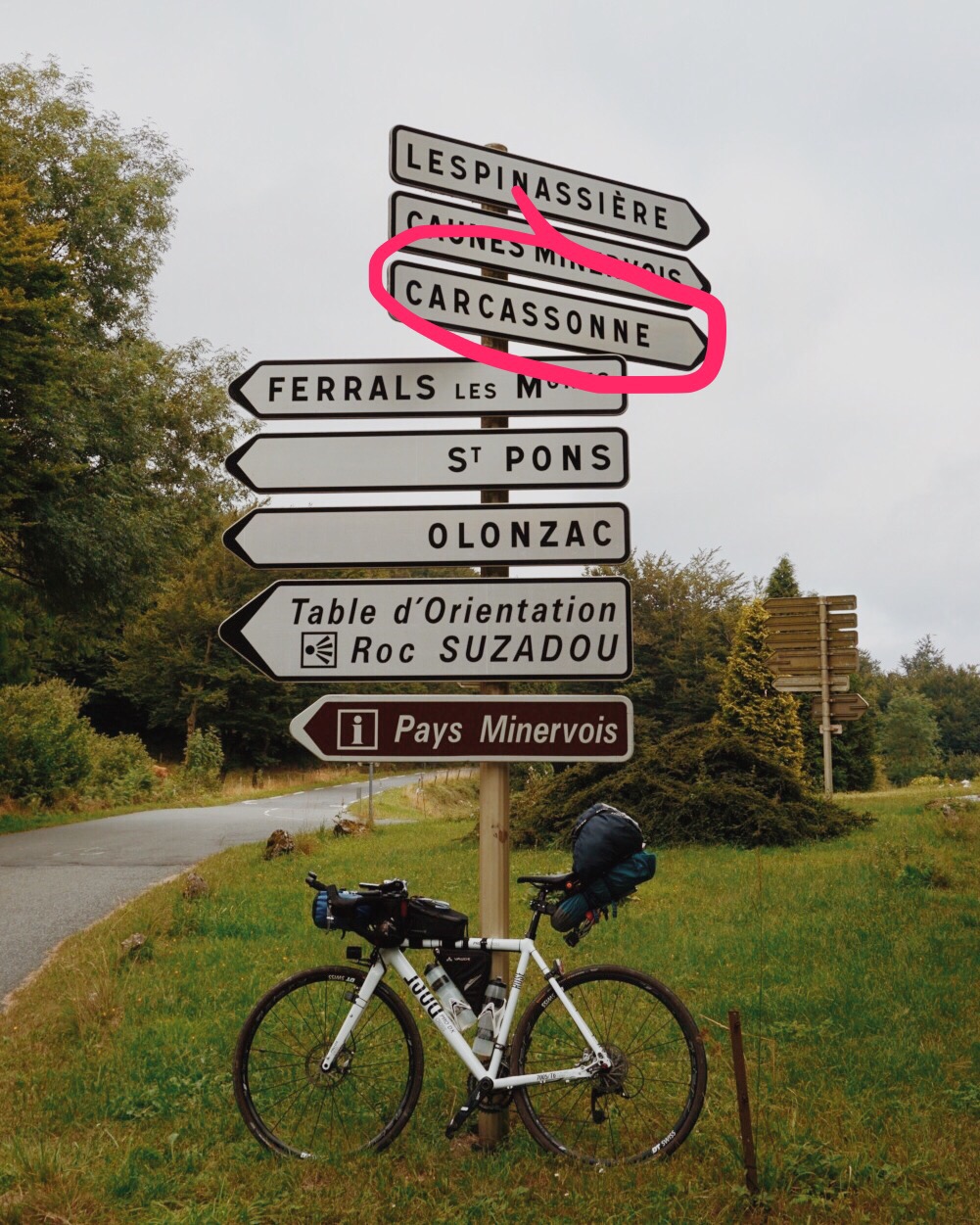
Here, in the following pic, I was basically on top. And this was also where for the first time I saw Carcassonne on a road sign:
Quite a relief to know that I did not have to climb anymore. And now followed the return on investment that I mentioned in my blog post 04: A loooooong descent through a very beautiful and narrow valley!
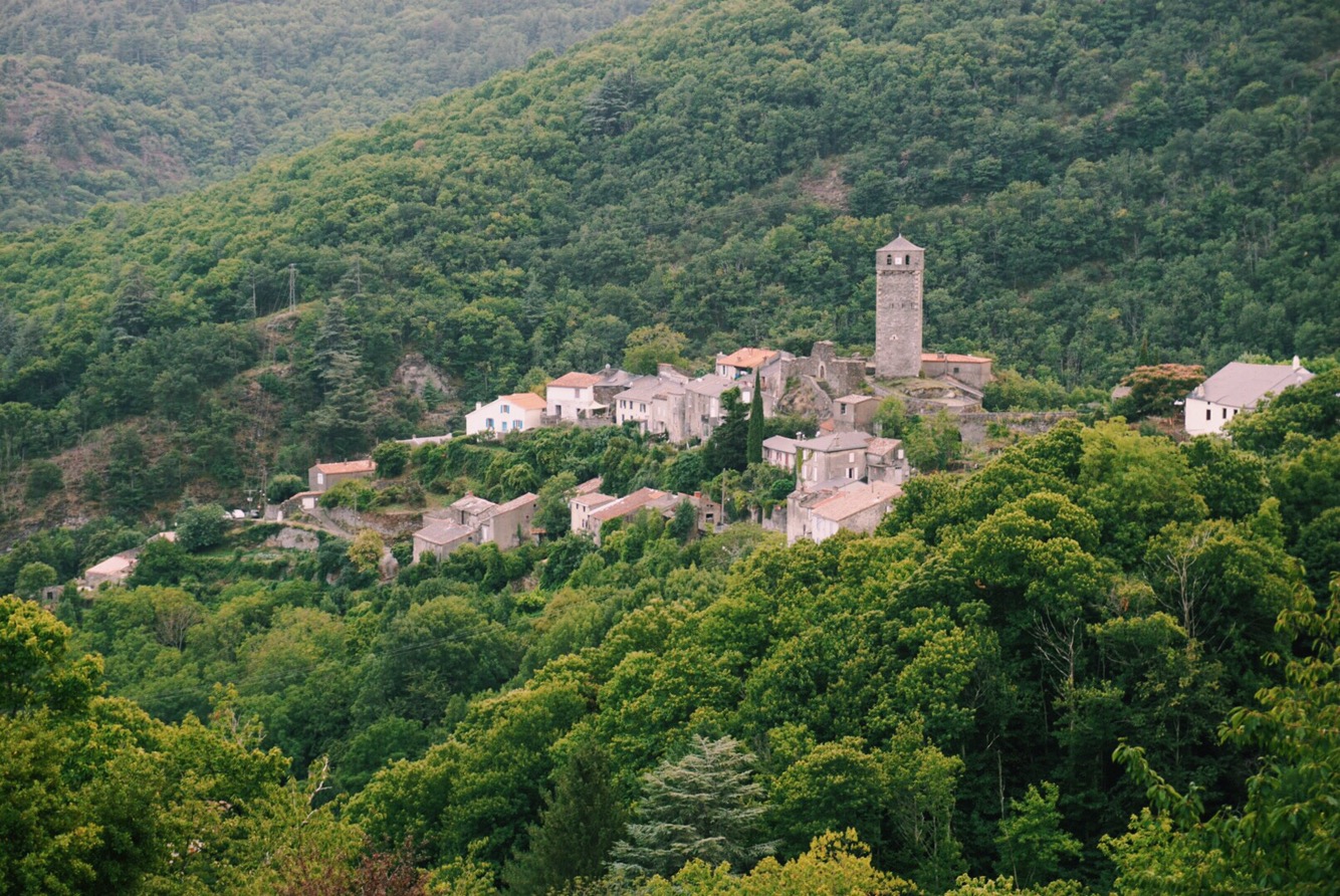
Lespinassière, the mountain village on top:
Suddenly the air was different. More humid, maybe? Somehow it smelled more summery and… more Mediteranean, which makes sense, because I was basically on top of a wall that was previously separating me from the Mediterranean Sea. All this made me feel like new born; I knew I had not much energy left today, but it didn’t matter, cause despite the still ca. 45km left to Carcassonne, there was hardly any work left to do.
When I arrived down at the bottom at Caunes-Minervois and saw the first houses and village after being on the Mediterranean side, the change became even more visible, in very predictable ways: The houses looked more roman/greek (more columns, those roman roof tiles, flowery ornaments) and the flora: I saw the first palm tree of my trip! My previous intuition to consider Carcassonne a landmark and a valid geographical dividing point of my trip was already confirmed.
The new, Mediterranean look (grey clouds in the background but Sunlight from the right(West)):
Now I just had to make it through the flatland to Carcassonne. 30km left. Luckily, the roads were still declining a little towards the river Aude in Carcassonne, so I had an easy and very high-paced ride on very straight roads with not too much traffic and interesting new landscapes: Very softly hilly landscape that was patched by either thick green or dry farm ground – wide views. I’m not exaggerating when I guess my average speed must have been around 38km/h here – aero bars, a feeling of relief and happiness and the so common energy boost that kicks in on the last miles, no matter how tough the day before was.
The day before I had announced to my land-lady of the BnB that I’d arrive around 21h. I arrived at 21.03h. Damn. Too late!
I was damn tired. It was humid, dark… but I was there. On schedule. And – as usual – a shower put me back together.
I will leave it at that, because telling you about how I experienced Carcassonne (spent there two nights) would destroy the positive note I hope to just have left us with. So, that’s it for now: I arrived in Carcassonne, exactly according to my plans after 6 days of cycling. So far this trip was working out so well: the landscapes, the rides, the people and friends I met (that was during the rest days), my gear… it all was even much better than I had hoped in my most optimistic ideas of the trip.